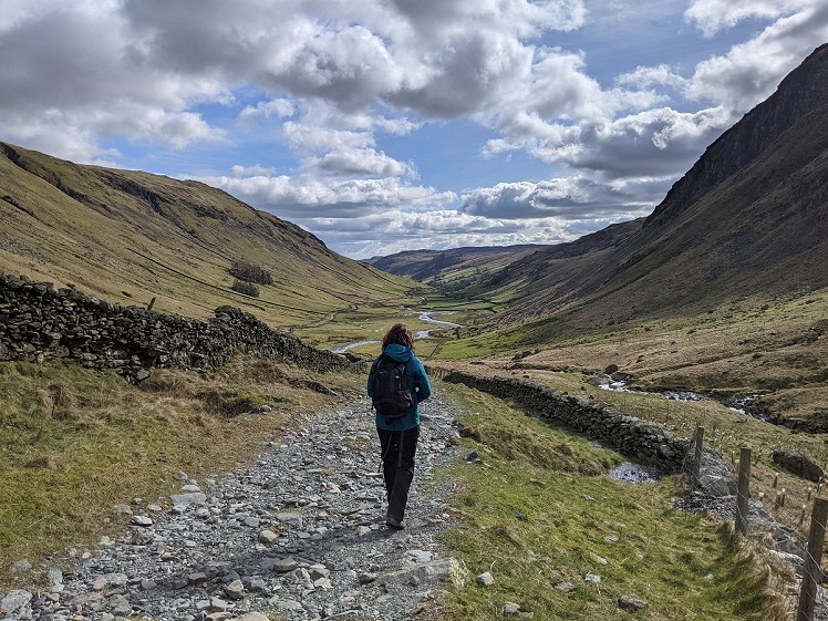
Avoid the crowds and help reduce traffic in the National Park with this big day out, starting from the train station in Kendal. Kentmere Pike is probably best known to most walkers as one of a long line of fells on the ever-popular Kentmere Horseshoe, but it's a worthy peak in its own right, and offers magnificent panoramas of the southern Lake District, as well as distant views of the North Pennines, Yorkshire Dales and Morecambe Bay. A stroll beside the River Kent is followed by a wander over the solitude of Green Quarter Fell. The route briefly touches on the classic Horseshoe to reach the grassy summit of Kentmere Pike, before descending past disused mines and quarries into the serene, picturesque and much-overlooked valley of Longsleddale.
Detailed description
This has been viewed 2,276 times
Download
OS maps and some other mapping apps don't allow waypointsStatistics
Difficulty: SevereDistance: 26.10 miles (42 km)
Total ascent: 1,113m
Time: 12 hours (Walking)
to rate this walk.
Additional Information
Start/Finish:If starting from a different part of Kendal, just join this route on the riverside path north of Victoria Bridge, but the walk is described from Kendal railway station, SD519932
Nearest town:
Kendal
Terrain:
A few short bits on pavements at the beginning and end, although most of the way through Kendal is on a riverside footpath. A clear, grassy path beside the River Kent is followed by a short section of paved road, but you won't see much traffic. On Green Quarter Fell, the path is obvious, with a couple of boggy sections. This joins a steep byway and then a well-walked path to the summit of Kentmere Pike. There is a pathless, grassy slope to descend into Longsleddale; then the route mostly follows obvious - and sometimes muddy - paths through farmland.
Seasonal variations:
It should be fine in most conditions, for proficient walkers, but you'll probably want as much daylight as possible for this one.
Weather and Hill Conditions: mwis: Lake District – Met Office: Lake District
Public transport:
Kendal railway station is on the Windermere Branch Line between Oxenholme (on the West Coast Main Line) and Windermere, and is served by trains roughly every hour. Kendal bus station is not far away, on Blackhall Road, and the walk can just as easily be started from there.
Maps:
OS Explorer OL7 (1:25,000), Harvey/BMC Lake District (1:40,000), OS Landranger 90 (1:50,000), OS Landranger 97 (1:50,000) Directory Listings:
Find more Listings near this route Tourist info:
Kendal (0153 979 516); Killington Lake (015396 20138); Windermere (015394 46499)
Further Routes
by Chris Scaife
- Stoupdale Head and White Combe 28 Sep, 2023
- Keswick to Ambleside, via the Helvellyn range 26 Jul, 2023
- Black Combe 28 Jun, 2023
- High Rigg 29 Mar, 2023
- Reston Scar, Hugill Fell and Black Crag 15 Nov, 2022
- Kentmere Horseshoe from Kendal 29 Sep, 2022
- Lyke Wake Walk 21 Aug, 2022
- Whitbarrow 3 Jul, 2022
- Wild Boar Fell and Swarth Fell - a walk on the wild side 14 Jun, 2022
- Hawnby Hill - A Little Yorkshire Gem 1 Feb, 2022


Anyone else spot the obvious improvement? There is a station in Burneside...
Station at Staveley as well!
But you'd miss the Where Eagles Dare schloss on the Kent
The entire skyline horseshoe taking in Gurnal Dubs, Potter Fell, Brunt Knott, the standard Kentmere horseshoe anticlockwise, then back over Sallows, Capple Howe and past Williamson's monument down to Staveley is an interesting alternative.
It's more convenient to get my butler to drop me at Sadgill and meet me later in Kentmere
I've described a walk from Kendal - a biggish town with more accommodation options and better transport links than Burneside - and I chose the station as the starting point because it's fairly central and easy to reach.
The walk from Kendal to Burneside is partly along an interesting section of the River Kent and partly beside some pleasant farmland. If you think skipping this bit and instead travelling by train to Burneside is 'the obvious improvement', go for it.