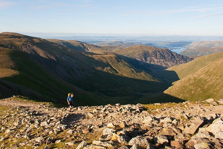
The Helvellyn range is a long line of fells stretching from Clough Head in the north to Dollywaggon Pike in the south. Walking this ridge offers a rare opportunity to stay above 2,000 feet for many hours and many miles, before dropping down to Grisedale Tarn. The walk continues up over Fairfield and then descends sedately on the eastern side of the Fairfield Horseshoe. This is a classic, challenging walk across the high fells, visiting numerous summits along the way. However, other than the steep ascents of Clough Head at the start of the ridge and up to Fairfield from Grisedale Tarn, most of the day is spent on gentle gradients with little loss of height between the fells. Although the ridge is usually walked from Threlkeld, this extended version from Keswick allows a pleasant warm-up along a horizontal, paved, former railway path.
See our article on this route
Detailed description
This has been viewed 2,082 times
Download
OS maps and some other mapping apps don't allow waypointsStatistics
Difficulty: SevereDistance: 22 miles (35.41 km)
Total ascent: 1,753m
Time: 10 – 14 hours (Walking)
to rate this walk.
Summits
Clough Head 726 mGreat Dodd 857 m
Watson's Dodd 789 m
Stybarrow Dodd 843 m
Raise 883 m
Whiteside 863 m
Helvellyn - Lower Man 925 m
Helvellyn 950 m
Nethermost Pike 891 m
Dollywaggon Pike 858 m
Fairfield 873 m
Hart Crag 822 m
Dove Crag 792 m
High Pike (Scandale) 656 m
Low Pike 508 m
Additional Information
Start The walk proper begins by the old station, at the start of the Keswick to Threlkeld railway path, but if using public transport, the logical start point is the bus station, which is conveniently located next to a Booths supermarket, NY262235; Finish Ambleside. The bus stop is on Kelsick Road, NY375043
Nearest town:
Keswick
Terrain:
Pavements through Keswick to the Keswick to Threlkeld railway path, which is totally flat and has a paved surface. The ascent of Clough Head is steep and via a narrow grassy path, but thereafter there is a broad path to follow.
Seasonal variations:
This is one for a long summer's day, with clear skies.
Weather and Hill Conditions: mwis: Lake District – Met Office: Lake District
Public transport:
Stagecoach bus 555 stops at both the start and finish, and is the ideal method of transport to use for this walk.
Maps:
OS Explorer OL4 (1:25,000), OS Explorer OL5 (1:25,000), OS Explorer OL6 (1:25,000), OS Explorer OL7 (1:25,000), Harvey/BMC Lake District (1:40,000), OS Landranger 90 (1:50,000), OS Landranger 89 (1:50,000)
Directory Listings:
Find more Listings near this route
Tourist info:
Keswick (017687 72645); Seatoller (017687 77294); Ullswater (017684 82414)
Further Routes
by Chris Scaife
- Stoupdale Head and White Combe 28 Sep, 2023
- Black Combe 28 Jun, 2023
- High Rigg 29 Mar, 2023
- Reston Scar, Hugill Fell and Black Crag 15 Nov, 2022
- Kentmere Horseshoe from Kendal 29 Sep, 2022
- Lyke Wake Walk 21 Aug, 2022
- Whitbarrow 3 Jul, 2022
- Wild Boar Fell and Swarth Fell - a walk on the wild side 14 Jun, 2022
- Hawnby Hill - A Little Yorkshire Gem 1 Feb, 2022
- Kendal Fell, Cunswick Scar, and Scout Scar 20 Dec, 2021


Excellent route, have been planning to do something similar over 2 days, with a wild camp somewhere up high. Hadn't thought of including the old railway line from Keswick.