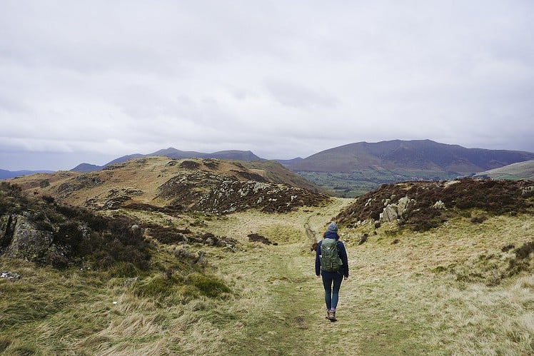
From the A591, passing the north end of Thirlmere en route to Keswick, High Rigg appears as a small, craggy mound with trees low down, thinning towards the top. It is unusual among Lakeland fells in that the land all around it is flat - this stand-alone peak juts out and does not belong to any other ridge - and all the peaks that surround it are substantially higher. It may be small, but there's no need to feel inadequate as this walk has all the variety you could ask for from a day in the Lake District. It's also easy to reach by public transport, and rarely busy. You don't need all day to do this and, as the highest point is a mere 357m above sea level, you don't need great weather either.
Detailed description
This has been viewed 1,089 times
Download
OS maps and some other mapping apps don't allow waypointsStatistics
Difficulty: EasyDistance: 4.66 miles (7.50 km)
Total ascent: 301m
Time: 2 – 3 hours (Walking)
to rate this walk.
Additional Information
Start/Finish:Bus stop at Thirlmere Dam Road End on the A591. If travelling by car, there is a parking area just to the south, at the junction of the A591 and the St John's in the Vale road, the B5322, NY315195
Nearest town:
Keswick
Terrain:
Clear paths all the way, first across the fell, then back across level ground to the east.
Seasonal variations:
Low-lying and relatively sheltered, as hilltops go, this is one for all seasons. The ascent and descent are both quite steep, however, so take care in slippery conditions.
Weather and Hill Conditions: mwis: Lake District – Met Office: Lake District
Public transport:
The 555 bus between Keswick and Lancaster is the ideal way to reach the starting point.
Maps:
OS Explorer OL4 (1:25,000), OS Explorer OL5 (1:25,000), Harvey/BMC Lake District (1:40,000), OS Landranger 90 (1:50,000) Directory Listings:
Find more Listings near this route Tourist info:
Keswick (017687 72645); Ullswater (017684 82414); Seatoller (017687 77294)
Further Routes
by Chris Scaife
- Stoupdale Head and White Combe 28 Sep, 2023
- Keswick to Ambleside, via the Helvellyn range 26 Jul, 2023
- Black Combe 28 Jun, 2023
- Reston Scar, Hugill Fell and Black Crag 15 Nov, 2022
- Kentmere Horseshoe from Kendal 29 Sep, 2022
- Lyke Wake Walk 21 Aug, 2022
- Whitbarrow 3 Jul, 2022
- Wild Boar Fell and Swarth Fell - a walk on the wild side 14 Jun, 2022
- Hawnby Hill - A Little Yorkshire Gem 1 Feb, 2022
- Kendal Fell, Cunswick Scar, and Scout Scar 20 Dec, 2021


