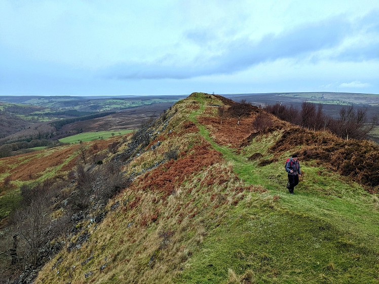
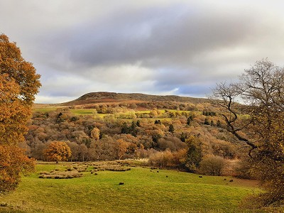
The North York Moors is mainly characterised by rolling heather moorland, where long distances can be walked with relatively little effort and where few other walkers are likely to be encountered. Hawnby Hill juts out like a sharp bastion of limestone grassland and native woodland in this sea of gently undulating heathland. Its distinctive shape belies its frankly tiny elevation - three Hawnby Hills piled on top of each other would still fall short of Munro height - but this is a summit that is unlikely to disappoint. The walk is a varied circuit through farmland, woodland and open moor, setting off from the charming village of Hawnby.
Fetching Map
Height Profile
metres / Distance
miles
Detailed description
1
SE5374489656 Walk south-east along the road, away from the church, with the River Rye on the right. This road soon passes a tea room in Hawnby village. Follow the road across Hawnby Bridge and uphill, then turn right along the track signposted to Daleside and Sunnybank Farm. The gradient of this track is such that height is gained quickly and effortlessly as you approach the farms. The limestone crag, Peak Scar, soon becomes visible amongst trees to the south-west.
2
SE5366389134 Before Sunnybank Farm, beside a beech tree, go right through the wooden gate to walk towards North Bank Wood. The small grassy path through the fields soon joins a larger track coming from the farm, which is followed westwards to North Bank Wood. When alongside this deciduous woodland, the path forks. Both pass gnarled trees and end up at the same place, but the left fork gives slightly better views of the surrounding moorland. Hawnby Hill to the north-east, and Easterside Hill farther east, are both prominent and distinctively-shaped landmarks. The obvious track continues west through large fields and the numbers of pheasant and red-legged partridge you are likely to see should make it clear that this land, like so much of the North York Moors, has been heavily modified for hunting purposes.
3
SE5131489522 Eventually, after a long plod over the fields, go through a gate at the corner of a plantation annexed on to Gowderdale Wood. The path now branches - go right on a broad grassy path across the moorland. Just past a shallow valley, there is a path (not marked on the OS map) branching left. Stay on the bridleway heading north, approaching Thorodale Wood and where the path meets the edge of the wood turn right onto a clear track downhill, passing a disused quarry. Turn left on the Arden Hall bridleway, which winds left and then right, passing several buildings, then continues north to a clearing. Under some enormous beech trees, go through a wooden gate on the right and head across the two fields by a fairly indistinct path. After passing through a wooden gate, join a much more distinct track and head slightly uphill past Mount Pleasant farm.
4
SE5271091470 Shortly after passing Harker Gates house on the left, cross the stile on the right and take a sharp right turn downhill. After another stile, go right on the track coming from St Agnes House. Where this track bends right towards the farm, go straight ahead on the footpath towards Half Moon Plantation. After crossing a wooden footbridge, turn left to go through a gate and across another wooden footbridge. Shortly thereafter, an elaborate bridge is used to cross the River Rye. The path now rises through Low Wood, mature native woodland with an abundance of holly. At the top of Low Wood, go through the gate on the left and up through the field towards Hawnby Hill, through the metal gate, then leave the obvious track and keep going uphill, aiming for the gate to the left of the house. Now turn left on to the bridleway signposted to Moor Gate.
5
SE5374091259 This bridleway is initially next to a barbed wire fence. At a gate in this fence, the broad grassy path turns right, uphill. There are numerous small paths in this area, but stay on the broad path until you reach the plateau, with Easterside Hill visible about a mile away to the east. At a crossroads of sorts, turn right on to a small grassy path, which leads up to the top of the hill. The summit ridge - and summit ridge is a rarely-used term around here - of Hawnby Hill is one of the finest in the Moors, with great views and steep slopes on either side. The western flank has patches of exposed limestone and on the eastern side there is a fair amount of native woodland. At the southern end of the ridge, the path descends steeply, and often muddily, to Hawnby. In the village, turn right and follow the road past the inn (The Owl) back to the church.
This has been viewed 2,283 times
Download
OS maps and some other mapping apps don't allow waypointsStatistics
Difficulty: ModerateDistance: 7.46 miles (12 km)
Total ascent: 424m
Time: 3 – 4 hours (Walking)
Voting:
from 1 votes
Login as Existing User
to rate this walk.
to rate this walk.
Additional Information
Start/Finish:Large lay-by beside All Saints Church, SE536897
Nearest town:
Hawnby
Terrain:
Mostly on clear paths, with short sections along a quiet road. The bit around High Buildings can be quite muddy.
Public transport:
The M4 bus from Helmsley to Stokesley runs near to the start of this walk.
Maps:
OS Explorer OL26 (1:25,000), OS Landranger 100 (1:50,000) Directory Listings:
Find more Listings near this route Tourist info:
Sutton Bank (01845 597 426); Helmsley (01439 770 173); Thirsk (01845 522755)
Further Routes
by Chris Scaife
- Stoupdale Head and White Combe 28 Sep, 2023
- Keswick to Ambleside, via the Helvellyn range 26 Jul, 2023
- Black Combe 28 Jun, 2023
- High Rigg 29 Mar, 2023
- Reston Scar, Hugill Fell and Black Crag 15 Nov, 2022
- Kentmere Horseshoe from Kendal 29 Sep, 2022
- Lyke Wake Walk 21 Aug, 2022
- Whitbarrow 3 Jul, 2022
- Wild Boar Fell and Swarth Fell - a walk on the wild side 14 Jun, 2022
- Kendal Fell, Cunswick Scar, and Scout Scar 20 Dec, 2021


An excellent area with many quiet corners and villages.