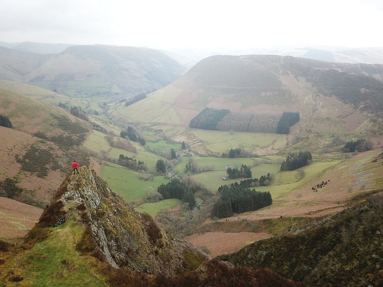
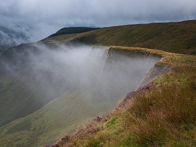
As you head south on the A470 and drop over the col at Bwlch Oerddrws, you are confronted by the grassy slopes on Maesglase, a magnificent whale of a hillside. Hidden on the other side, in a remote cwm, is Craig Maesglase, a rugged rocky escarpment that runs across the head of the valley. This walk makes a horseshoe around the impressive central waterfall, which is overlooked by what can only be described as something of a Devil's Point or Pwint y Diafol in Welsh. This impressive crest can be traversed to give a pleasant walk with mind-blowing outlooks across a remote area of Mid Wales.
Fetching Map
Height Profile
metres / Distance
miles
Detailed description
1
SH8558314986 Head away from the village along the A470 from the layby to the signposted public footpath. Head up this through the forest to reach a forestry track. Continue along here in the same direction for 100m or so to where the footpath heads up through the woods again. This pops out onto the hillside in a corner by a small stream, some distance below where the right of way is actually marked.
2
SH8491614966 Follow the boundary of the forestry along and slightly down to its corner and then strike out contouring across the hillside along a small path. Eventually you get to a small marker post where you take the upper path that appears to rise but doesn't that much, and instead carries on contouring around the hillside to eventually reach Bwlch Siglen.
3
SH8353313680 From the col head up the path which is closest to the waterfall. Eventually, just before the waterfall loses its steepness in a small hanging valley, a path cuts right across the heather to the top of the waterfall. Step over the stream and head straight up the hillside to gain the exposed edge of Craig Maesglase. Follow the edge around and past a small plateau and continue up and along the crest to eventually descend down to the main impressive waterfall. To its left is the impressive point which is unnamed so we have taken the liberty to call it Pwint y Diafol or The Devil's Point.
4
SH8262814048 Carry on along the crest, and where this peters out continue in the same vein to reach what feels like a sub-summit above a ridge that descends from the main Maesglase summit plateau. Do not be tempted to descend this ridge as the farmer will not welcome your appearance.
5
SH8260614951 Head leftwards along the ridge to gain the first summit of Maen Du, which according to the OS map should be the summit. However more recent surveys suggest it is the Craig Rhiw-erch end of the twin summit. So head out west to bag the true high point of Maesglase.
6
SH8172415020 Backtrack nearly all the way to the Maen Du summit where a small path cuts north down a ridge, and after 200m or so turn right to pick up another ridge which heads down northeast. A short steep descent leads to flat narrow col-like feature on the ridge, just before the 509m spot height.
7
SH8257115636 From the col head down and right on a prominent path/quad track down to Ty'n-Y-Celyn farm, and then head back down the main track to the A470.
8
SH8460215637 Turn right on the A470 and walk back along the side of the road to the vehicle.
This has been viewed 5,850 times
Download
OS maps and some other mapping apps don't allow waypointsStatistics
Difficulty: ModerateDistance: 6.52 miles (10.50 km)
Total ascent: 645m
Time: 3 – 4 hours (Walking)
Voting:
from 1 votes
Login as Existing User
to rate this walk.
to rate this walk.
Additional Information
Start/Finish:Start by the layby on the side of the road just outside the village of Dinas Mawddwy. Alternatively, park in the village by turning off the A470 and taking the first left by the public toilets, opposite the Red Lion Pub and using the larger car park there, SH855150
Nearest town:
Dolgellau.
Terrain:
Generally pleasant grassy hillside with some heather in places with small often indistinct paths and occasional boggy sections. The path has great exposure as you walk across the top of Craig Maesglase. If the exposure doesn't appeal, you can take the main rounded ridge to its left up to the summit.
Seasonal variations:
Due to its altitude this walk is unlikely to be badly affected by snow except in rare hard winters.
Weather and Hill Conditions: mwis: Snowdonia – Met Office: Snowdonia
Public transport:
There maybe a local bus service to close by on the A470.
Guidebooks:
Maps:
OS Explorer OL18 (1:25,000), OS Explorer OL23 (1:25,000), OS Landranger 124 (1:50,000), OS Landranger 125 (1:50,000) Directory Listings:
Find more Listings near this route Tourist info:
Dolgellau (01341 422888); Machynlleth (01654 703 369); Bala (01678 521 021)
Further Routes
by Mark Reeves
- Snowdon via the Llanberis Path, and down the Snowdon Ranger 9 Oct, 2020
- Dolwyddelan - The Cwm Penamnen Horseshoe 10 Jul, 2020
- A Round of the Northern Carneddau 3000ers 11 Jun, 2020
- Moel Hebog to Moel Lefn 5 Mar, 2020
- Cwm Cneifion in Winter - Hidden Gully and Y Gribin 20 Feb, 2020
- Dartmoor - The North Moor from Princetown 12 Feb, 2020
- Snowdon Via the South Ridge and the Watkin Path 21 Dec, 2019
- Glyder Fach and Glyder Fawr from the Pen Y Gwryd 27 Nov, 2019
- The New Forest: Abbot's Well - Fritham Circuit 26 Aug, 2019
- The Atlantic Ridge of Carnedd Y Filiast 7 Aug, 2019


Brilliant walk, but even better if you start from the Bwlch and do the full circuit of the 2000ft hills and descend to Dinas Mawddwy. We hitchhiked back up to the Bwlch, but there are probably bus routes going to Dolgellau. Lovely engraved boundary stones and great views - doubt you will see a soul after the plane spotters at the Bwlch. The waterfall is a brilliant ice climb in a very hard winter. I can recommend the Red Lion in Dinas Mawddwy - a first class old fashioned pub. Well worth calling into after this or a walk up the Arans. Also a good cafe in the village.