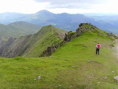
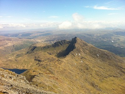
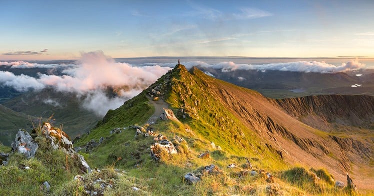
This is one of the longest routes up and down Snowdon and as such gives a challenging day to the highest point in England and Wales. The South Ridge offers a fine exposed walk up an occasionally rocky mountain ridge to get to the impressive narrows of Blwch Main high above Cwm Tregalan and Cwm Clogwyn, before heading to the summit. The route then descends the way it came briefly before traversing across the south face via the Watkin Path. This section is being rebuilt slowly and is not as treacherous as it once was, but still requires the walker to be happy on a steep and occasionally loose path across an exposed face. From Bwlch Y Saethau (Col of the Arrows) the walking returns to well-maintained path which turns sharply down hill at Bwlch Ciliau, where the route descends to Cwm Llan and on past Gladstone Rock.
Detailed description


This has been viewed 6,803 times
Download
OS maps and some other mapping apps don't allow waypointsStatistics
Difficulty: ModerateDistance: 8 miles (12.80 km)
Total ascent: 1,095m
Time: 6 – 9 hours (Walking)
to rate this walk.
Additional Information
Start/Finish:Start in the Watkin Path Car Park, in the Gwynant Valley. Close by is the amazing Gwynant Cafe, SH626506
Nearest town:
Beddgelert
Terrain:
The terrain is a mix of well manicured paths, open hillside, rocky gravel paths and rocky ridge. Whilst never approaching a grade one scramble there are a couple of sections on the South Ridge that scramble over rock.
Seasonal variations:
Whilst generally south-facing and likely to be the first to be stripped of snow and ice in winter, it is not uncommon to find lying snow, ice and neve above 700m on the South Ridge and especially from Blwch Main onwards which is over 900m. As such attempting this route in winter requires full winter hillwalking equipment (ice axe and crampons) and appropriate skills.
Weather and Hill Conditions: mwis: Snowdonia – Met Office: Snowdonia
Public transport:
There is a bus service that heads down the Gwynant but it is generally infrequent.
Maps:
OS Explorer OL17 (1:25,000), OS Explorer OL18 (1:25,000), Harvey/BMC Snowdonia (1:40,000), OS Landranger 115 (1:50,000) Directory Listings:
Find more Listings near this route Tourist info:
Beddgelert (01766 890615); Blaenau Ffestiniog (01766 830 360); Llanberis (01286 870 765)
Further Routes
by Mark Reeves
- Snowdon via the Llanberis Path, and down the Snowdon Ranger 9 Oct, 2020
- Dolwyddelan - The Cwm Penamnen Horseshoe 10 Jul, 2020
- A Round of the Northern Carneddau 3000ers 11 Jun, 2020
- Maesglase, a Mid Wales Gem 24 Apr, 2020
- Moel Hebog to Moel Lefn 5 Mar, 2020
- Cwm Cneifion in Winter - Hidden Gully and Y Gribin 20 Feb, 2020
- Dartmoor - The North Moor from Princetown 12 Feb, 2020
- Glyder Fach and Glyder Fawr from the Pen Y Gwryd 27 Nov, 2019
- The New Forest: Abbot's Well - Fritham Circuit 26 Aug, 2019
- The Atlantic Ridge of Carnedd Y Filiast 7 Aug, 2019


Another recommendation for the outstanding Caffi Gwynant - no connection other than being a loyal customer - but note that it's closed until 01 Feb 2020.