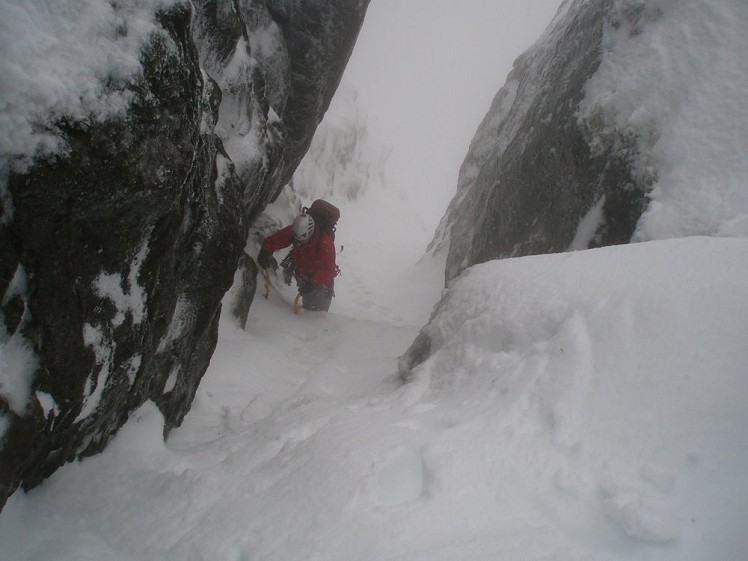
This winter mountaineer's horseshoe climbs a short but exciting grade II gully that is all but hidden from above and below (the clue is in the name). The gully heads up between two sheer spurs, making it feel like you're walking up a tight corridor. You literally pop out of this and then head east towards the top of Y Gribin, a fantastic grade I winter ridge, which is descended. This route is an out and out winter climb, and not for walkers. Unless there is consolidated snow on the ground then Hidden Gully will not be climbable. There is a BMC temperature gauge in the area so you can check the ground condition before heading up.
Fetching Map
Height Profile
metres / Distance
miles
Detailed description
1
SH6495860375 From the car park walk up the main track that heads up the left side of the National Trust Interpretation Centre. Follow this up through a decorative gate, over a bridge and on up a wide paved footpath. The path makes a sharp right and heads up to the outflow from Llyn Idwal. From here turn left and follow the path along the shore and through a drystone wall.
2
SH6467359618 Just after the drystone wall a path leaves this main path and starts to head up and right across the hillside, passing below Sub-Cneifion Rib, and continuing to gain the hanging valley of Cwm Cneifion. Once in the cwm start up the left side of the valley, aiming for a small flattening on a spur below the impressive Clogwyn Ddu, which is a popular winter climbing venue.
3
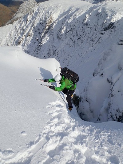
SH6469958241 From the spur head up to gain Hidden Gully (see photo below). From the base of the gully, climb a couple of pitches to pop out onto the plateau at the top. This is a genuine (if easy) winter climb, not a walker's route, and can only be recommended to properly equipped and experienced climbing teams.
4
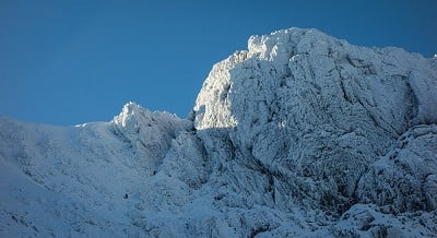
SH6460958014 Having popped out of the gully onto the plateau, turn left and follow the broad ridge towards the top of Y Gribin. In bad weather this can involve white out navigation. From the top of the Y Gribin Ridge, descend the narrow arete. This is often easier but more exposed if you stick with the true ridge rather than the flanks. Just before the end of the ridge you need to descend down and left to pick up a path that runs across a large football pitch sized flattening, before the ridge narrows a little and the path picks its way down to a T-junction with a footpath.
5
SH6518559436 Turn right and walk along the path towards the outflow from Llyn Bochlwyd and take the path that follows the left bank down, gently at first, before a section of rocky stairs leads to flatter ground below. Stay on the path and use the stepping stones to pass over a wet boggy area to eventually join the main Llyn Idwal path at a prominent right hand bend. Carry straight on down the path to the car park.
This has been viewed 3,883 times
Download
OS maps and some other mapping apps don't allow waypointsStatistics
Difficulty: SevereDistance: 3.80 miles (6.11 km)
Total ascent: 662m
Time: 4 – 7 hours (Walking)
Voting:
from 3 votes
Login as Existing User
to rate this walk.
to rate this walk.
Additional Information
Start/Finish:Start at the Ogwen Cottage Car Park. This is a pay and display. If full there is some parking on the main road where you can get the vehicle fully off the A5, SH649604
Nearest town:
Bethesda
Terrain:
This is a winter climbing route. Hidden Gully needs to be full of well consolidated snow for this route to be climbable. An ill defined path climbs up through the cwm to reach steeper and steeper ground until close to the base of the Grade II gully. If in condition the gully is little more than a staircase, however many parties will need to rope up. You then descend the excellent grade 1 scramble / grade I winter ridge of Y Gribin.
Seasonal variations:
You cannot climb this route unless winter conditions prevail high on the mountains. For an idea of ground conditions see https://www.thebmc.co.uk/idwal
Weather and Hill Conditions: mwis: Snowdonia – Met Office: Snowdonia
Public transport:
There are infrequent bus to Ogwen from Bethesda and Betws-Y-Coed
Guidebooks:
Welsh Winter Climbs
Maps:
OS Explorer OL17 (1:25,000), Harvey/BMC Snowdonia (1:40,000), OS Landranger 115 (1:50,000), OS Landranger 114 (1:50,000) Directory Listings:
Find more Listings near this route Tourist info:
Llanberis (01286 870 765); Bangor (01248 352786); Beddgelert (01766 890615)
Further Routes
by Mark Reeves
- Snowdon via the Llanberis Path, and down the Snowdon Ranger 9 Oct, 2020
- Dolwyddelan - The Cwm Penamnen Horseshoe 10 Jul, 2020
- A Round of the Northern Carneddau 3000ers 11 Jun, 2020
- Maesglase, a Mid Wales Gem 24 Apr, 2020
- Moel Hebog to Moel Lefn 5 Mar, 2020
- Dartmoor - The North Moor from Princetown 12 Feb, 2020
- Snowdon Via the South Ridge and the Watkin Path 21 Dec, 2019
- Glyder Fach and Glyder Fawr from the Pen Y Gwryd 27 Nov, 2019
- The New Forest: Abbot's Well - Fritham Circuit 26 Aug, 2019
- The Atlantic Ridge of Carnedd Y Filiast 7 Aug, 2019


