Whilst hordes of people walk up the Llanberis Path on summer weekends, it is still worth doing if you're looking for the easiest way up Snowdon on foot. Going back down the same way is the simplest way home, but for variety an alternative descent via the Snowdon Ranger path is well worth using if you want to avoid the masses, and enjoy a longer and more remote-feeling walk.
Fetching Map
Height Profile
metres / Distance
miles
Detailed description
1
SH5826459797 From the car park cross the main road and turn left in front of the Snowdon Mountain Railway station. At the mini roundabout carry straight on for 100m or so to a gate on the right. Follow the path from here up through the woods to the cafe. This is more pleasant than walking up the tarmac road to the same point.
2
SH5790459246 From the cafe turn left and follow the road up through a gate, passing a large farm building on the right. About 100m further up the road is the well signposted start to the Llanberis Path. Head up here; at first it is not too steep but after a short while the path starts to ascend diagonally across the hillside towards a gate at a prominent drystone wall. Here the ground flattens off again.
3
SH5859558426 From the gate carry on along the path and cross under the railway via a small bridge and continue on to the disappointingly-named Halfway House, which is really only about a third of the way up in terms of height gain.
4
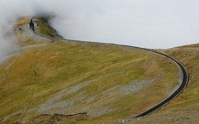
SH5992756979 Carry on along the path to where it turns left and starts to ascent Allt Moses the steep staircase that is the first place that can bring the inexperienced to their knees due to the effort. At the top of the stairs the path crosses the railway again close to Clogwyn Station, under a small bridge.
5
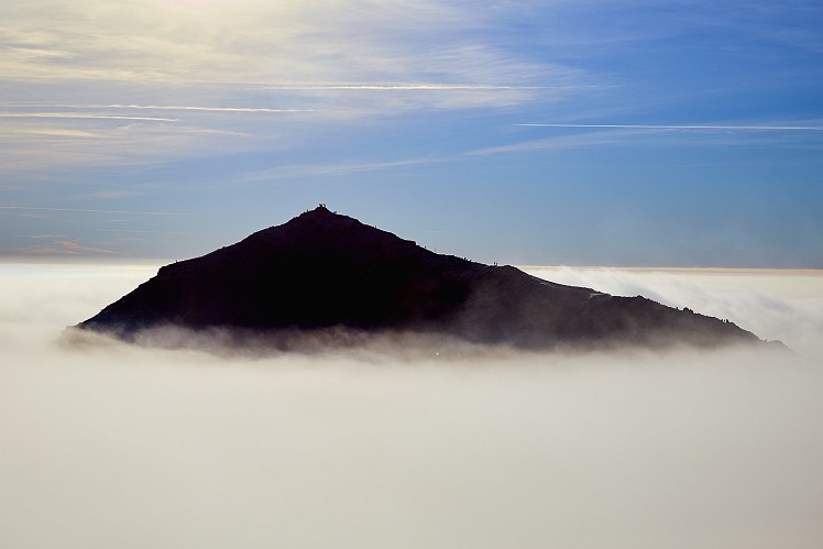
SH6081656048 Head under the bridge, and if you are lucky you can enjoy the amazing if exposed views down into the Llanberis Pass on the left. The views are short lived as the path soon starts to rear up again and combined with the loose gravel this makes this another physically challenging section for the uninitiated. The angle soon eases and the path starts to bend to the right and flatten as it approaches the finger stone at Bwlch Glas. Here several paths merge, including the Snowdon Ranger down which we will descend later. Carry more or less straight on along the path that now runs just above the railway up the final ridge to the summit. The summit is often rammed, as is the cafe if it is open (closed between Oct-Mar). 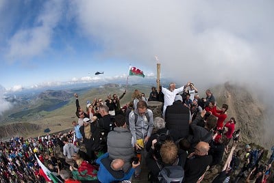
© Mark Reeves, May 2012
6
SH6100454371 From the summit backtrack the way you came to reach Bwlch Glas.
7
SH6078054876 Just below the finger stone is the railway track and below that is a the Snowdon Ranger Path that heads off in a NNW direction below the railway, slowly veering left away from the tracks to pick up the ridge line of Clogwyn D'ur Arddu. This descends gently at first before a series of steep zig-zags leads to a point on the path that is just below Bwlch Cwm Brwynog. Carry on along the now flat path for just over 1km to a gate. Just over 100m past the gate is an obvious track that heads off up and right.
8
SH5730855285 Turn off the Snowdon Ranger path and head up the path and over Bwlch Maesgwm and down the prominent path that heads down the remote valley the other side. This valley is locally referred to as Telegraph Valley, as it used to have a row of telegraph poles. At the end of the valley follow the path as it follows the hillside down and to the left to pick up the end of a track that leads to some remote houses. Carry on along the continuation of the track via a dip where a stream passes underneath the road. Just after this the path picks up a small drystone wall which it follows past a lonely house before reaching a gate in the road where the road turns down and right.
9
SH5727359069 Head through the gate to descend the road past a farm, a campsite and a youth hostel, before coming into the village of Llanberis, where you pass the local primary school and library before hitting the High Street by an outdoor shop and a cafe.
10
SH5781660100 Turn right onto the high street and follow the road to its end where it joins the A4086. Carry on a short distance to return to the car park opposite the Snowdon Mountain Railway.
This has been viewed 3,437 times
Download
OS maps and some other mapping apps don't allow waypointsStatistics
Difficulty: DifficultDistance: 11.31 miles (18.20 km)
Total ascent: 1,107m
Time: 6 – 8 hours (Walking)
Voting:
from 1 votes
Login as Existing User
to rate this walk.
to rate this walk.
Additional Information
Start/Finish:Park in the large car park opposite the Snowdon Mountain Railway. This is a pay and display car park and gets busy quite quickly, although its size means it usually has space if turning up in the morning, SH582599
Nearest town:
Llanberis
Terrain:
Generally well maintain mountain path as you head up, with occasional loose gravel on the steeper sections.
Seasonal variations:
On the occasions that winter conditions are prevalent on the mountain you will need ice axe and crampons. Whilst most people ignore this and survive, it is often through luck rather than judgement. In hard-frozen winter conditions many people wrongly choose to follow the rail track down rather than the Llanberis Path. This can be a deadly choice as between Clogwyn Station and Bwlch Glas is a notorious accident black spot above the cliffs of Clogwyn Moch where a convex slope, topped by a short icy section, has led to many people slipping to their deaths. Do not follow the rail track, instead follow the footpath.
Weather and Hill Conditions: mwis: Snowdonia – Met Office: Snowdonia
Public transport:
There are several bus services to Llanberis and the main bus stop at the far end of the village is close to the car park.
Maps:
OS Explorer 263 (1:25,000), OS Explorer OL17 (1:25,000), OS Explorer OL18 (1:25,000), Harvey/BMC Snowdonia (1:40,000), OS Landranger 115 (1:50,000), OS Landranger 114 (1:50,000) Directory Listings:
Find more Listings near this route Tourist info:
Llanberis (01286 870 765); Beddgelert (01766 890615); Bangor (01248 352786)
Further Routes
by Mark Reeves
- Dolwyddelan - The Cwm Penamnen Horseshoe 10 Jul, 2020
- A Round of the Northern Carneddau 3000ers 11 Jun, 2020
- Maesglase, a Mid Wales Gem 24 Apr, 2020
- Moel Hebog to Moel Lefn 5 Mar, 2020
- Cwm Cneifion in Winter - Hidden Gully and Y Gribin 20 Feb, 2020
- Dartmoor - The North Moor from Princetown 12 Feb, 2020
- Snowdon Via the South Ridge and the Watkin Path 21 Dec, 2019
- Glyder Fach and Glyder Fawr from the Pen Y Gwryd 27 Nov, 2019
- The New Forest: Abbot's Well - Fritham Circuit 26 Aug, 2019
- The Atlantic Ridge of Carnedd Y Filiast 7 Aug, 2019
