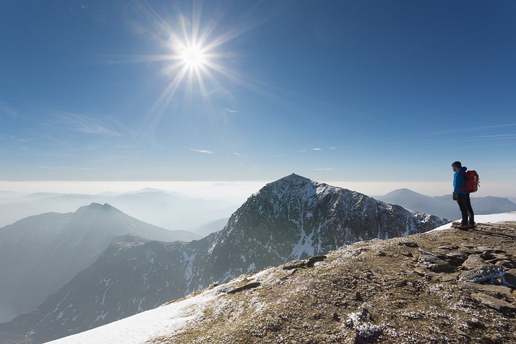
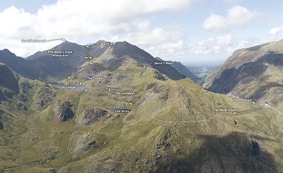
As the highest point in England and Wales, Snowdon really needs no introduction. This is perhaps the most popular mountain in the UK, with hundreds of thousands ascents a year. Whilst the majority will make their way up and down the Llanberis Path, those with some experience of hillwalking may want to look at something a little more engaging. The combination of the PYG and Miner’s Track makes for a pleasant circuit in a rugged mountainous setting, with a couple of rocky sections that offer interest. The route can be done in either direction, however the PYG track, named after the Pen Y Gwryd Hotel, the original starting place for the walk, gains height more steadily rather than saving the ascent for the end. As such it makes more sense to ascend this route and then descend the Miner’s Track. Whilst not a true horseshoe as both routes share the finale up to the summit, this is a good way to get the most out of the mountain.
Detailed description

This has been viewed 5,565 times
Download
OS maps and some other mapping apps don't allow waypointsStatistics
Difficulty: ModerateDistance: 7.21 miles (11.60 km)
Total ascent: 784m
Time: 5 – 7 hours (Walking)
to rate this walk.
Additional Information
Start/Finish:Pen-y-pass pay and display car park (see public transport section), SH646556
Nearest town:
Llanberis
Terrain:
Ranges from the flagstone-paved Pyg Track and the almost road-like Miner's Track to much steeper and stonier mountain paths. No bogs - you can leave your gaiters at home.
Seasonal variations:
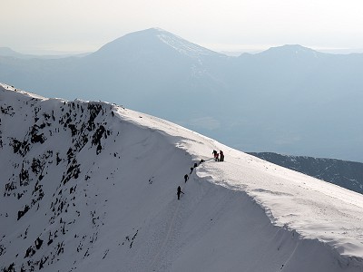
In full winter conditions this exciting summer walk becomes a lot more committing. Ubove the intersection of the PYG and Miners Track the ground can become hard snow or ice. In extreme winters the final climb to Blwch Glas can be at risk of avalanche due to wind slab accumulation. It can also be very steep and icy, requiring an axe and crampons for safe passage. The path is frequently hidden under snow. In winter arguably the biggest risk is from ill prepared hillwalkers attempting the route without ice axe or crampons, who risk wiping out people below them as they skid their way down from the summit.
Weather and Hill Conditions: mwis: Snowdonia – Met Office: Snowdonia
Public transport:
If you're not parking at Pen y Pass, an alternative is to park in Nant Paris Park and Ride. This will often be overflowing by 9am in the summer, and a local farmer has a field he charges a similar fee to park in. From Nant Paris the Sherpa Bus runs up to Pen Y Pass, however times are limited so you might want to use one of the many taxis. Several local taxi firms now have 7 seater minibuses that cost around £10-15 from Nant Peris and £15-20 if you get picked up in Llanberis. If descending to Pen Y Pass, you might need to get above the car park to get a reception if you are calling for a taxi on your return, although in peak times there is almost a taxi rank here.
Maps:
OS Explorer OL17 (1:25,000), OS Explorer OL18 (1:25,000), Harvey/BMC Snowdonia (1:40,000), OS Landranger 115 (1:50,000) Directory Listings:
Find more Listings near this route Tourist info:
Llanberis (01286 870 765); Beddgelert (01766 890615); Blaenau Ffestiniog (01766 830 360)
Further Routes
by Mark Reeves
- Snowdon via the Llanberis Path, and down the Snowdon Ranger 9 Oct, 2020
- Dolwyddelan - The Cwm Penamnen Horseshoe 10 Jul, 2020
- A Round of the Northern Carneddau 3000ers 11 Jun, 2020
- Maesglase, a Mid Wales Gem 24 Apr, 2020
- Moel Hebog to Moel Lefn 5 Mar, 2020
- Cwm Cneifion in Winter - Hidden Gully and Y Gribin 20 Feb, 2020
- Dartmoor - The North Moor from Princetown 12 Feb, 2020
- Snowdon Via the South Ridge and the Watkin Path 21 Dec, 2019
- Glyder Fach and Glyder Fawr from the Pen Y Gwryd 27 Nov, 2019
- The New Forest: Abbot's Well - Fritham Circuit 26 Aug, 2019


