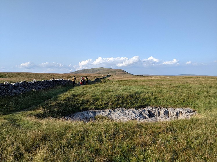
This Three Counties walk begins in North Yorkshire, before crossing into Cumbria and then Lancashire. Whernside is the highest peak in North Yorkshire, but is rarely as busy as its Three Peaks companions Ingleborough and Pen-y-ghent. On this circuit, it is reached by a long, broad, leisurely ridge that overlaps little with the Three Peaks walk itself. Across the valley, Great Coum, Green Hill and Gragareth form a ridge of similar proportions, which includes the highest point in Lancashire. In between is tranquil Kingsdale, with grassy hillsides punctuated by limestone scars, home to a number of caves. Perhaps the best known of these is Yordas, a former show cave that featured in the works of Romantic poet William Wordsworth and artist J. M. W. Turner, and one that - in normal weather conditions - is perfectly accessible to walkers armed with nothing more technical than a helmet, light and pair of wellies.
Detailed description
This has been viewed 2,151 times
Download
OS maps and some other mapping apps don't allow waypointsStatistics
Difficulty: DifficultDistance: 17.40 miles (28 km)
Total ascent: 947m
Time: 6 – 9 hours (Walking)
to rate this walk.
Additional Information
Start/Finish:Roadside parking near Yordas Cave, SD706790
Nearest town:
Ingleton
Terrain:
The paths are all easy to follow, and the broad ridges on both sides of the valley have drystone walls to lead the way. There are a couple of short sections along a quiet road.
Seasonal variations:
Parts of the Gragareth ridge can be quite boggy after rain.
Weather and Hill Conditions: mwis: Lake District – Met Office: Yorkshire Dales
Public transport:
No public transport in Kingsdale, but you could travel to Ingleton by bus, then walk along the Ingleton Waterfalls Trail (fee charged) and join this walk on the lane just past the footbridge over Kingsdale Beck. This would make it a longer walk, but the Waterfalls Trail is worth seeing.
Maps:
OS Explorer OL2 (1:25,000), OS Landranger 98 (1:50,000) Directory Listings:
Find more Listings near this route Tourist info:
Ingleton (015242 41049); Kirkby Lonsdale (01524 271 437); Horton-in-Ribblesdale (01729 860333)
Further Routes
by Chris Scaife
- Stoupdale Head and White Combe 28 Sep, 2023
- Keswick to Ambleside, via the Helvellyn range 26 Jul, 2023
- Black Combe 28 Jun, 2023
- High Rigg 29 Mar, 2023
- Reston Scar, Hugill Fell and Black Crag 15 Nov, 2022
- Kentmere Horseshoe from Kendal 29 Sep, 2022
- Lyke Wake Walk 21 Aug, 2022
- Whitbarrow 3 Jul, 2022
- Wild Boar Fell and Swarth Fell - a walk on the wild side 14 Jun, 2022
- Hawnby Hill - A Little Yorkshire Gem 1 Feb, 2022


What about the original Three Counties walk, highest points of Westmoreland, Cumberland, and Lancashire. I did this as an end to end walk many, many moons ago. OK, so these counties have been changed, but the trek is still possible.
Thinking about it there have probably been several 'Three counties walks' involving other areas.
John
Just a minor point, Chris. The County Stone was demoted in 1974 when it used to sit where Westmorland, Yorkshire and Lancashire met. Now it's just Cumbria and Lancashire. If you go south of Green Hill that's where (North) Yorkshire meets Lancashire.