Ingleborough may not be the highest of Yorkshire's celebrated Three Peaks, but in many ways it is the jewel in the crown of the entire Yorkshire Dales National Park. Its many attractions include vast swathes of limestone pavement, unusual flora and fauna, astonishing glacial erratic boulders, and some of the finest caves in the UK. These include the Gaping Gill system, home to an enormous main chamber where the surface stream plunges underground down a 98-metre waterfall. You could spend a lifetime on Ingleborough and not see every nook and cranny, but this walk takes in some of the highlights of its southern flanks.
Fetching Map
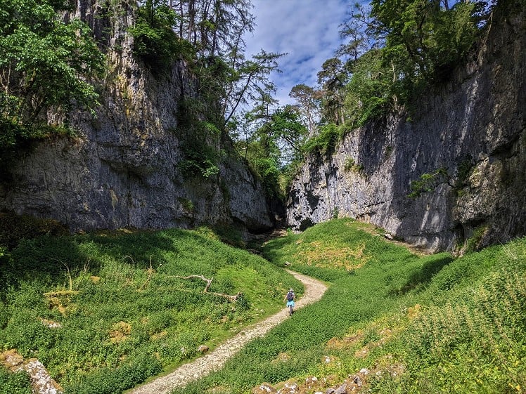
Height Profile
metres / Distance
miles
Detailed description
1
SD7460669190 Walk into the village and cross Clapham Beck by a narrow stone footbridge, then turn right to reach the Ingleborough Nature Trail. There is a small fee to use this path, which runs through woodland past a small lake and a 19th century ornamental grotto to reach Ingleborough Cave. If you have the time, this impressive show cave is well worth a visit. Immediately after passing the show cave, the track crosses a stone bridge and you can see Clapham Beck emanating from the underworld.
2
SD7542971099 Continue along the obvious track, very slightly uphill with small rocky crags on either side, to enter Trow Gill. This dramatic limestone gorge pinches in towards a narrow upper exit, and after a short distance the path crosses the wall via a stile. A number of shakeholes in this area are home to cave entrances, many of which link up to the Gaping Gill system. Gaping Gill itself can soon be seen, recognised from afar by the fence around the top. Here, the deep valley of Fell Beck comes to an abrupt end, as the stream disappears underground, not to see the light of day again until its resurgence from Ingleborough Cave. Viewed from underground, Gaping Gill Main Chamber is undoubtedly one of the most spectacular sights in the British Isles. Non-cavers who wish to see it from this perspective should check the websites of Bradford Pothole Club and Craven Pothole Club; both clubs arrange annual winch meets, during which visitors can be lowered down the shaft in a sturdy chair.
3
SD7514172717 Now return to the main path and follow this uphill. The path steepens towards Little Ingleborough, but from here to the summit of Ingleborough is a walk in the park. Turn left on the summit plateau towards the trig point, cairn and wind shelter; but the actual highest point is marked by the ruins of a tower that was built in 1830 and destroyed soon afterwards. The remains of an Iron Age hill fort and hut circles can be seen to the east of the summit. Far-reaching views can be expected on a clear day, including the Lakeland Fells, Morecambe Bay and Pendle Hill, as well as the surrounding peaks of the Pennines and Yorkshire Dales.
4
SD7410974552 Head east along a broad, rocky path. Looking down to the left from here, you should be able to see Ribblehead Viaduct on the famous Settle-Carlisle railway. After a short steep descent, go right at a fork in the path, heading towards distant Pen-y-ghent. This is part of the Three Peaks walk and the path is clear and easy to follow. Soon you will be on an area of moorland known as the Allotment, well known to cavers for its wealth of underground delights. These include Nick Pot, whose main shaft - Vulcan - is as high as the main chamber in Gaping Gill. Shortly after passing a derelict shooting hut, take the right fork in the path to leave the Three Peaks walk behind.
5
SD7683573718 This obvious path heads south through grassland, then cuts through a section of limestone pavement. Ingleborough's limestone pavements are important sites for wildlife, including ferns - even the most casual observer should notice a few different species here. When the Pennine Bridleway is reached, bear right, then immediately left on a grassy path. Follow this downhill, soon arriving at a point where numerous paths lead off in different directions. The most obvious track leads downhill to Crummack Lane, but take a fainter path that rises slightly to the SSW and follow the ridge until a stile leads across the wall to the Norber erratics.
6
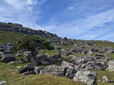
SD7673470009 The Norber erratic boulders, some of which are improbably poised, are the result of melting glaciers at the end of the last ice age, and it is worth spending some time wandering around to inspect this fascinating area. When you feel you have lingered enough, follow the footpath across a large field to Thwaite Lane. This track is now followed back to Clapham via two long, dark tunnels under the Ingleborough Hall Estate.
This has been viewed 1,932 times
Download
OS maps and some other mapping apps don't allow waypointsStatistics
Difficulty: ModerateDistance: 10.81 miles (17.40 km)
Total ascent: 611m
Time: 5 – 7 hours (Walking)
Voting:
from 3 votes
Login as Existing User
to rate this walk.
to rate this walk.
Additional Information
Start/Finish:National Park car park in Clapham, SD745692
Nearest town:
Clapham
Terrain:
The first part of the walk, as far as Ingleborough Cave, is smooth and accessible. The path from there to the summit and down to the Allotment is clear and well-maintained, with rocky steps for the steepest parts. Grassy paths are used to descend from the Allotment towards Crummack Dale, then along the ridge to Norber. The boulder-strewn scars of Norber can be negotiated by tiny, grassy paths, before returning to Clapham along Thwaite Lane, which is a wide, gravel track. There are two tunnels to walk through on Thwaite Lane, and these are dark places at any time of day.
Seasonal variations:
The stone steps near the top of Ingleborough should be treated carefully when icy, but really this is very much an all-weather route.
Weather and Hill Conditions: mwis: Lake District – Met Office: Yorkshire Dales
Public transport:
See the DalesBus Craven Connection timetable: https://www.dalesbus.org/cravenconnection.html
Maps:
OS Explorer OL2 (1:25,000), OS Explorer OL41 (1:25,000), OS Landranger 98 (1:50,000) Directory Listings:
Find more Listings near this route Tourist info:
Ingleton (015242 41049); Horton-in-Ribblesdale (01729 860333); Settle (01729 825192)
Further Routes
by Chris Scaife
- Stoupdale Head and White Combe 28 Sep, 2023
- Keswick to Ambleside, via the Helvellyn range 26 Jul, 2023
- Black Combe 28 Jun, 2023
- High Rigg 29 Mar, 2023
- Reston Scar, Hugill Fell and Black Crag 15 Nov, 2022
- Kentmere Horseshoe from Kendal 29 Sep, 2022
- Lyke Wake Walk 21 Aug, 2022
- Whitbarrow 3 Jul, 2022
- Wild Boar Fell and Swarth Fell - a walk on the wild side 14 Jun, 2022
- Hawnby Hill - A Little Yorkshire Gem 1 Feb, 2022


Very timely. I shall be in that part of the world in August and this looks just the ticket for a day's amble. Thank you.