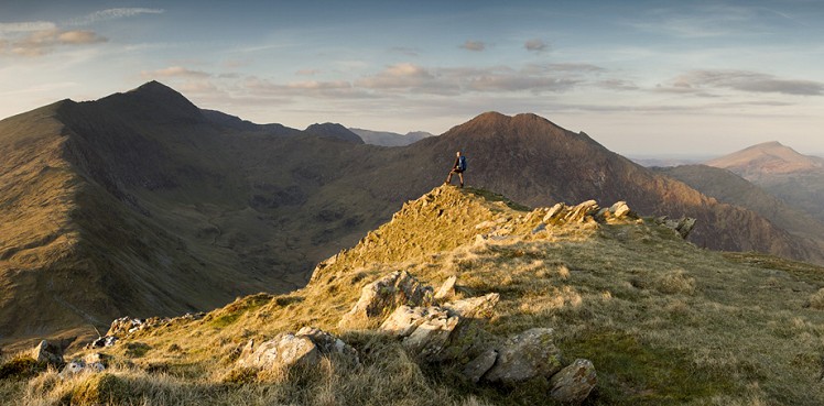
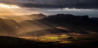
This is one of the great outlier walks around Snowdon, and ideal for a shorter mountain walk with amazing views across to Snowdon itself, plus the Moelwyns, Nantlle Ridge and Moel Hebog. The area has a few disused mines and despite its appearances has quite a remote feel to it. The route heads up into Cwm Llan before making towards Yr Aran.
Fetching Map
Height Profile
metres / Distance
miles
Detailed description
1
SH6281650678 From the car park turn left on the road and head to the well signposted start of the Watkin Path about 50m along on the opposite side of the road to the car park. Follow the track and then take the path up through woods. The path eventually rejoins the 4x4 track just before it makes a sharp left turn. Shortly after this the track starts to head around to the right around a bowl feature and crosses the prominent disused incline near its base. It then comes above some pools on the Afon Cwm Llan, where a path branches off to the right and crosses the river on a stone bridge - this is the eventual turn off on the descent. For now stay on the track and walk up to the mouth of Cwm Llan to a hydro dam.
2
SH6211852008 From close to the dam take the first left turn up a path, almost heading straight up the hill. Ignore the right turn along another track and instead carry on up the hillside following a faint path that heads up past some ruined buildings and a disused quarry working to eventually reach the main ridge of Yr Aran close to the 528m spot height, by a drystone wall.
3
SH6143551515 Follow the drystone wall along the ridge in a fairly straight line to where the wall kinks left. After about 250m you need to leave the drystone wall and follow the ridge on the left to the summit of Yr Aran.
4
SH6044851511 The extension to Craig Wen is entirely optional: Carry on over Yr Aran in the same direction and follow the ridge down to a col, and then continue along the ridge to Craig Wen.
5
SH5941950567 About turn here and retrace your steps to the col. Head back up towards Yr Aran, and after an initial altitude gain of 20m head over to the left of the ridge to gain a rounded spur, about 250m away from the col.
6
SH5997451419 Contour across the hillside over the top of two small spurs after 150m and 200m respectively. Carry on in the same direction until you can start heading down a ridge to Bwlch Cwm Llan.
7
SH6052952140 At the Blwch turn right and follow some stone steps down from the ridge to a prominent path that then traverses slightly down but more across the hillside, before it finally reaches the quarry track. Turn right here and follow the track to rejoin your route from earlier at a junction where a path heads down a gully.
8
SH6188051893 Turn right and reverse your previous steps. At the main 4x4 track turn right past the hydro dam. Walk for 400m down the main track to a small path on the left that crosses the Afon Cwm Llan via a picturesque stone bridge.
9
SH6223351634 Head down the path and across the bridge before ascending briefly to a drystone wall. Turn right and follow a faint path down the side of the river to where you get penned in by a tributary coming in from the left. To the right is a bridge across the Afon Cwm Llan.
10
SH6293551362 Cross the bridge and follow the road through the small farming hamlet and campsite area to reach the track that the Watkin path heads up, and walk back to the car park.
This has been viewed 4,690 times
Download
OS maps and some other mapping apps don't allow waypointsStatistics
Difficulty: ModerateDistance: 7.27 miles (11.70 km)
Total ascent: 767m
Time: 4 – 5 hours (Walking)
Voting:
from 1 votes
Login as Existing User
to rate this walk.
to rate this walk.
Additional Information
Start/Finish:The Car Park at the bottom of the Watkin Path, which is now a pay and display, SH627507
Nearest town:
Llanberis
Terrain:
A mix of track and mountain path. In general it is not too boggy, save for a few parts of the descent. Most of the route is on fairly well established paths, but the descent requires some navigational skill to contour across the north west face of Yr Aran.
Seasonal variations:
In winter the tops can be cover in snow and ice, but due to the lower altitude of this peak the conditions are not often full-on.
Weather and Hill Conditions: mwis: Snowdonia – Met Office: Snowdonia
Maps:
OS Explorer OL17 (1:25,000), OS Explorer OL18 (1:25,000), Harvey/BMC Snowdonia (1:40,000), OS Landranger 115 (1:50,000) Directory Listings:
Find more Listings near this route Tourist info:
Beddgelert (01766 890615); Blaenau Ffestiniog (01766 830 360); Llanberis (01286 870 765)
Further Routes
by Mark Reeves
- Snowdon via the Llanberis Path, and down the Snowdon Ranger 9 Oct, 2020
- Dolwyddelan - The Cwm Penamnen Horseshoe 10 Jul, 2020
- A Round of the Northern Carneddau 3000ers 11 Jun, 2020
- Maesglase, a Mid Wales Gem 24 Apr, 2020
- Moel Hebog to Moel Lefn 5 Mar, 2020
- Cwm Cneifion in Winter - Hidden Gully and Y Gribin 20 Feb, 2020
- Dartmoor - The North Moor from Princetown 12 Feb, 2020
- Snowdon Via the South Ridge and the Watkin Path 21 Dec, 2019
- Glyder Fach and Glyder Fawr from the Pen Y Gwryd 27 Nov, 2019
- The New Forest: Abbot's Well - Fritham Circuit 26 Aug, 2019


