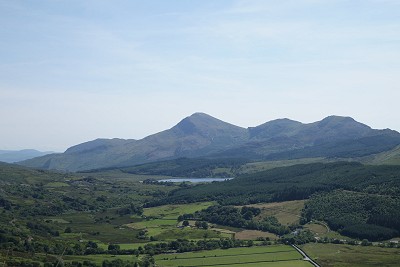
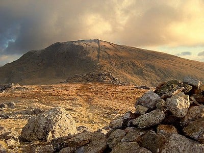
Moel Hebog is a smaller mountain that sits in the inner orbit of Snowdon, yet despite the geographical proximity this hill is a world apart from the bun fight that is often found on the summit of its loftier neighbour. This route takes in Moel Hebog and the ridge that runs North towards Rhyd Ddu, followed by a valley walk back to Beddgelert (unless you have two cars and pre-place one in the Beddgelert Forest Car Park).
Fetching Map
Height Profile
metres / Distance
miles
Detailed description
1
SH5880648138 From the car park walk towards the Welsh Highland Railway station and walk away from the car park on the right side of the railway tracks along a path. At the end of the platform there is a small path that crosses the tracks and heads through a field; keep to the right side to head over a small bridge that gives access to a private road. Walk along this for 400m or so to just before the road makes a sharp left, where the Lon Gwyrfai footpath heads off to the right. After less than 50m the path splits.
2
SH5799147940 From the split in the path take the lefthand path that starts to lead more uphill towards the summit. For the first 200m of altitude gain the path is on some open hillside but after that it picks up a prominent ridge line that leads up to the summit of Moel Hebog. This section of the path is well worn and popular with people simply going to the summit and back.
3
SH5648446926 In bad visibility you will need to take a bearing to reach the col at Bwlch Meillionen, which lies north-west of the summit. From Bwlch Meillionen carry along the ridge in roughly the same direction to reach the summit of Moel Yr Ogof.
4
SH5563847834 It is a fairly easy amble to get from Moel Yr Ogof to Moel Lefn via the main ridge that links them.
5
SH5530148535 The descent of Moel Lefn is probably the hardest part of this route, with a need to be able to route find on fairly complex mountainous terrain. In particular, after you have been walking along the long flat summit ridge, you then descend a steeper rockier section. Whilst this should not be scrambling, it does require sound mountain judgement in getting to the bottom of the steep section before you move to the left to follow the undulating ridge down and right to Bwlch Cwm-Trwsgyl, which has great views out across to Snowdon.
6
SH5531449674 The descent through the forest is something of a maze, although recent forestry work means the area is a little bit more open. Descend via a path from the col to pick up a main forestry track. Head down this very briefly and then take a path leading off right. Follow this over a slight rise before the path starts to descend slowly as it crosses the hillside before moving back in what was once a forested area. The path then starts to descend more steeply and eventually you come through a small clearing before meeting the Lon Gwyrfai near Hafod Ruffyd Ganol. If you parked a second your car in the Beddgelert Forestry Car Park you will need to turn left here.
7
SH5698049615 From the junction with the Lon Gwyrfai pathway, turn right and follow the track back along the valley floor to eventually reach the point you turned off the track and headed up Moel Hebog. From here reverse your steps back to the car park.
This has been viewed 3,555 times
Download
OS maps and some other mapping apps don't allow waypointsStatistics
Distance: 7.27 miles (11.70 km)Total ascent: 881m
Time: 6 – 8 hours (Walking)
Voting:
from 1 votes
Login as Existing User
to rate this walk.
to rate this walk.
Additional Information
Start/Finish:The main pay and display car park in Beddgelert is found just behind the Tourist Information Office, SH587482
Nearest town:
Beddgelert
Terrain:
Mountainous path, which on the initial walk up is well defined. Beyond the summit of Moel Hebog the route becomes less defined and at times you're walking across moorland and rocky outcrops. Steep and complex descent from Moel Lefn.
Seasonal variations:
Occasionally winter conditions do happen on Moel Hebog, however the altitude ensures that this rarely remains.
Weather and Hill Conditions: mwis: Snowdonia – Met Office: Snowdonia
Public transport:
Various bus services call at Beddgelert, and although it is a little left field there is also the heritage Welsh Highland Railway, which runs between Rhydd-Ddu and Beddgelert.
Maps:
OS Explorer 254 (1:25,000), OS Explorer OL17 (1:25,000), OS Explorer OL18 (1:25,000), Harvey/BMC Snowdonia (1:40,000), OS Landranger 115 (1:50,000) Directory Listings:
Find more Listings near this route Tourist info:
Beddgelert (01766 890615); Porthmadog (01766 512981); Blaenau Ffestiniog (01766 830 360)
Further Routes
by Mark Reeves
- Snowdon via the Llanberis Path, and down the Snowdon Ranger 9 Oct, 2020
- Dolwyddelan - The Cwm Penamnen Horseshoe 10 Jul, 2020
- A Round of the Northern Carneddau 3000ers 11 Jun, 2020
- Maesglase, a Mid Wales Gem 24 Apr, 2020
- Cwm Cneifion in Winter - Hidden Gully and Y Gribin 20 Feb, 2020
- Dartmoor - The North Moor from Princetown 12 Feb, 2020
- Snowdon Via the South Ridge and the Watkin Path 21 Dec, 2019
- Glyder Fach and Glyder Fawr from the Pen Y Gwryd 27 Nov, 2019
- The New Forest: Abbot's Well - Fritham Circuit 26 Aug, 2019
- The Atlantic Ridge of Carnedd Y Filiast 7 Aug, 2019


