


My Favourite Map For Life, Not Just For Christmas
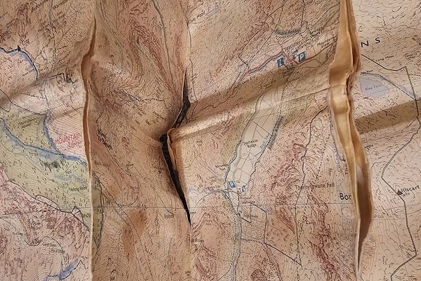
Give someone a map and you're passing on the gift of imagination, says Norman Hadley. Four decades after receiving a Lake District set - now torn and crackly, but still much loved - he has never stopped dreaming of the fells. Maps are for life,...


Comments
Grand stuff, Ronald. I might take issue with you over the north-south comparison, or maybe that should wait until my contribution to this series...
Well it was my Dad's suggestion really. And I believe there is some proper climbing on Dove Crag (too difficult for my Dad, though). But if you do truly prefer Superwalker Lake District South East, that's a grand place indeed for the bogs and solitude. Solitude all the greater given that one person who isn't in Longsleddale is me. Do feel free to re-use my pic if actually extolling Great Sca Fell as against the un-Great one at Wasdale Head.
Well, I don't know when my piece is coming out, but on the east-versus-west question, my perspective shifted radically when I took up mountain biking and fell-running. The amount of rideable and runnable terrain make places like Longsleddale a treat. Not that it wasn't before.