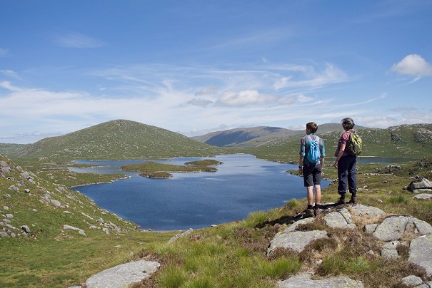
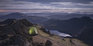
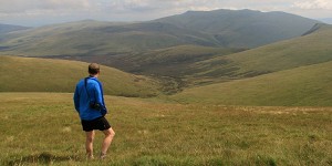
Mini Guide: The Cheviots

© Ronald Turnbull

Long grassy ridges with Roman roads running up them; lots of little green hilltops, each with its own iron-age hill fort; quiet, empty glens winding into the hills; and some bleak, heathery moorland along the top of it all. For a combination of nobody else about, with a huge amount of hillwalking, it's hard to beat the Cheviots. Ronald Turnbull lifts the lid on this overlooked frontier range.


It's a hill range 30 miles wide, lying right across the UK's least visited national park and straddling a national border at pretty much its loneliest point. If you're after long walks with big horizons and nobody much else about, look no further.

Miles and miles of nothing but Northumberland.  © Russell Lovett
Miles and miles of nothing but Northumberland.
© Russell Lovett, Feb 2020

Where else can you stride the grassy tops, under the skylarks, over the blood-soaked turf of history, on the UK's truly international range of hills?

Admittedly this is not the UK's greatest range. It's not even in the top two of those beginning with a C. It's true that the Cheviots are even more wild and shaggy than the Chilterns or the Cotswolds, and at least as exciting as the Campsie Fells while being both wider and higher. But at the same time, the Cheviots do lack the jaggy excitement of the Cuillin. They're nowhere near so huge, their wilderness is appreciably less blizzard-ridden than the Cairngorms. But for long windy ridge walks – provocative little hills with remnants of Iron Age stonework – steepsided green valleys with long, winding silver rivers: for those, the Cheviots are very good indeed.

History has dealt harshly with this lump of land north of Newcastle and south of Scotland's River Tweed. Ravaged by armies from both sides of the border, its social structures collapsed altogether after the Battle of Flodden in 1513; to be replaced by blood feud, kidnapping for ransom, and a set of special Border Laws. And when the neighbouring warlord came over the hill and burned down the houses and stole all the cows, there was nothing for it but going back over the hills and stealing theirs.

On Staerough Hill, with a view to the Curr and the Cheviot  © Ronald Turnbull
On Staerough Hill, with a view to the Curr and the Cheviot
© Ronald Turnbull

Depopulated in the 1500s, the later centuries haven't been any more helpful. The nibbling teeth of the eponymous Cheviot sheep destroyed both local livelihoods and the native wildwoods. On the English side, the resulting empty foothills were just right for the tank and artillery ranges of today, alongside Europe's biggest wood-pulp plantation.

But from a self-centred hillwalker perspective, this ravagement and abandonment has its small side benefit. Carter Bar to the Cheviot is 33km up around the 600m mark with never a road the whole way; add to that the long ridges stretching down on either side. Where else can you stride across the grassy tops in quite the same free and easy way, under the skylarks, over the blood-soaked turf of history, on the UK's truly international range of hills?

Cheviot - Northumberland National Park  © davii
Cheviot - Northumberland National Park
© davii, Dec 2020

Cheviots in a nutshell

1. The mighty Cheviot, only hill apart from Cairn Gorm to name an entire range

2. The full watershed ridgeline, Carter Bar to Wooler: 45km in a one-er if you want

3. Hill forts, dozens of them, on the grassy little lower hills. Several have visible stonework remains, and with a bit of cunning you can bag seven in a day.

4. St Cuthbert's Way: arguably the nicest, not actually the shortest, and definitively the least Scottish of Scotland's Great Trails (given that half of it's in England).

5. Silly little volcanic hills along the River Tweed like Eildon and Rubers Law.

On Housey Crags, Hedgehope Hill  © Ronald Turnbull
On Housey Crags, Hedgehope Hill
© Ronald Turnbull

The solitary walker on the Cheviots has an intense feeling of loneliness and isolation, much more than on Kinder Scout or the Cross Fell range, largely due to the extensive area of foothills on all sides, rising in waves one after another and forming the horizon in every direction

Wainwright on the Pennine Way

Upper Coquet Valley, Northumberland National Park.  © Russell Lovett
Upper Coquet Valley, Northumberland National Park.
© Russell Lovett, Jan 2020

Principal summits

Path up Saughieside Hill, looking to Great Hetha and Trowupburn  © Ronald Turnbull
Path up Saughieside Hill, looking to Great Hetha and Trowupburn
© Ronald Turnbull

Must-do routes

Cheviot by Hen Hole

The Cheviot has to be climbed. It misses out on Corbett status only by being 2km the wrong side of the Border; it's so much bigger than anything else around that it's visible from both Lochnagar and Ingleborough. The summit itself, though, is half a square kilometre of swamp. And the obvious horseshoe above the Linhope valley gives a couple more swampy tops, whose main distinction is having been listed up until 1994 in Donald's Tables of Scottish 2000-ers ("pending reconquest").

The top of The Cheviot is as much water as dry land  © Ronald Turnbull
The top of The Cheviot is as much water as dry land
© Ronald Turnbull

Fortunately there's a better way: by way of the bit of the Cheviot that isn't actually there, the humungous hole on its western side. The Hen Hole has waterfalls along the bottom and little granite crags along the side: the hens in question are probably peregrines.

There was actually more road access through the Cheviots in Roman times than there is today

Windy Gyle

Windy Gyle is the main summit on the Border Ridge itself, and your only chance of bagging a Scottish Donald while remaining entirely in England.

The Cheviot from Windy Gyle  © Ronald Turnbull
The Cheviot from Windy Gyle
© Ronald Turnbull

Unlike the Cheviot, Windy Gyle is a conjunction of airy ridgelines. As such it was a meeting point for the two sides on days of Border truce; one of its ancient cairns is named after a bloke called Lord Russell who got killed on a truce day. It's a hard choice whether to climb the Gyle from the English or the Scottish side. The ridgelines up from Scotland are excellent, with a variety of grand horseshoe routes out of the upper Bowmont Water. But the English side is more convenient if you happen to live in England [someone has to I guess - Ed.].

Upper Coquetdale circular

In the rolling hills of Upper Coquetdale you'll rarely encounter crowds (except perhaps of sheep), and this quiet round of the obscure Saughy Hill and the equally un-hyped Usway Burn is no exception. In that sense it's quintessential Cheviots.

Dere Street to Chew Green

The high Cheviot ridgeline separates Scotland from England over a stretch of almost 50 miles, from Wooler across to the gap at Kielder village. So people have be obliged to go across the top. And by 'people' I mean iron Age warriors, Roman soldiers, 16th-century cattle thieves and drovers of the 1700s. It's scarcely surprising that hillwalkers of the 21st Century are impelled to get in on the act. The grassy trackway from Kale Water on the Scottish side to the Roman fort at Chew Green has been a firm favourite for well over two thousand years.

Yeavering Bell

At the exit of the College valley, Yeavering Bell hill fort still shows a ring of ancient stonework all around the top. But the fun comes when you work out just how many more hillforts you can gather at the same time. There's West Hill and St Gregory's Hill immediately below, Humbleton Hill overlooking Wooler, while Great and Little Hetha plus the fort on Blackhag Rig and the impressive Ring Chesters all lie eastwards on the other side of the valley.

On the England-facing side, Ingram in the Beamish valley is startpoint for another fort-ful sort of walk.

There's a lot to be said for the lower hills too - St Cuthberts Way crossing Wideopen Hill   © Ronald Turnbull
There's a lot to be said for the lower hills too - St Cuthberts Way crossing Wideopen Hill
© Ronald Turnbull

Long Distance Options

St Cuthbert's Way

Writing on UKH about the benefits of the short long-distance walk, St Cuthbert's Way was very much on my mind. From the ruined abbey at Melrose to the other ruined abbey at Lindisfarne on Holy Island, it retraces (sort of) the post-death wanderings of St Cuthbert's corpse when fleeing from the Vikings. Which makes an excellent excuse for a route of an unassuming 60km, poking its head above the 300m contour but not much higher, with a variety of riverside, woodland and little hills like the Eildons and Grubbit Law, and skirting the northern edge of the Cheviots. But the clincher is at the end, where (if you've calculated your tides right) you take your boots off and slither across the underwater mud (or above-water causeway) to Lindisfarne.

www.stcuthbertsway.info

Pennine Way

The stretch along the Cheviots between Byrness and Kirk Yetholm forms the final (or initial - depending what way round you do it) 40 or so km of this classic grad daddy of all England's long distance trails. High, wild, and with no pubs or tea shops the whole way, it's generally considered to be the most gruelling section of the PW. 

Along the Anglo-Scottish border

A fine pretext for a long and largely solitary walk, the 120-odd-mile national border reaches its high point along that now-well-trodden frontier ridge:

Maps

OS Landrangers (1:50,000) 74, 75, 80 meet inconveniently near The Cheviot's summit

OS Explorer (1:25,000) OL16

Harvey Superwalker (1:40,000) Cheviot Hills (NB smaller scale than standard Superwalker)

Harvey Trail Map (1:40,000) St Cuthbert's Way

Guidebooks

Walking in Northumberland by Viv Crowe (Cicerone)

Walking in the Scottish Borders by Ronald Turnbull (Cicerone)

St Cuthbert's Way by Ronald Turnbull (Rucksack Readers)

Weather forecasts

Southern Uplands forecast from MWIS includes Cheviots both sides of the Border

Seven-day summit forecast for the Cheviot from Met Office

Best Bases

Historic depopulation of the border hills means that accommodation and facilities are limited, especially on the southern side. You have to go a fair way downstream in the Northumberland dales to reach useful small towns like Rothbury and Bellingham. At the eastern end of the range, however, there's an excellent base: the small (but handsome and historic) town of Wooler, with pubs, shops and a hostel. On the Scottish side, historic border towns like Melrose and Jedburgh are great for ruined abbeys but not that handy for the hills. Kelso is closer, with the bonus of its own riverside walks to Roxburgh for that rainy day. But the handiest stopoffs have to be the Yetholms, at the point where the border ridge runs down to valley level.

Wooler is on St Cuthbert's Way, and Kirk Yetholm is on the Pennine Way as well: their two websites are valuable for walker-friendly accommodation and information.

www.stcuthbertsway.info

https://www.nationaltrail.co.uk/en_GB/trails/pennine-way/trail-information/

Sunset from a bivvy bag on the Cheviots, looking north into Scotland  © Ronald Turnbull
Sunset from a bivvy bag on the Cheviots, looking north into Scotland
© Ronald Turnbull

Accommodation

Byrness: Forest View Walkers' Inn

YHA Wooler

Kirk Yetholm: Friends of Nature Hostel

Mounthooly Bunkhouse, right under the Cheviot's Hen Hole

High level huts on the Pennine Way: Auchope Rig NT877201 and Lamb Hill NT804129

Transport

The nearest railway station is Berwick on Tweed, well outside the area. Even road travel into and around the Cheviots can be awkward, with long road distances between two sides of the same hill. The A697 trunk road, a secondary route between Newcastle and Edinburgh, runs through Wooler at the eastern edge of the range.

Wooler can also be reached by bus in under an hour from Alnwick (no. 473) or Berwick (no. 464). To get to Kirk Yetholm takes 3 hrs from Berwick on two buses via Kelso.

Infrastructure within the Cheviots has significantly degraded since the cattle-droving of the 18th Century – there was actually more road access through the Cheviots in Roman times than there is today. However, there is still convenient access for travelers on foot, via the Pennine Way from the south or St Cuthbert's one from the northwest.

Pubs and food

The appeal of the Cheviots, for hillwalkers, is their lack of appeal. Below the little visited hills lie little visited villages, and any pub I'm recommending here could decide not to bother reopening nest time summer comes around…

Wooler has a selection of inns, none of which has overwhelmed me with the temptingness of its menu. The Border Inn at Kirk Yetholm is distinguished as the end point of the Pennine Way, and Wainwright's promise of a pint for any foot traveller arriving from Edale may have shrunk to a less debauched half-pint but is still being honoured out of his book royalties. The food there is good, but you'll need to book a table. Further west, and not so close to the hills, the Templehall Hotel at Morebattle Inn is a solid little country pub on St Cuthbert's Way.

The Rose and Thistle at Alwinton gave me a hearty bar meal last time I was in there, and has a good atmosphere, with beer from the Hadrian Border Brewery.

The café hut at Ingram, in the Beamish valley, is superbly placed for hillfort-bagging, but for food and coffee you need to be there between 10am and 4pm.

Accommodation Advertise here

No Premier Listings found in this area

Outdoor Shops Advertise here

No Premier Listings found in this area


Loading Notifications...
Facebook Twitter Copy Email