


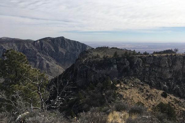
Destination Hillwalking in Wild West Texas
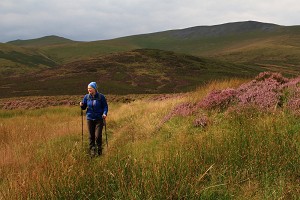
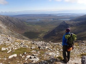
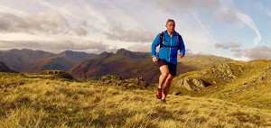
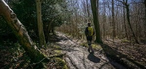
In Spring 2022, Munroist Ian Robertson went to the desert hills of west Texas in search of something a bit different, and ended up having one of the best trips of his 30-year hillwalking career.
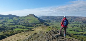
Pyrenees-based guide Miguel Ibáñez describes Andorra's three most interesting peaks - all nearly 3000m high, and yet each suitable for rope-free summer walkers.
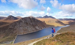
The tiny Pyerenean principality of Andorra is only 464 square kilometres, but that area is mostly made up of mountains - over 100 of them. After the ice age glaciers retreated they left behind 80 lakes in the mountains, and today these are one of Andorra's main attractions. With easy access to the trails, and big peaks that don't require climbing skills, this is one of the premiere walking destinations in the Pyrenees.

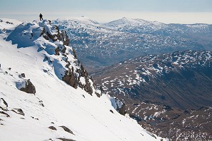
Also spelled 'Comapedrosa', this is the highest peak in Andorra, so in summer it can be busy. There are two things worth noting: the views from the summit, and the elevation gain of 1400m. If you make the hike shorter, I advise you to stay overnight at the Comapedrosa mountain hut (2267m) the night before. Staff at the hut prepare dinner, breakfast and packed lunches.

When to go?
From late spring until late October. The rivers carry a lot of water and there are still some snow patches starting at 2400m, so crampons and ice axe are advisable if you climb before mid-July.
The route
You start at Arinsal ski resort (1467m) and follow the GR11 trail, pass by the Comapedrosa hut and leave the GR11 at Estany Negre lake (2591m). From there, you reach the summit following the south-west crest line. From the summit there are excellent views of Pica d'Estats (3140m), the highest peak in the Catalan Pyrenees, and Carlit, in France, the highest peak in La Cerdanya. If you do stay overnight at the Comapedrosa hut, the following itinerary allows you to reach three more peaks, and views over the Vallferrera valley and Monteixo range:
This is the basis of a wonderful circular route - not to be missed!
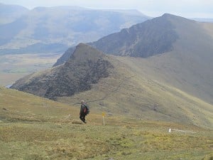
Climbing Tristaina peak is now a half-day hike, or nearly, thanks to the road which goes to Vallnord-Arcalís ski resort. This peak is situated between France and Spain, in the North of Andorra. Tristaina is one of the peaks I love most for several reasons. The hike takes you past three beautiful lakes, the Tristaina lakes, situated on terraces, each at a different altitude. The summit is small, with bird's-eye views; the peak is slim and beautiful, and easily recognised from the south.

When to go?
From late June until late October.
The route
You should park your car beside the road in a small parking area before La Coma restaurant. There is a signpost which informs that you are on the HRP (Haute Route Pyrénéenne, in French), a signposted trail which crosses the Pyrenees, similar to the GR11 and GR10. You should follow the HRP marks to the highest Tristaina lake. There, you turn left and head to the pass situated on the left of the summit. Steep slopes before the pass with some screes! Once at the pass, turn right and follow the crest line to the summit. This crest line runs between France and Andorra. From here there are excellent views over the lakes in France, with Forcat lake the biggest. Also infinite views to the East, South and West. Often the French side is covered by clouds. You can either come back on the same path, or:
One of my best memories of this peak is the view of the Forcat lake, in France, above the clouds so often present on the French side of the Pyrenees.

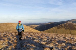
Estanyó peak is known as the view point of Andorra because it is above 2900m, and located far from the Andorra borders. One of the highlights of this ascent is the Sorteny Valley. There are only three nature reserves in Andorra, and Sorteny valley is one. The diversity of flora is worth a visit. On the way up you can visit the small Botanic Garden, where you can see the main flowers of this mountain. It will take 15 minutes.

When to go?
From Early July until late October.
The route
Best to drive to the car park not far from the Sorteny staffed mountain hut, though you need a 4WD vehicle. Once in the car park, follow a path that is barely marked, following the Estanyó river valley. Eventually you reach the Estanyó lake (2399m), a beautiful lake surrounded by mountains. It's a peaceful place. In early summer you will see hundreds of different flowers. Turn left and walk up the crest line of the Roca del Rellotge range. The path is marked with cairns. Follow the crest line to the summit. From there you can overlook Andorra in all directions. If the weather is good, it's worth staying there for a while to enjoy the views. To come back, follow this itinerary:

The currency is the Euro, and Catalan is the official language. Andorra is well used to tourists, so you can easily communicate in other languages such as Spanish, French and English. To learn more about Andorra in English, click here. I don't agree with everything on this site, but most of the information is correct.
Maps
Unfortunately, there are only two maps which cover all Andorra. Their scale is 1:40000 though. A scale of 1:25000 is more suitable, but apparently that doesn't exist. One of the maps is produced by Editorial Alpina. Another publishing house, Editorial Piolet, has produced the other one. Editorial Piolet also has another map scaled 1:15000, but it covers only a small part of the country.
When to go
From the middle of summer – see the details above for every peak. Some peaks can be walked in winter, but the paths are different. Winter walking is the subject for a separate article.
Guided or solo?
It depends on your experience in high mountains. If you are not very used to walking above 2500m, you should hire a guide. You should also have good navigation skills if you want to go solo. Some parts of the paths are marked only with cairns. Even where there are painted marks, at some places the paint has vanished.
Rest days and sightseeing
There is not much to do in Andorra if you're not hiking, apart from shopping. If you like skiing, Andorra is full of ski resorts, but that's another story. Among other attractions, Ordino is a village worth a visit. It features in my blog as one of the Most Beautiful villages in the Pyrenees . Escaldes is a village well known for its sulphurous springs where the water rises at 61°C. You can relax at the Caldea spa.
Where to stay
I would say Andorra has the largest concentration of hotels in the Pyrenees. Hotels are full in winter, but in summer there is plenty of availability and lots of competition on price. If you feel comfortable sleeping in a dormitory, the Sorteny staffed mountain hut is a good choice. It's quite new, the facilities are in good condition and the food is excellent. The Sorteny valley is well known for its beauty and flora.
Getting there
You can fly either to Barcelona or Toulouse. Both are about the same distance and the same travelling time from Andorra la Vella, the capital. The journey takes about 2.5 hours. You can get to Andorra by bus from Barcelona. Take a look at:
From Toulouse, check out these websites:
Getting around
Renting a car is the cheapest option, letting you move around freely and avoid having to pay for taxis to the starting point of hikes. There is also a local bus service, but it mostly doesn't serve the points most interesting for hikers. More information here, though it's only in Catalan.
Guidebooks
The best are in Catalan, Spanish and French. Of the English language guides, try:
The Mountains of Andorra by Alf Robertson and Jane Meadowcroft (Cicerone)
Walks and Climbs in the Pyrenees by Kev Reynolds (Cicerone)
You can also find useful information published by the Andorra Government here, which has details of some walking tracks.

TrekPyrenees organize walking holidays in Spain, mainly in the Spanish Pyrenees, but also in France and Andorra. They also explore other scenic mountain ranges in Catalonia such as Montsant, Ports de Beseit and Montseny - all protected natural parks. Their tours last from 2-8 days.
In Spring 2022, Munroist Ian Robertson went to the desert hills of west Texas in search of something a bit different, and ended up having one of the best trips of his 30-year hillwalking career.

Daft online reviews occasionally make it into the mainstream media, and they don't get much sillier than complaints about mountains. Since we're not above laughing at the less hill-savvy, we've mined Tripadvisor for some...


Comments