


Destination Hillwalking in Wild West Texas
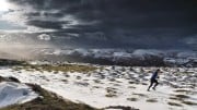
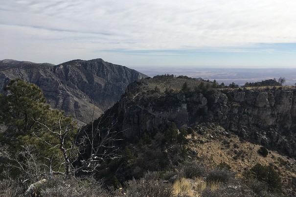
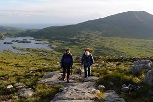
In Spring 2022, Munroist Ian Robertson went to the desert hills of west Texas in search of something a bit different, and ended up having one of the best trips of his 30-year hillwalking career.
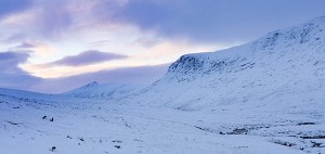
Overlooked by legions of outdoor fans as they speed past en route to Wales, the forgotten hills of Shropshire are one of the great hidden gems of British hillwalking. Most of the county's hills lie south of Shrewsbury and are confined by the rivers Severn and Teme. True, none of them reach 2000ft 'mountain' status, but if you're striding out along the long, airy ridges it matters not a jot. The hills are mostly velvety green like the Howgills, but many have an underlying framework of hard volcanic rock, which surfaces as dark summit crags and tors.

Shropshire is indeed quiet, a place for easy livers and, although few who have never visited would think of it as a prime hillwalkers' destination, in reality those rivers flow through some of the prettiest hills in England.


As you motor down the A49 from Shrewsbury the first hill you come across is The Lawley, a short, steep-sided whaleback ridge. Hiding behind it until the last moment is Caer Caradoc Hill, an even steeper sided hill layered with dusky crags. This volcanic hill, which sits alongside the Church Stretton Fault, was formed when a collision between the two tectonic plates thrust the one to the east upwards. The heat that ensued brought about the volcanic action that formed the dolerite crags of Caer Caradoc and the surrounding Stretton Hills east of the fault. The best routes up Caer Caradoc begin from the Cwms Road (track) which accesses the south and east slopes. However, a far more satisfying full day-walk takes in the neighbouring Hope Bowdler Hills. It begins from the B4371 Much Wenlock Road just beyond Church Stretton's last houses, climbs to Gaer Stone and Hope Bowdler Hill before dropping down to tackle Caer Caradoc. This is followed by rounding the Lawley to the west, doubling back to climb its ridge, then rounding Caer Caradoc and the wooded Helmeth Hill on the west side before returning to the start.

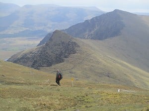
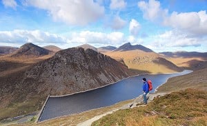
Lying across the other side of the Church Stretton Valley, the No match for crag id:"Long Mynd" is a 7-mile (11km) heather ridge, perhaps Shropshire's best known hill range. It's riven in the east by several steep-sided, twisting valleys known locally as batches, which provide excellent routes to the tops. The busiest of these is the Carding Mill Valley, Church Stretton, managed by the National Trust. It's a crowded place rather spoiled by coach parties and car visitors. That said, it doesn't take long to leave the crowds behind and enter landscapes where you can see waterfalls, wild horses and, if the time is right, eat the hillside whinberries.

Ashes Hollow, which runs from the summit at Pole Bank down to Little Stretton, is less frequented, as is The Townbrook Valley, which furrows through the hillsides below the craggy Devil's Mouth peak. In the east the valleys are shorter and coombe-like, and the paths up them are fewer and more direct. There are countless route combinations, each with their own attractions, but the best is a skyline walk taking in the whole ridge. It begins at All Stretton and climbs through the Batch and Jonathan's Hollow before heading south along the ridge. The descent begins on a track straddling the unnamed 456m hill, down through forestry to the mouth of Minton Batch before following country lanes through Minton and Little Stretton, where there is a choice of low paths skirting the Mynd's eastern slopes back to the start.

One of my favourite ranges, Stiperstones, looks across to the Long Mynd from the west. Its 3 mile (5km) ridge is cloaked with heather and whinberry. In the north there's a complex of side ridges riven by western dingles (small valleys). Further south the ridge narrows and is punctuated by jagged, tor-like crags like the one known as Devil's Chair. Just to the south of it, the impressive Manstone Rock, the summit of Stiperstones, looms large on the skyline, easily recognisable with its trig point capping its angular structure. Nearly 500 million years ago the mountain's summit ridge would have been rising out above glaciers. The ground was subjected to constant freezing and thawing, which shattered the rock into the screes and tors you see today. All around the ridge are the relics of lead mining – the sites at Snailbeach and the Bog are fascinating and add interest to any walk.
There's a really satisfying half day walk beginning from the Bog car park in the south. It climbs to the ridge via Cranberry Rock, visits Manstone Rock and the Devil's Chair before descending the bridleway south of Perkin's Beach. A prominent track heading south above Tankerville leads back to the Bog. For those who want to make a day of it, this walk can be combined in a figure-of-eight taking in Nipstone Rock, sometimes known as South Stiperstones.

Brown Clee Hill is the highest in Shropshire and is the local hill for Birmingham and many of the West Midlands towns. The Pearl of Shropshire it is not. This poor hill, along with neighbouring Titterstone Clee Hill, has over the centuries been savaged by quarrymen and miners, hunting for dhustone (dolerite) and any other minerals found beneath the surface. The hills have also been speared by communications masts and capped by huge 'golf balls' (communications radomes). It's all fascinating for industrial archaeologists but too messed about for the purist. Both hills have gobsmacking views and their share of quiet corners though, so it would be worth spending half a day on each. The best way up Brown Clee begins from a small car park a couple of miles west of Cleobury North and climbs the east slopes through Stanbroughs Woods. You can take the car almost to the top of Titterstone Clee Hill – this highway to heaven begins from the A4117 a couple of miles west of Cleehill village.

Drive west from Craven Arms, through the Clun Valley and you'll see gentler hills, some forested but all green with smooth grass slopes typical of Silurian geology. Unexciting? No, there's mystery in those hills. Ancient civilizations dating back to Neolithic times made their homes on the hilltops and the earthwork rings of Iron Age forts can still be found today. Bury Ditches north of Clun and Burrow Fort north of Aston-on-Clun are the finest examples and both have good paths to them. Continuing westwards towards little Newcastle you come across Offa's Dyke, an 8th century earthwork Welsh-English border dyke running from Chepstow to Prestatyn. Hereabouts, it's at its finest, never more so than on No match for crag id:"Llanfair Hill". Walks from Knighton and Llanfair Waterdine will show you all the best bits.

The hills get smaller as you go northwards towards Shrewsbury, but the volcanic hog's back that is The Wrekin makes one last stand as it soars above the rooftops of Telford. Although covered with forest there's just enough open ground and lots of rocky outcrops to make this a top priority on a hillwalkers' list. The Wrekin's summit is capped by a large 20-hectare Iron Age fort, once home to the Cornovii tribe. The secret here is not to try to make a day of it by adding contrived routes across farmland. There's a car park at the north end of the ridge, where waymarked routes climb past Halfway House café (Wrekin Cottage on the map), onto the ridge and through Hell and Heaven Gates to the summit. Descend to the track junction beneath Little Hill and return to the car park.
When to go
You can walk in Shropshire at any time. Spring is a delightful time when nature is vibrant with new life and colour. The bracken is still red; in the woods the vivid chrome green of the new leaves contrasts with the abundant spring flowers, which have poked their heads up above last year's leaves.
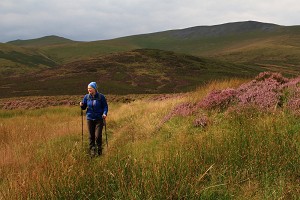
In summer the days have lengthened, making it possible to do much longer walks, or evening walks, taking in the sunset. The ground at this time has dried out, although you'll find that low-level paths may be a little overgrown. Make sure you take your waterproof leggings at this time for dew-drenched vegetation can soak you quite quickly as can farmers' crops. Mid to late August is the best time to see the heather blooming on Stiperstones and the Long Mynd.
In autumn the nights draw in again but the flame-colours of the bracken and the woods add great beauty to the landscape. Whinberry leaves have turned red, and the heather to dark russet. Together they mix with the grasses to create a tapestry of colour any tweed designer would be proud of.
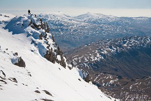
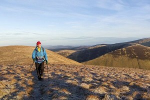
Winter, when the snow has fallen, gives the hills a new dimension and most sogginess in the ground will be replaced by a crunch under your feet. Some of the vegetation will have died back, making progress along the lower paths easier. Woodland paths may however be slippery at this time.

Getting there
By bus: 410 National Express London to Shrewsbury via Telford and Birmingham (for all regions)
By rail: Shrewsbury to Birmingham (onwards to London, East Midlands and North); to Swansea via Heart of Wales line; to Manchester.
Getting around
Like most rural areas Shropshire's bus services are sketchy. However, on Bank Holidays and summer weekends there's a regular and useful shuttle bus centred on Church Stretton. It takes a circular route around and over the Long Mynd and Stiperstones. See the shuttlebus website here
Links between the major towns of Shrewsbury, Ludlow, Bridgnorth and Telford are frequent and villages in between such as Much Wenlock, Church Stretton, Craven Arms and Ironbridge benefit from this. However, the out of the way places such as Stiperstones and the Clun Valley are not so well served. A car or a taxi would be a distinct advantage, especially outside the summer months.
Detailed travel information can be found at travelinemidlands
Where to stay
Church Stretton is the prime resort for the Long Mynd and the Stretton Hills and has several inns and B&Bs. There is also an abundance of shops for restocking purposes, including a walkers' shop. For Stiperstones there are two splendid inns – The Bridges (Horseshoe Inn) at Ratlinghope or the Stiperstones Inn in Stiperstones village. At Wentnor there are also two fine inns, the Crown and the Inn on the Green – a little further south but still with short car rides to both Stiperstones and the Long Mynd start points. Knighton, just over the Welsh border is best placed for Offa's Dyke routes and has a choice of inns and B&Bs plus plenty of shops. For those who like larger towns, Ludlow to the south of the region may fit the bill. This historic castle town has plenty of everything, including sophisticated restaurants and a theatre.
Hostels
There are youth hostels at Clun (The Mill), Wilderhope Manor, Wenlock Edge and Ironbridge Coalport, and independent hostels at Bridges Long Mynd; Womerton Farm near All Stretton and Stokes Barn, Much Wenlock.
Good campsites (selected)
Whitcliffe Farm Ludlow; Wheathill Touring Park (for Brown Clee and Titterstone Clee Hills); The Sytche, Much Wenlock; Wayside Caravan & Camping, Aston on Clun; Green Caravan Park, Wentnor; and Small Batch, Little Stretton (for the Long Mynd).
Maps
OS Explorers 201, 203, 216, 217, 218, 241 and 242 cover Shropshire's Hill country.
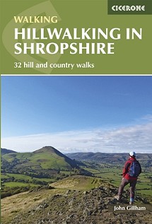
Hillwalking in Shropshire by John Gillham
This new Cicerone guidebook covers 32 walks in the hills of Shropshire. The walks, which are graded easy, moderate or hard, range from 3 miles (5km) to 12 miles (19km) and can be walked in all seasons.
The selected routes take in highlights such as The Wrekin, Wenlock Edge, Long Mynd and Stiperstones, Castle Ring and Bury Ditches. Featuring 1:50K OS mapping (shown at 1:40K for greater clarity), and step-by-step route descriptions, as well as information on accommodation, getting around, bases for the Shropshire hills and history of the region, the guide details everything you need to walk in Shropshire.
In Spring 2022, Munroist Ian Robertson went to the desert hills of west Texas in search of something a bit different, and ended up having one of the best trips of his 30-year hillwalking career.

Daft online reviews occasionally make it into the mainstream media, and they don't get much sillier than complaints about mountains. Since we're not above laughing at the less hill-savvy, we've mined Tripadvisor for some...


Comments