Patterdale Parish Boundary Walking

Administrative boundaries are often a fiddly distraction on OS maps, masquerading as footpaths and obscuring detail. But in this case a boundary forms the basis for a challenging round. Follow the hilly skyline of Patterdale parish and you'll clock up an impressive list of fells, not to mention sky high distance and ascent stats. From the rolling Dodds to the craggy coves of Helvellyn and Fairfield, Ullswater’s woods to High Street’s wide horizons, this classic circuit takes in the finest features of the eastern Lake District. The route is used every July as the basis for a gruelling one-day fundraising challenge, but it’s also great as a backpacking weekend. Wild camping spots abound, not to mention the handy mid-route option of the Priests Hole cave on Dove Crag (usually busy - a tent may prove preferable). As ever, the rules are up to you, but while it would be pedantic to stick rigidly to the exact boundary every step of the way, you should at least visit every summit.

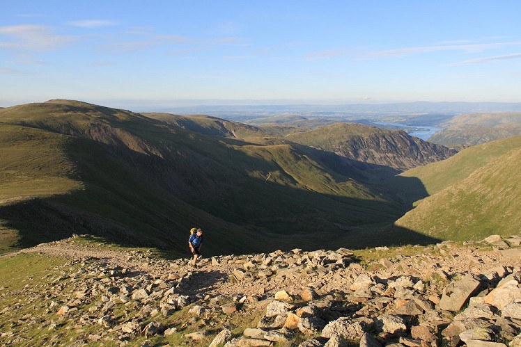
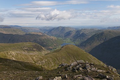
Ullswater and the distant North Pennines from the ascent of Lower Man  © Dan Bailey - UKHillwalking.com
Ullswater and the distant North Pennines from the ascent of Lower Man
Fetching Map

Detailed description

1
NY3859016966 From Glenridding take the A592 north then a parallel footpath along the wooded shore of Ullswater. Return to the road where it squeezes under Stybarrow Crag, and soon after turn left onto a path signed for Glencoyne. This climbs steeply through woods before descending to join a track in Glencoyne. Turn left onto this, passing the houses at Seldom Seen and continuing steadily uphill to the boggy col at Nick Head.

2
NY3626018251 Turn right to climb up and over grassy Green Side. Continue onto the domed summit of Stybarrow Dodd. Head down into Sticks Pass – the path is obvious – and then continue up a rocky trail, passing Lakeland's only ski tow, to reach the stony summit of Raise.

3
NY3427817395 From the summit cairn the path leads southwest around Keppel Cove and up to White Side. Ahead rises the Helvellyn massif, high point of the weekend. Descend roughly south into another little col, with the deep scoop of Brown Cove to your east and, confusingly, the buttresses of Browncove Crags to your west. Plod up the rocky ridge to the shoulder of Lower Man, then on around the edge of the cove to the summit plateau of Helvellyn. Pass a cairn marking the top of Swirral Edge and continue over the true summit to a wind shelter just beyond.
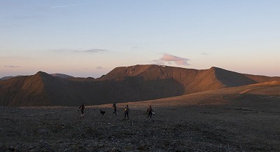
On Raise at dawn, heading for Helvellyn  © Dan Bailey - UKHillwalking.com
On Raise at dawn, heading for Helvellyn
© Dan Bailey - UKHillwalking.com, May 2016

4
NY3416815147 Continuing south, there's a heavily trodden trail on the west flank of the ridge, but sticking with the crest is better for the airy clifftop feel. It's a short climb onto Nethermost Pike. Follow the craggy edge of Ruthwaite Cove to reach the grassy summit of Dollywaggon Pike.

5
NY3460313064 Continue south along the edge of Cock Cove to re-join the busier main path. This makes a steep, zigzagging descent to reach a trail junction just above Grisedale Tarn. Turn right, heading past the tarn to the boggy watershed beyond. From here climb steeply by an old drystone wall onto the free-standing summit of Seat Sandal.

6
NY3438611528 Head east over the broad summit slopes, then descend a steep and eroded trail into the saddle of Grisedale Hause. Go straight over at a path junction, then tackle the relentless scree grind up Fairfield's west spur.

7
NY3586811739 Go east over the summit plateau and descend rough ground into the little col of Link Hause at the head of dramatic Link Cove. It's a short climb onto Hart Crag, then a rocky descent to the broad grassy col beyond. As the approximate mid point of the walk this is a good spot for two-day teams to think about camping. There's little shelter on the high ground, but down to the northeast grassy pitches are found. Those heading for the Priest's Hole should carry on down the Dovedale-bound path until level with the steep face of Dove Crag (the cliff, not the summit).
Waking up in the Priests Hole - not a line I've often used   © Dan Bailey - UKHillwalking.com
Waking up in the Priests Hole - not a line I've often used
© Dan Bailey - UKHillwalking.com, May 2014

8
NY3706710859 From the the col below Hart Crag, take the path beside a wall to the broad top of Dove Crag (the summit, not the cliff). Beyond the summit stay with the wall a short while until a path is met on the left, marked by a line of old fence posts. This soon drops steeply onto the boggy ground above the head of Scandale. The path winds through hummocks, passing just south of Little Hart Crag before descending into Scandale Pass.

9
NY3879709573 Above looms Red Screes, a shapeless grassy lump from this angle and, like Seat Sandal, another of those lone hills where much of your height gain is inevitably soon to be lost again. An eroded path leads up the northwest flank, shadowing a drystone wall. As the angle rolls back towards the top the trail bears left to reach the summit. Here Red Screes instantly redeems itself with a stunning view down Patterdale to distant Place Fell. More from that later.
Patterdale and Place Fell from Red Screes  © Dan Bailey - UKHillwalking.com
Patterdale and Place Fell from Red Screes
© Dan Bailey - UKHillwalking.com, May 2014

10
NY3965008749 The descent towards Kirkstone Pass is steep, but on a decent path that winds down through the rocks. The pass may be one of the lower points on the walk, but here you've finally broken the back of this route. Climb steeply east onto St Raven's Edge. Turn left here to follow a wall along the knobbly crest. Beyond a boggy saddle is a long gently-angled climb onto Caudale Moor. The high point is the eastern summit, Stony Cove Pike.

11
NY4179710008 Head roughly east-northeast, then follow a wall over open ground. Next comes a precipitous descent on a rubbly path with occasional scraps of scrambling, leading down to Threshthwaite Mouth. An obvious trail now follows a wall on a steep and rubbly ascent to the improbably tall cairn on Thornthwaite Crag. Here take the wide path east, looping around the head of the Hayeswater valley for the gentle stroll onto the grassy plateau of High Street.

12
NY4408211041 Continue north along a drystone wall, down to the Riggindale Straits col. The parish boundary avoids Rampsgill Head, instead staying with the wall to traverse the hillside overlooking Hayeswater. To stay true to the line you should climb the mini summit of The Knott in passing and then, sad to say, there's also a big grassy up-and-down over Rest Dodd that you might otherwise have skirted. Once back on the main path weave through knobbly ground to scenic Angle Tarn.

13
NY4177814539 Climb over a shoulder of Angletarn Pikes, make an airy traverse across the hillside above Dubhow Beck, then descend to the low saddle of Boredale Hause. The end is now tantalisingly close, but first the parish boundary is going to make you climb Place Fell. It's a brutally steep zigzagging ascent. Once the angle relents cross knobbly ground to the summit cairn.
Ullswater, St Sunday Crag and the Helvellyn range from the sneaky wee path on Place Fell's western flank  © Dan Bailey - UKHillwalking.com
Ullswater, St Sunday Crag and the Helvellyn range from the sneaky wee path on Place Fell's western flank
© Dan Bailey - UKHillwalking.com, May 2014

14
NY4056016958 The true parish boundary now wanders north to the outlying summit of Kilbert How before cutting across Ullswater back to Glencoyne, but as you're not going to walk on water this is a detour too far. Instead go north only briefly, bearing left where the route divides on a devious trail weaving among hummocks past The Knight to a boggy hollow just short of Birk Fell. Here the path turns hard left beside a stream before taking a descending diagonal across a hillside of rocks and juniper overlooking Glenridding.

15
NY3970017193 At the base of the hill drop to the lower of two traverse paths, heading south towards Patterdale village. Turn right through a farm and cross a bridge to reach the A592, which soon leads back to Glenridding.

This has been viewed 5,081 times

Loading Notifications...
Facebook Twitter Copy Email