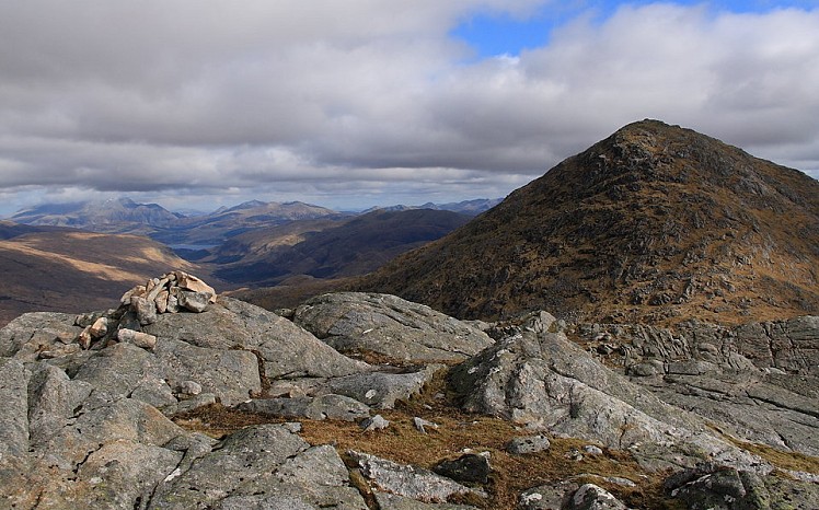
The highest among a chaos of rugged hills in the wild heart of Ardgour, Sgurr Dhomhnuill is a steep-sided pyramid that offers typically challenging West Highland walking. Cut off from the 'mainland' by Loch Linnhe, this area has the feel of an island, and most people use a ferry to get here. With no higher ground for a long way in any direction the peak is a superb viewpoint, an outlook spanning all the way from Rum to Ben Cruachan, Mull to Schiehallion. Inland are the more celebrated peaks of Lochaber, well seen from here but a world away in terms of popularity. If the lack of well-worn paths here is anything to go by, comparatively few people bother with Ardgour - a major plus point in its favour. The absence of 3000-footers must have a lot to do with it, but the Munroists' loss can be your gain. Various routes are possible. The walk described here gives a logical three-peak circuit, with a long but beautiful approach through the Ariundle Oakwood National Nature Reserve ( http://www.nnr-scotland.org.uk/ariundle-oakwood ), one of the largest remaining fragments of native Atlantic oak woods in Scotland.
Detailed description
This has been viewed 6,203 times
Download
OS maps and some other mapping apps don't allow waypointsStatistics
Difficulty: DifficultDistance: 11.31 miles (18.20 km)
Total ascent: 1,080m
Steepest Gradient: 38% (1 in 3)
Time: 6 – 8 hours (Walking)
to rate this walk.
Additional Information
Start/Finish:Ariundle Oakwoods NNR car park, NM825633
Nearest town:
Strontian
Terrain:
An easy track in the woods, but up on the hills the paths soon dwindle and there's plenty of rough going. Expect bogs, rocky bits and complex knobbly ground that'll be hard to navigate in mist. There are optional scrappy scrambly bits in places, and a steep descent on Sgurr Dhomhnuill's northwest flank.
Seasonal variations:
In snowy or icy conditions the descent of Sgurr Dhomhnuill's northwest flank needs particular care and shouldn't be taken lightly. It might be better to reverse the route direction so that this section is taken in ascent instead.
Weather and Hill Conditions: mwis: Northwest Highlands – Met Office: West Highlands
Public transport:
Corran ferry times: http://www.lochabertransport.org.uk/TransportinLochaber/PublicTransport/Ferries/CorranFerry.aspx Bus from Fort William to Strontian http://www.shielbuses.co.uk/index.html
Guidebooks:
The Corbetts, SMC
Maps:
OS Explorer 391 (1:25,000), OS Landranger 40 (1:50,000)
Accommodation:
Bunkhouse at the Ariundle Centre http://www.independenthostelguide.com/selected-accommodation.php?area=767
Find more Listings near this route
Tourist info:
Strontian (0845 22 55 121)
Further Routes
by Dan Bailey UKH
- Beinn Dorain and Beinn an Dothaidh 5 Feb
- East Ridge of Beinn a' Chaorainn and Beinn Teallach 21 Jan
- A' Chralaig and Mullach Fraoch-choire 4 Dec, 2023
- Meall na Teanga & Sron a' Choire Ghairbh - The Loch Lochy Munros 6 Nov, 2023
- Bynack More 19 Oct, 2023


