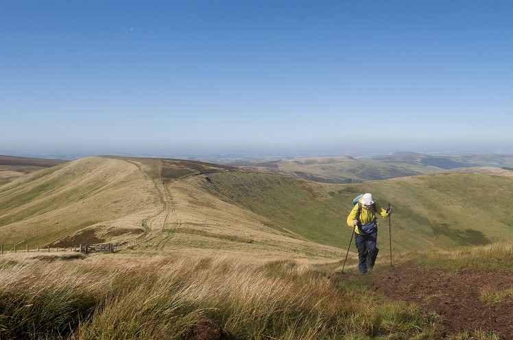
Half in England, half in Scotland Windy Gyle is the main summit on the Border Ridge that runs along the watershed of the Cheviots. Two Roman roads cross the main ridge, and this circular route, on the English side, uses one of them, The Street, for a gentle climb to the Borderline. 2km along that fine, high line lead to the summit, with its Bronze Age cairn and wide views into both countries. The equally descent along the lower ridge of Ward Law offers great views along Coquetdale.
Fetching Map
Height Profile
metres / Distance
miles
Detailed description
1
NT8664010347 Head up the valley road for 1km. Just after crossing Rowhope Burn, take a green track forking up right, The Street. The green track runs up the grassy ridgeline, beside fences, with a level section along Hindside Knowe.
2
NT8404412504 The track turns north, running up the right (east-facing) flank of Swindside Law. It descends slightly to a col, and follows the wide ridgeline over Black Braes to a Pennine Way signpost below a fence corner.
3
NT8349114974 You'll now be following the waymarked Pennine Way to Windy Gyle summit. At this signpost turn half-right, northeast, on a path across soggy moorland to a small col. The path heads up east, then runs along the ridgeline, keeping to right of the fence along the top of steep drops towards Coquetdale. After a slight drop to a narrower ridgeline, head up the summit slope of Windy Gyle, passing through a gate on your left on the way up, to the large sprawling cairn.
4
NT8552715195 Take a wide path just east of south to another signpost, and keep ahead, downhill. The path bends left to cross the top of a stream (Scotchman's Ford) then slantss down the top of the grassy slope down to right of Little Ward Law summit. It passes diagonally through the wide, flat saddle behind Ward Law, and drops east of south. Pass down to right of a plantation into the tree strip above Murder Cleuch.
5
NT8688613361 At a crossing track turn right for 2050m to a gate on the left. Through this, head south along the wide ridgeline towards Barrow Law. Just before the last slight rise to Barrow Law's top, the green track bears left, and slants straight down to the farm at Barrowburn.
6
NT8673510789 Cross a footbridge ahead up to an outlying building. Turn right onto a path above a broken wall. In 400m you can turn right again to cross a high footbridge over River Coquet to the walk start.
This has been viewed 668 times
Download
OS maps and some other mapping apps don't allow waypointsStatistics
Difficulty: ModerateDistance: 9.07 miles (14.60 km)
Total ascent: 432m
Time: 4:30 – 5 hours (Walking)
Voting:
from 2 votes
Login as Existing User
to rate this walk.
to rate this walk.
Additional Information
Start/Finish:Small car park south of Barrowburn in upper Coquetdale, Northumberland, NT866105
Nearest town:
Rothbury
Terrain:
Grassy paths and hill tracks
Seasonal variations:
As the name suggests, Windy Gyle can be exposed to harsh weather in winter.
Weather and Hill Conditions: mwis: Southern Uplands
Public transport:
None
Guidebooks:
Walking in the Scottish Borders by Ronald Turnbull (Cicerone) https://www.cicerone.co.uk/walking-in-the-scottish-borders
Maps:
OS Explorer OL16 (1:25,000), OS Landranger 80 (1:50,000) Directory Listings:
Find more Listings near this route Tourist info:
Otterburn (01830 520 093); Rothbury (01669 620887); Wooler (01668 282123)
Further Routes
by Ronald Turnbull
- The Cheviot: Border Ridge and Hen Hole biggie 14 Feb, 2023
- Minnigaffs from Loch Trool 10 Nov, 2022
- Loch Enoch, Galloway Hills 30 Aug, 2022


