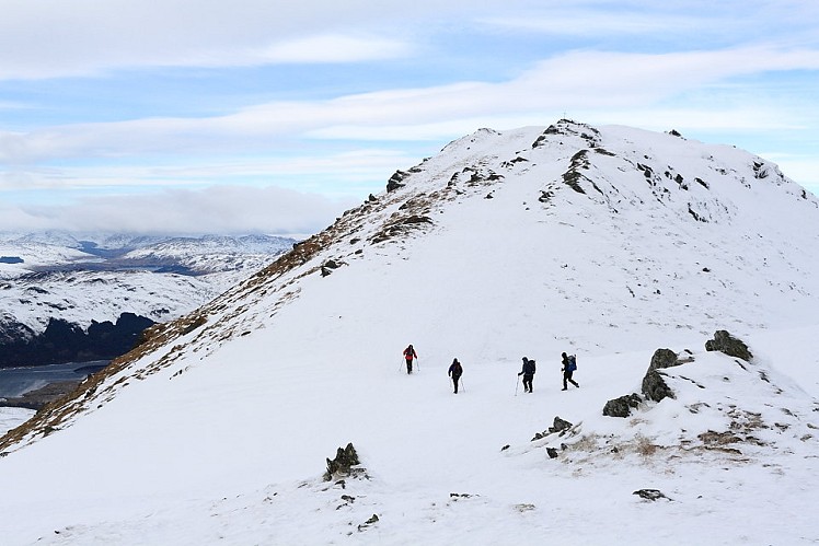
Standing on the edge of the Trossachs, Ben Ledi is prominent from much of the Central Belt, its steep-sided outline easily recognisable. An accessible base, a quick simple ascent and summit views spanning both Highlands and Lowlands combine to make this an understandably popular Corbett. Stick with the normal route and you can be up and down in a couple of hours; but the (optional) longer circuit described here makes a more satisfying trip, with the rough empty ground on Ardnandave Hill a nice contrast to busy Ben Ledi.
Fetching Map
Height Profile
metres / Distance
miles
Detailed description
1
NN5862709177 From beside the bridge take an obvious engineered path west, climbing quite steeply through forestry. On meeting a burn the path turns left, following it upstream to leave the woods. Having crossed the burn the path continues south-southwest uphill to outflank Ben Ledi's craggy east face, before cutting quite hard right to reach the broad crest of the southeast ridge. This gives a long, steady ascent with a couple of little false summits. The top is marked by a cross, a memorial for a policeman killed on a mountain rescue, and a little higher the trig point itself.
2
NN5623409758 Now follow a broken-down fence along the obvious steep-sided ridge, at first northwest and then north around the edge of a little corrie. Having reached a point overlooking the Bealach nan Corp the fence kinks left down a vague crest to reach this col. A path descends roughly east from here into Stank Glen, but for Ardnandave Hill keep going with the fence posts, passing Lochan nan Corp (named after an apocryphal funeral party that drowned when the ice gave way), then climb over Bioran na Circe (spot height 722 on the 1:50,000 map). Head north from here, trending right to stay with the high ground. It's all knolls and hollows, with little that passes for a path. Go over a double fence and weave through more knolls to reach Ardnandave Hill’s high point.
3
NN5671012482 To descend cross more lumpy ground onto the knobbly southeast spur. Newly planted forestry bars the lower slopes of the spur, so to avoid getting tangled up with this this veer west-southwest from about 550m altitude, where a rough slope leads into Stank Glen (it smells alright now). Meet a waymarked footpath in the bottom of the glen, following this along the left bank of the Stank Burn. At a junction with a forestry track go right, crossing the burn and continuing along its right bank. The path soon bisects another forestry track (look for the waymark) before continuing downhill through woods past a waterfall. At the houses at Stank pick up the Callander and Strathyre Cycle Route, which gives a quick easy return to the start.
This has been viewed 8,563 times
Download
OS maps and some other mapping apps don't allow waypointsStatistics
Difficulty: ModerateDistance: 7.78 miles (12.52 km)
Total ascent: 867m
Steepest Gradient: 26% (1 in 4)
Time: 4 hours (Walking)
Voting:
from 1 votes
Login as Existing User
to rate this walk.
to rate this walk.
Additional Information
Start/Finish:Car park just off the A84, NN586092
Nearest town:
Callander
Terrain:
A clear well-used path as far as Ben Ledi's summit, while the continuation over Ardnandave hill is pathless, boggy in places and generally much rougher.
Seasonal variations:
A good winter round with no notable difficult bits; snow can often drift quite deeply in the folds and hollows of Ardnandave Hill.
Weather and Hill Conditions: mwis: Cairngorms & Monadhliath – Met Office: West Highlands
Public transport:
Regular buses from Stirling to Callander
Guidebooks:
The Corbetts & Other Scottish Hills, SMC http://www.smc.org.uk/Publications/Publications.php?ID=3
Maps:
OS Explorer 365 (1:25,000), OS Landranger 57 (1:50,000) Directory Listings:
Find more Listings near this route Tourist info:
Callander (08452 255 121); Aberfoyle (08452 255 121); Dunblane (08707 200 613)
Further Routes
by Dan Bailey UKH
- East Ridge of Beinn a' Chaorainn and Beinn Teallach 21 Jan
- A' Chralaig and Mullach Fraoch-choire 4 Dec, 2023
- Meall na Teanga & Sron a' Choire Ghairbh - The Loch Lochy Munros 6 Nov, 2023
- Bynack More 19 Oct, 2023
- Beinn a' Mhuinidh 4 Oct, 2023


