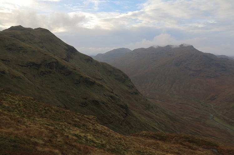
A steep-sided peak with some nice knobbly terrain, and an impressive outlook over the Balquhidder glen and nearby Crianlarich hills, Stob a' Choin would doubtless be far better known if only it was 50m higher. Luckily its Munro shortfall keeps this fine hill under wraps. Tucked away near the head of the glen, this stand-alone Corbett is an excellent pretext for the scenic single-track drive down Loch Voil.
Fetching Map
Height Profile
metres / Distance
miles
Detailed description
1
NN4457618449 Continue on the road, now private, to pass through Inverlochlarig farm. The outlaw folk hero Liam Neeson lived here or hereabouts; try not to rustle any cattle in passing. Stay on the main glen track through cow pastures, following the River Larig to a big footbridge over the river.
2
NN4273817462 On the south bank of the river bear roughly southwest over the boggy lower ground, then make a rising traverse across steepening grassy slopes, more or less in a beeline for the summit. It's hard going, and if you can find anything resembling a path you'll be doing better than me. Cross several small streams to meet the deep-cut burn draining the Bealach Coire an Laoigh. Instead of trying to negotiate this treacherous-looking gorge follow a fence up its east bank. Skirt left of a craggy bluff and carry on beside the gorge until roughly the 470m contour. Here the stream can be safely stepped over.
3
NN4209916451 Follow an obvious broad terrace steeply up and right, above one band of crags and below another, to reach a pronounced level shoulder on the skyline of the mountain's north ridge. A trudge up grassy slopes leads without further complication to the little cairn on the north summit. This has a nice airy view back down over the glen to the gnarled skyline of the Crianlarich munros. Continue south to the mountain's marginally higher main top.
4
NN4169715946 Head almost due east to descend rough ground, with a dilapidated fence line as a guide, into the notch of the Bealach Coire an Laoigh. A steep climb out of the col leads onto the lovely crest of Meall Reamhar, where the fence runs on over a series of rocky knolls and mini summits to the final top at 836m.
5
NN4273115391 The north-northeast ridge is the obvious way down. It's nice and knobbly, with another bit of fence to show the way and even the odd hint of path. As you near the end of the ridge veer off northwest to descend the steep grass slopes above the glen. Abandon any hopes of a trail here and just make straight for the footbridge, and the track home.
This has been viewed 6,617 times
Download
OS maps and some other mapping apps don't allow waypointsStatistics
Difficulty: ModerateDistance: 6.73 miles (10.83 km)
Total ascent: 853m
Steepest Gradient: 55% (1 in 2)
Time: 4 – 5 hours (Walking)
Voting:
from 1 votes
Login as Existing User
to rate this walk.
to rate this walk.
Additional Information
Start/Finish:Car park at the end of the public road from Balquhidder, NN445184
Nearest town:
Callander
Terrain:
Easy farm track to start and finish, but it's rough going on the hill itself, with a lot of very steep grass slopes and few traces of path. On the complex knobbles east of the summit route finding could be tricky in poor visibility.
Seasonal variations:
If there's an avalanche risk it may be worth avoiding the ascent as described (which is also pretty steep in winter hillwalking terms) and going up and back down the north-northeast ridge instead.
Weather and Hill Conditions: mwis: Southeastern Highlands – Met Office: West Highlands
Public transport:
No chance
Guidebooks:
The Corbetts, SMC
Maps:
OS Explorer 365 (1:25,000), OS Landranger 56 (1:50,000), OS Landranger 57 (1:50,000) Directory Listings:
Find more Listings near this route Tourist info:
Tyndrum (08452 255 121); Tarbet (Loch Lomond) (08707 200 623); Killin (08707 200 627)
Further Routes
by Dan Bailey UKH
- East Ridge of Beinn a' Chaorainn and Beinn Teallach 21 Jan
- A' Chralaig and Mullach Fraoch-choire 4 Dec, 2023
- Meall na Teanga & Sron a' Choire Ghairbh - The Loch Lochy Munros 6 Nov, 2023
- Bynack More 19 Oct, 2023
- Beinn a' Mhuinidh 4 Oct, 2023
Jack Frost
12 Nov, 2014
Rob Roy Macgregor will be turning in his grave at the thought of being confused by Liam Neeson


