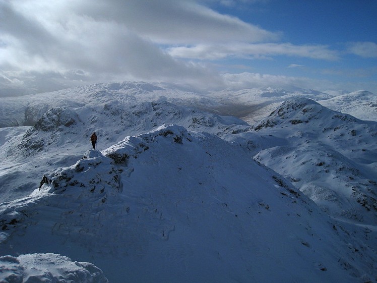
The classic ridge walk of the southern Highlands gives a varied and interesting route over several knobbly summits, in a grand position overlooking Loch Tay. The short narrow arete on Meall Garbh is the day's highlight, and though it's airy there's no real scrambling to speak of. It's a lot of work for a single Munro tick, particularly in winter, but the full traverse is worth the effort; and thanks to the high start there's less total ascent than you might suppose.
Fetching Map
Height Profile
metres / Distance
miles
Detailed description
1
NN6050638311 Take the track roughly southwest for a few hundred metres, then turn right onto an obvious and well-trodden path. This climbs west for just over 1km onto the broad crest of the ridge, which it then follows north to Meall nan Tarmachan's south top (spot height 923m). Bear northwest from here across a little saddle and a fence, then climb quite steeply through a tier of scrappy crags before curving left to reach the summit. This ascent can be tricky in deep snow or poor visibility.
2
NN5849239036 Descend a clear path, initially south and then southwest, passing a pool on a broad saddle to enter lumpy bumpy ground above the cliffs of Cam Chreag. From here a short steep ascent leads to the sharp peak of Meall Garbh, the best summit on the round.
3
NN5780138290 Heading west a brief descent brings you to the famous arete, a narrow level crest with an entertainingly airy feel. Unfortunately it's so short that you could almost miss it if you blinked at the wrong moment. The crest then broadens as it drops west towards the next col; but just before this saddle is a bad step, unseen until you reach it. This short rocky descent is only likely to prove awkward if it's wet or icy, and in fact there's a less problematic line just north of the obvious worn path.
Beyond the saddle the path weaves over two minor peaks before climbing to the summit of Beinn nan Eachan – all a bit confusing if it's misty.
4
NN5701638372 To get off Beinn nan Eachan bear a little right in descent to bypass some crags. Then there's more of that knobbly confusing ground as the ridge begins to swing south, climbing to the grassy summit of Creag na Caillich. From here keep following the high ground south over some mini tops. Below is a col, and again the best descent to it is to err slightly right to skirt a craggy patch.
5
NN5631436759 At the col turn left, descending scree under the rambling crags of Creag na Caillich to reach an old vehicle track. Now just follow this back east across the moor below the Tarmachan peaks - with luck you'll have a view of everything you've just climbed.
This has been viewed 11,968 times
Download
OS maps and some other mapping apps don't allow waypointsStatistics
Difficulty: ModerateDistance: 8.48 miles (13.64 km)
Total ascent: 842m
Steepest Gradient: 34% (1 in 3)
Time: 5 hours (Walking)
Voting:
from 2 votes
Login as Existing User
to rate this walk.
to rate this walk.
Additional Information
Start/Finish:Layby where the track joins the Ben Lawers road, NN604383
Nearest town:
Killin
Terrain:
Well trodden trails but reasonably rough throughout, with the occasional short steep section and some potentially tricky route finding in a pea souper. The Meall Garbh is narrow but short lived and hands-free, though the rocky descent at its far end needs more care if wet. From the west end of the traverse it’s a quick return leg on a 4WD track.
Seasonal variations:
Quite arduous in deep snow (but then, which hill isn't?). In decent winter conditions the Meall Garbh arete gives a very mild taste of the delights of mountaineering ridges, but watch out for icy conditions on the descent from the arete's far end. The rest of the route is straightforward.
Weather and Hill Conditions: mwis: Cairngorms & Monadhliath – Met Office: East Highlands
Public transport:
Infrequent local buses run from Killin to Aberfeldy; you could ask to be dropped at the bottom of the Ben Lawers road.
Guidebooks:
The Munros, SMC http://www.smc.org.uk/Publications/Publications.php?ID=1
Maps:
OS Explorer 378 (1:25,000), OS Landranger 51 (1:50,000)
Accommodation:
Braveheart Backpackers, Killin 01567 829 089 Ben Lawers Bunkhouse, Glen Lyon 01887 866 318
Find more Listings near this route
Tourist info:
Killin (08707 200 627)
Further Routes
by Dan Bailey UKH
- East Ridge of Beinn a' Chaorainn and Beinn Teallach 21 Jan
- A' Chralaig and Mullach Fraoch-choire 4 Dec, 2023
- Meall na Teanga & Sron a' Choire Ghairbh - The Loch Lochy Munros 6 Nov, 2023
- Bynack More 19 Oct, 2023
- Beinn a' Mhuinidh 4 Oct, 2023


