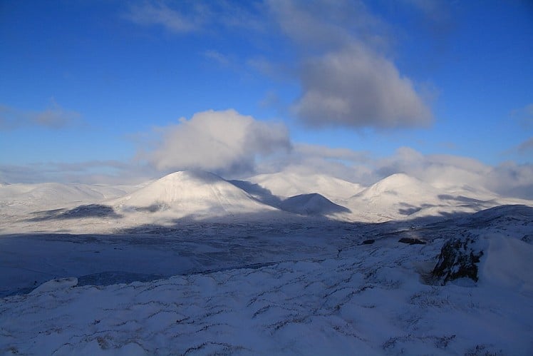
Rising over touristy Pitlochry and the wooded Pass of Killiecrankie, its stand-alone position on the edge of the highlands proper gives Ben Vrackie a nice spacious feel. The standard route on this accessible Corbett is a pleasant there-and-back leg stretch on an easy path; the route described here adds an optional loop to give a wee bit more body to the day.
Fetching Map
Height Profile
metres / Distance
miles
Detailed description
1
NN9440959767 The start of the ascent is signposted, with the route through the woods looking more complicated on large scale maps than it actually proves to be on the ground. Follow the Moulin Burn uphill through trees on a clear path. Beyond a short stretch of forestry track the path climbs steadily along the wood margin, going through a patch of conifers and dodging over the burn once or twice to reach the wood margin.
Now on open moor the well-surfaced path passes beneath a power line, trending northeast as it climbs. At a junction stay right to cross a burn, continuing up to a pass between the little lumps Creag Bhreac and Meall na h-Aodainn Moire. At the next junction go right, then left at a third, skirting around the hillside to reach Loch a Choire, a shallow dammed lake with an odd boulder island.
2
NN9479462430 Cross the dam. Ben Vrackie is now dominant ahead; the stone-paved ascent path stays right of the steepest rockiest ground, zigzagging up the slope and then looping quite hard left for the final climb to the summit. A viewpoint indicator gives a clue to what you're seeing - on a clear day it's quite a lot.
3
NN9507763213 Most people head back the way they came, and I usually do too, but if you're wanting to be out for more than two hours you could try this optional extra:
Descend northwest, and then contour around the slope to pick up Ben Vrackie's broad west ridge. This leads easily, but without much by way of a path, onto the rocky terminal summit of Meall an Daimh, which has good views down towards the River Garry and north to Beinn a' Ghlo.
4
NN9386964090 Descent is again pathless. Go roughly south at first, then bear more south-southwest, weaving steeply down among scattered outcrops to reach a clear track on the easier-angled ground below. This leads back to Moulin via a short easy climb over the Bealach na Searmon (not named on smaller scale maps); there are a couple of junctions but the right route is obvious.
This has been viewed 11,683 times
Download
OS maps and some other mapping apps don't allow waypointsStatistics
Difficulty: ModerateDistance: 7 miles (11.30 km)
Total ascent: 813m
Steepest Gradient: 39% (1 in 3)
Time: 3:30 hours (Walking)
Voting:
from 1 votes
Login as Existing User
to rate this walk.
to rate this walk.
Additional Information
Start/Finish:Woodland car park reached via a steep uphill drive from Moulin (to get here go left at the hotel, then take the next right), NN943597
Nearest town:
Pitlochry
Terrain:
An obvious, well-made path all the way up; the optional extension over Meall an Daimh is pathless.
Seasonal variations:
A good hill for winter novices, though if it's icy the final ascent can feel quite steep.
Weather and Hill Conditions: mwis: Cairngorms & Monadhliath – Met Office: East Highlands
Public transport:
Bus or train to Pitlochry.
Guidebooks:
The Corbetts and other Scottish Hills, SMC http://www.smc.org.uk/Publications/Publications.php?ID=3
Maps:
OS Explorer 386 (1:25,000), OS Landranger 53 (1:50,000), OS Landranger 43 (1:50,000), OS Landranger 52 (1:50,000)
Accommodation:
Pitlochry Backpackers Hotel 01796 470044
Find more Listings near this route
Tourist info:
Pitlochry (01796 472215); Aberfeldy (01887 820276); Dunkeld (01350 727688)
Further Routes
by Dan Bailey UKH
- East Ridge of Beinn a' Chaorainn and Beinn Teallach 21 Jan
- A' Chralaig and Mullach Fraoch-choire 4 Dec, 2023
- Meall na Teanga & Sron a' Choire Ghairbh - The Loch Lochy Munros 6 Nov, 2023
- Bynack More 19 Oct, 2023
- Beinn a' Mhuinidh 4 Oct, 2023


