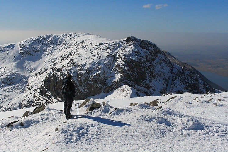
The very highest point in England might be a bit of a dull lump but there's much more to Scafell Pike than its overcrowded summit. This stern, stony mountain sprawls over a large area, its many impressive corners offering some of the grandest mountain scenery in the Lake District. The justifiably popular approach along the Corridor Route takes you through the heart of it all. Close the loop by heading over the mountain's three lesser tops, Broad Crag, Ill Crag and Great End, each as worthwhile as the Pike itself. Nb. This walk ignores the Pike's near neighbour Scafell, the direct route to which is via the notorious rock step of Broad Stand, a serious little scramble best left to climbers.
Detailed description
You might descend the southeast flank but it's just as easy to retrace your steps briefly to go down via Calf Cove. Follow the path to Esk Hause, another pivotal pass / motorway interchange. just before the low point of the col cut north on a path that runs below the rambling northeast face of Great End (home of classic winter climbs) to another path junction above Ruddy Gill.
This has been viewed 19,957 times
Download
OS maps and some other mapping apps don't allow waypointsStatistics
Difficulty: DifficultDistance: 9.15 miles (14.72 km)
Total ascent: 1,046m
Steepest Gradient: 32% (1 in 3)
Time: 6 hours (Walking)
to rate this walk.
Additional Information
Start/Finish:Road end at Seathwaite - plenty of parking spaces but they still fill up on sunny weekends, NY235122
Nearest town:
Keswick
Terrain:
Rough stony paths all the way, though there's no scrambling.
Seasonal variations:
As the highest mountain in the area Scafell Pike naturally gives a superb winter trip. But don't underestimate it. Aside from the obvious challenge of its length a couple of sections may need some care in icy conditions or deep snow, particularly crossing the gills on the Corridor Route and the descent from Scafell Pike towards Broad Crag.
Weather and Hill Conditions: mwis: Lake District – Met Office: Lake District
Public transport:
Regular buses from Keswick to Seatoller.
Guidebooks:
A variation on this route is covered in Great Mountain Days in the Lake District, Mark Richards, pb. Cicerone http://www.cicerone.co.uk/product/detail.cfm/book/516/title/great-mountain-days-in-the-lake-district/refer/ukh
Maps:
OS Explorer OL4 (1:25,000), OS Explorer OL6 (1:25,000), Harvey/BMC Lake District (1:40,000), OS Landranger 89 (1:50,000)
Accommodation:
Campsites at Seathwaite, Seatoller and Stonethwaite; Thorneythwaite Farm B&B near Seatoller 017687 77237; Borrowdale YHA 0845 371 9624; plenty more options in Langdale and Wasdale
Find more Listings near this route
Tourist info:
Seatoller (017687 77294); Grasmere (015394 35245); Keswick (017687 72645)
Further Routes
by Dan Bailey UKH
- East Ridge of Beinn a' Chaorainn and Beinn Teallach 21 Jan
- A' Chralaig and Mullach Fraoch-choire 4 Dec, 2023
- Meall na Teanga & Sron a' Choire Ghairbh - The Loch Lochy Munros 6 Nov, 2023
- Bynack More 19 Oct, 2023
- Beinn a' Mhuinidh 4 Oct, 2023


