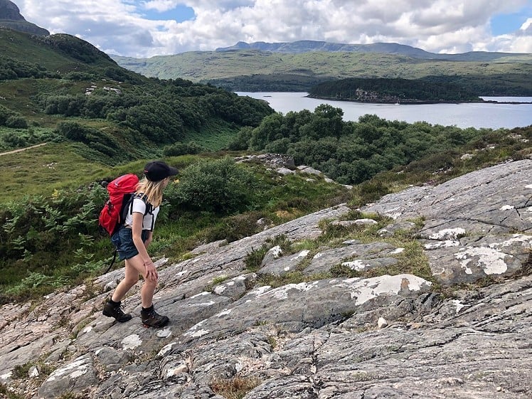
Even on a hillwalking holiday you might not want to make every walk a big one, and there's lots to be said for rest days and poor-weather alternatives. Of the many fantastic low-level options around Applecross and Torridon, An Aird stands out as a highlight. Jutting into Loch Torridon, this rugged little peninsula combines impressive mountain views and mostly easy walking, offering a lovely circuit from the postcard-perfect village of Shieldaig.
Fetching Map
Height Profile
metres / Distance
miles
Detailed description
1
NG8160754259 From the waterfront in Shieldaig follow the road north, uphill to the primary school at a hairpin bend. From here a track passes the school, then bends left past the grass sports pitch and a little crag (logged on UKClimbing). At a junction stay right. The track now runs broadly north onto the hummocky, rocky, part-wooded peninsula. Pass above two little bays (good swimming).
2
NG8154355336 At a junction turn left onto a narrower footpath. This climbs over slabby rocks (painted arrows mark the direction), winds through birch woods, then makes a short and slightly scrambly descent into a broad open area. Continue heading north to rejoin the vehicle track.
3
NG8126455960 Just before reaching a large green shed and small house (private residence, not a bothy), turn off left to follow a muddy footpath out onto the craggy little headland at the north end of the bay of Camas Ruaidh. This is a fantastic viewpoint looking over the narrows of Loch Torridon to the craggy landscape on its north side. Return to the vehicle track, pass left of the shed, and descend steeply to a little slipway and fishing bothy on the rocky shoreline (good swimming, can be a bit tidal through the channel).
4
NG8129856114 Head back uphill towards the shed, turning left to follow the footpath up a short chain-assisted rock step onto the heathery ground above the house. From here the path, a little soggy underfoot, weaves west. At a trail junction you can take either fork, but the more exploratory way is left, descending a steep slippy slope into birch woods to reach a meadow and white-painted house at Bad Callda.
5
NG8159256025 Turning inland, follow the track south, passing through the knolls in the middle of the peninsula with views of the Torridon hills and a nearby fish farm. Before reaching the obvious bay of Camas an Leim the track curves right, bringing you back to the junction of stage 2. Now just retrace your steps to Shieldaig.
This has been viewed 1,280 times
Download
OS maps and some other mapping apps don't allow waypointsStatistics
Difficulty: EasyDistance: 3 miles (4.83 km)
Total ascent: 198m
Time: 1:30 – 2 hours (Walking)
Voting:
from 1 votes
Login as Existing User
to rate this walk.
to rate this walk.
Additional Information
Start/Finish:Shieldaig - there's parking on the water front, NG815542
Nearest town:
Lochcarron
Terrain:
A mix of stony vehicle track and clear footpaths. Some rocky sections of almost-scrambling. Not 100% bog-free, but pretty dry as these things go.
Public transport:
Buses are limited in Wester Ross. Try the local minibus service connecting Applecross and Shieldaig with Inverness https://lochcarrongarage.co.uk/bus
Weather and Hill Conditions:
mwis: Northwest Highlands – Met Office: West Highlands Maps:
OS Explorer 428 (1:25,000), OS Explorer 433 (1:25,000), OS Landranger 24 (1:50,000) Directory Listings:
Find more Listings near this route Tourist info:
Lochcarron (01520 722357)
Further Routes
by Dan Bailey UKH
- East Ridge of Beinn a' Chaorainn and Beinn Teallach 21 Jan
- A' Chralaig and Mullach Fraoch-choire 4 Dec, 2023
- Meall na Teanga & Sron a' Choire Ghairbh - The Loch Lochy Munros 6 Nov, 2023
- Bynack More 19 Oct, 2023
- Beinn a' Mhuinidh 4 Oct, 2023


This is a lovely little walk, which I have done a number of times. A few observations:
At the junction marked as point 2, there is an option to follow the track right, instead of left. The two paths converge a little later, although the path that joins them is not shown on the OS map.
The house at the north end of the peninsula is lived in by a very interesting chap who has been there off-grid for over 20 years. If he's around, it's well worth stopping for a chat.
Watch out for the white-tailed eagles. There is usually a pair nesting on Shieldaig island, and the birds are often seen overhead as one walks round the peninsula. There are good viewing points a few hundred yards past the school.
It's not a very exacting walk, so one doesn't exactly earn the coffee and cake, but Nanny's, at the south end of the village, is a good place to stop for refreshments.