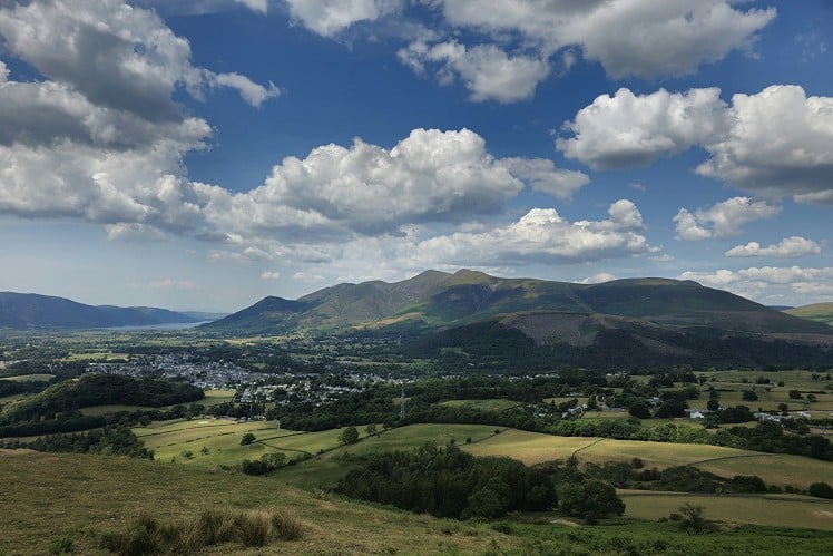
The central ridge of Lakeland may not have dramatic pinnacles along its watershed but the tops are richly carpeted with heather, the flanks are beautifully wooded and the very centrality means breath-taking panoramas. Skiddaw looks sensational from here, as does Blencathra. The Helvellyn range marches alongside you to your east. Steep slopes fall westward from your feet into steamer-waked Derwentwater. Save this one for a good day.
Fetching Map
Height Profile
metres / Distance
miles
Detailed description
1
NY2821922689 There are a few pull-ins along the lane to the caravan park. You know the drill about parking responsibly, right? Start walking south up the lane.
2
NY2836622105 There's an acute fork in the path, closely followed by a footbridge, closely followed by another fork. In each case take the right. There are fingerposts to Walla Crag so it's not difficult.
3
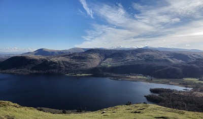
NY2772521288 Just before the summit of Walla Crag, there's a stile over the fence. It's well worth going close to the edge here to experience the view down to Derwentwater and Great Wood. Just don't tip over the edge unless you're armed with a parapent.The way to Bleaberry Fell is clearly visible heading south. Only the last, eastward swing, is steep. From there, head south through a landscape of heather, to High Seat. In summer, this area is rich in stonechats and broad-bodied chasers. You can see how little reascent is required in this view from across the lake.
4
NY2871018036 From the stone shelter, head NW on turf. This very soon becomes a stone-laid path dropping down the shoulder of Dodd, parallel to Ashness Gill.
5
NY2703719706 At the bottom of the open fell, you'll suddenly find a cluster of tourists around the photographic honeypot of Ashness Bridge. Take the footpath on the eastern bank of the gill, signposted to Great Wood. Keep going, broadly on a contour to the Great Wood car park. Keep going through this, then swing up the slope a little to a higher contour heading NE.
6
NY2803722359 When you reach the gill, turn right, head up tthe southern edge of the gill to a footbridge. Cross this, and go up to the lane you started from.
This has been viewed 711 times
Download
OS maps and some other mapping apps don't allow waypointsStatistics
Difficulty: ModerateDistance: 8 miles (12.90 km)
Total ascent: 657m
Time: 4 – 4:30 hours (Walking)
Voting:
from 1 votes
Login as Existing User
to rate this walk.
to rate this walk.
Additional Information
Start/Finish:Castlerigg Hall Caravan and Camping Park (about 1km SE of the stone circle), NY281227
Nearest town:
Keswick
Terrain:
Vast swathes of heather. Can be damp after rain.
Seasonal variations:
The central ridge is a good pick in drought or frost.
Weather and Hill Conditions: mwis: Lake District – Met Office: Lake District
Public transport:
555 Bus
Guidebooks:
Wainwright Book 3 - Central Fells
Maps:
OS Explorer OL4 (1:25,000), Harvey/BMC Lake District (1:40,000), OS Landranger 89 (1:50,000) Directory Listings:
Find more Listings near this route Tourist info:
Keswick (017687 72645); Seatoller (017687 77294); Ullswater (017684 82414)
Further Routes
by Norman Hadley
- St Sunday Crag 30 Apr
- Bannisdale Horseshoe 6 Apr
- Sallows and Sour Howes 20 Mar
- Kinder Downfall and the Reservoir Round 14 Feb
- Buttermere Horseshoe 3 Jan
- Brock Crags and Angletarn Pikes 12 Dec, 2023
- The Kentmere Frog 27 Nov, 2023
- High Street North 15 Nov, 2023
- Sgùrr a' Chaorachain: a slice of Applecross 17 Sep, 2023
- Wolfhole Crag: A Journey to the Centre of the Earth 5 Sep, 2023


Nice route. For anyone wanting to add a couple of extra Wainwrights with not much more ascent, it's straightforward to continue on to High Tove from High Seat, then do and out and back to Armboth Fell, then head down to Watendlath from High Tove. From Watendlath, the single track minor road then heads down to Ashness Bridge and rejoins this route at Step 5.
Good shout, gld73. I've also done this as a linear walk, carrying on over Ullscarf and High Raise before fetching up in Langdale. There's plenty of potential to divert via Steel Fell, Helm Crag or Silver How to link up via the 555 bus service.