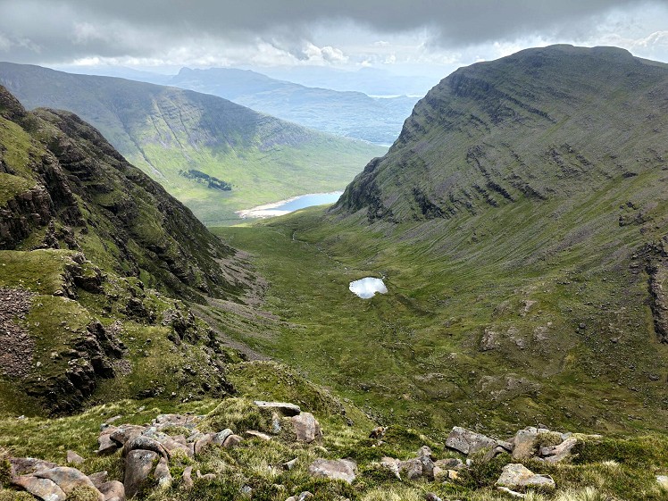
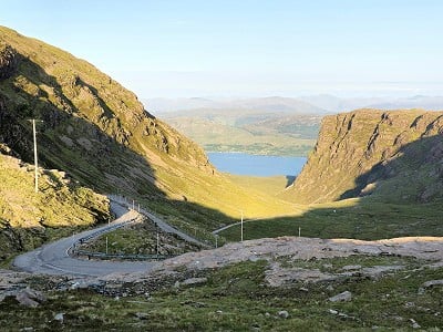
On the map, the Applecross peninsula looks as if the gods, on a particularly raucous stag weekend, hurled an axe into the sea. To the Gaelic speaker, this is A' Chomraich: the Sanctuary. To the Munro monomaniac, this is terra whybothera. But there are two fine Corbetts, a staggeringly impressive mountain pass, miles of fantastic coast and spectacular views over to Skye. This route is unusual because tarmac boosts you to a whopping 626m. This puts Sgùrr a' Chaorachain in a whole other category of west coast hill, in a region that typically requires a pull from barely above sea-level. This opens up the option of a quick outing, diplomatically squeezable into a family holiday.
Fetching Map
Height Profile
metres / Distance
miles
Detailed description
1
NG7742442655 Start at the pull-in at the apex of the bealach. Take the ugly gravel track, complete with snow poles, east to the equally ugly signalling installation at 773m. At least the views are spectacular!
2
NG7859942473 Don't let the labels on the OS map fool you into thinking you're at the top. See that peak out to the south east? That's the true summit at 792m. Start by heading due south along the corrie edge.
3
NG7868541781 Swing due east for the easy-but-scenic walk out along the undulating ridge crest, passing over a series of little tops before the final short pull to the summit.
4
NG7974541746 Retrace steps back to the bealach summit. Or add the taller Corbett, Beinn Bhan, if you want to make more of it. But this involves a complex, twisty ridge on rough ground and would miss out on Beinn Bhan's impressively corried eastern flank in any case.
This has been viewed 807 times
Download
OS maps and some other mapping apps don't allow waypointsStatistics
Difficulty: EasyDistance: 4.23 miles (6.80 km)
Total ascent: 375m
Time: 2 – 2:30 hours (Walking)
Voting:
from 1 votes
Login as Existing User
to rate this walk.
to rate this walk.
Additional Information
Start/Finish:Bealach na Ba summit, NG774426
Nearest town:
Lochcarron
Terrain:
Torridonian sandstone boulders mixed with a rich tapestry of grass, sea-pinks, and alpine alchemilla.
Seasonal variations:
In winter, getting to the start of the route is likely to be the most dangerous part of the day.
Weather and Hill Conditions: mwis: Northwest Highlands – Met Office: West Highlands
Public transport:
Hmm. Good luck.
Guidebooks:
The Corbetts by Hamish Brown
Maps:
OS Explorer 428 (1:25,000), OS Landranger 24 (1:50,000) Directory Listings:
Find more Listings near this route Tourist info:
Lochcarron (01520 722357); Kyle of Lochalsh (0845 22 55 121); Broadford (0845 22 55 121)
Further Routes
by Norman Hadley
- St Sunday Crag 30 Apr
- Bannisdale Horseshoe 6 Apr
- Sallows and Sour Howes 20 Mar
- Kinder Downfall and the Reservoir Round 14 Feb
- Buttermere Horseshoe 3 Jan
- Brock Crags and Angletarn Pikes 12 Dec, 2023
- The Kentmere Frog 27 Nov, 2023
- High Street North 15 Nov, 2023
- Wolfhole Crag: A Journey to the Centre of the Earth 5 Sep, 2023
- Wansfell Pike 16 Aug, 2023


