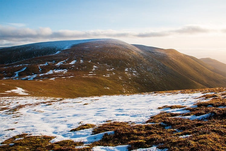
If you've only ever walked to the main summit of Ben Wyvis via the standard route from the west then you might have it down as a very busy hill, and not a particularly complex one. But of course there's a lot more to it than that. A range of many tops and radiating spurs, Wyvis saves its sprawling and isolated side for the east, where two craggy corries roll out into an expanse of moorland foothills. It's wild and little-trodden over here, and while this may be due to the predominance of bog, the quietness has its own appeal. Almost separate enough to be in with a shot at full Munro status, the satellite top of Glas Leathad Beag makes a worthwhile target in its own right, a soggy but ultimately rewarding circuit that feels very far from the main ridge Munro-motorway.
Detailed description
This has been viewed 841 times
Download
OS maps and some other mapping apps don't allow waypointsStatistics
Difficulty: ModerateDistance: 11.81 miles (19 km)
Total ascent: 872m
Time: 6 – 7 hours (Walking)
to rate this walk.
Additional Information
Start/Finish:Park (considerately) by a track entrance just before the turning circle at the end of the public road in Glen Glass, NH547689
Nearest town:
Alness
Terrain:
Largely on estate tracks, though some are made more of peat slurry than solid ground. Boggy terrain is sustained, but nowhere extreme. Best in a dry spell?
Seasonal variations:
This would be a long day in a short winter daylight window, but with no particular difficulties. The smooth grassy slopes of Wyvis can be avalanche prone but the ground covered here ought to avoid most risk.
Weather and Hill Conditions: mwis: Northwest Highlands – Met Office: West Highlands
Public transport:
None
Maps:
OS Explorer 432 (1:25,000), OS Explorer 437 (1:25,000), OS Landranger 20 (1:50,000), OS Landranger 21 (1:50,000) Directory Listings:
Find more Listings near this route Tourist info:
Strathpeffer (0845 22 55 121); North Kessock (0845 22 55 121)
Further Routes
by Dan Bailey UKH
- East Ridge of Beinn a' Chaorainn and Beinn Teallach 21 Jan
- A' Chralaig and Mullach Fraoch-choire 4 Dec, 2023
- Meall na Teanga & Sron a' Choire Ghairbh - The Loch Lochy Munros 6 Nov, 2023
- Bynack More 19 Oct, 2023
- Beinn a' Mhuinidh 4 Oct, 2023


