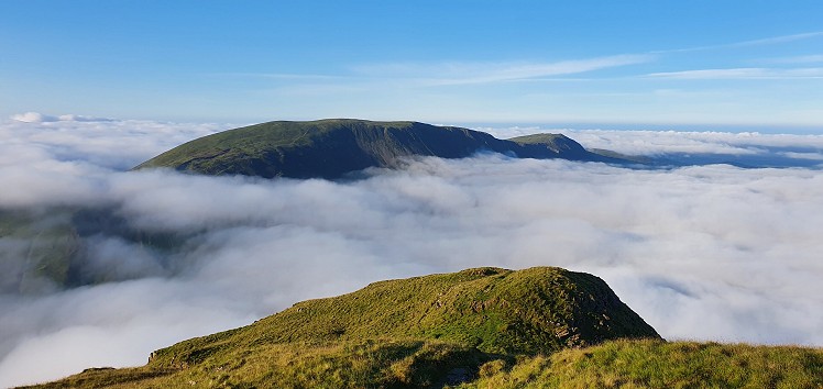
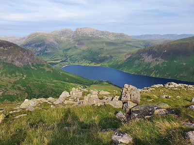
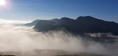
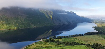
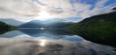
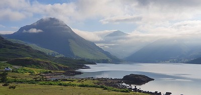
For most people, getting to Wasdale is a journey so epic it may require assistance from grey wizards with staffs. The temptation is strong, having got there, to throw yourself at the big hills around the dalehead, with Scafell Pike standing in for Mount Doom. But the flanking fells are also well worth exploring, with knobbly summits, deep gullies and no fewer than three tarns tucked into their folds. This route takes a clockwise circuit of the Nether Beck drainage basin, with an excellent finish on the rocky escarpment of Red Pike and the upturned boat of Yewbarrow.
Fetching Map
Height Profile
metres / Distance
miles
Detailed description
1
NY1510105411 From the road junction, take the road signposted towards Gosforth
2
NY1443805594 Turn right at Greendale (a very good place for yellowhammers, incidentally) and head up the obvious path by the stream.
3
NY1429206112 Don't get into the stream bed itself, but head up the broad ridge to Middle Fell. The views get better and better with height. Amble anticlockwise round the skyline circling Greendale Tarn, to Seatallan.
4
NY1396808400 From Seatallan, there's a surprisingly long and steep drop to the northeast, to the col of "Pots of Ashness". You can ponder what the quality of ashness might be, and how one might pot it, on the steep climb to Haycock. Difficulties can generally be turned on the left.
5
NY1447910708 The wall heading east-north-east is now your guide to Scoat Fell. The option is presented of a quick out-and-back to Steeple if you want to add a seventh Wainwright to your day's tally.
6
NY1611011400 Head south on the dramatic escarpment over Red Pike (the Wasdale one, obviously) and descend to the col of Dore Head.
7
NY1750809510 Scramble sportingly up the rocks of Stirrup Crag to reach the gorgeous crest of Yewbarrow. The Scafells look utterly sensational from here.
8
NY1757609133 The traverse of the ridge is not too difficult; I've never found Great Door a significant obstacle. Just make sure you don't go straight on over the nose of Bell Rib without a wingsuit or a jetpack.Instead, veer right down scree and awkward little rock-steps, then contour back onto the bracken-covered nose of the fell to descend to Overbeck Bridge.
9
NY1680506810 The way back is along the road but you absolutely will not mind a bit of tarmac if you have a clear day. Trust me.
This has been viewed 1,217 times
Download
OS maps and some other mapping apps don't allow waypointsStatistics
Difficulty: DifficultDistance: 11 miles (17.70 km)
Total ascent: 1,411m
Time: 7 – 7:30 hours (Walking)
Voting:
from 1 votes
Login as Existing User
to rate this walk.
to rate this walk.
Summits
Middle Fell 582 mSeatallan 692 m
Haycock 797 m
Little Scoat Fell 841 m
Red Pike (Wasdale) 826 m
Stirrup Crag 616 m
Yewbarrow 628 m
Additional Information
Start/Finish:Wastwater shore, NY150054
Nearest town:
Nether Wasdale
Terrain:
Mostly easy but some scrambling on Yewbarrow
Seasonal variations:
Stirrup Crag could be a significant obstacle if iced up.
Weather and Hill Conditions: mwis: Lake District – Met Office: Lake District
Public transport:
In summer, please consider using the shuttle bus from Nether Wasdale to reduce congestion.
Guidebooks:
Wainwright Western Fells
Maps:
OS Explorer OL4 (1:25,000), OS Explorer OL6 (1:25,000), Harvey/BMC Lake District (1:40,000), OS Landranger 89 (1:50,000) Directory Listings:
Find more Listings near this route Tourist info:
Sellafield (019467 76510); Seatoller (017687 77294); Egremont (01946 820 693)
Further Routes
by Norman Hadley
- St Sunday Crag 30 Apr
- Bannisdale Horseshoe 6 Apr
- Sallows and Sour Howes 20 Mar
- Kinder Downfall and the Reservoir Round 14 Feb
- Buttermere Horseshoe 3 Jan
- Brock Crags and Angletarn Pikes 12 Dec, 2023
- The Kentmere Frog 27 Nov, 2023
- High Street North 15 Nov, 2023
- Sgùrr a' Chaorachain: a slice of Applecross 17 Sep, 2023
- Wolfhole Crag: A Journey to the Centre of the Earth 5 Sep, 2023


