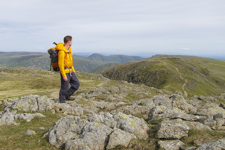
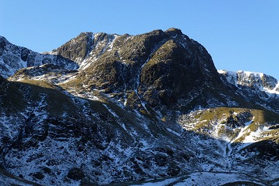
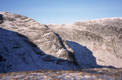
Fairfield is a fell of split character, its gentle and heavily trodden southern flank a striking contrast to the wild and craggy north side. Here the ground is bitten into two dramatic coves, Sleet and Link, divided by the gnarled spur of Greenhow End. This is the double-headed Deepdale, one of the more quietly inspiring locations in the Lake District. Providing a connoisseur's alternative to the ever-popular Fairfield Horseshoe, this walk takes you into Link Cove, from where Greenhow End is climbed via a rough route with some optional scrambling. Return to the valley via Hart Crag and the long interesting arm of Hartsop Above How.
Fetching Map
Height Profile
metres / Distance
miles
Detailed description
1
NY3991014415 Park in a lay-by at Bridgend on the A592. The way up Deepdale is straightforward, initially on a track past a couple of farms. After 1.5km the track becomes a clear footpath, which weaves around extensive drumlins. All the while Greenhow End looms ever larger ahead. Leave the path where it rises towards Sleet Cove, crossing a stream and contouring left beneath Mart Crag. A short steep slog up grass and scree, skirting beneath the craggy front of Greenhow End, brings you to the mouth of Link Cove. Avoid scattered crags low down on your left by staying right of the right branch of Link Cove Gill (the left branch is a popular grade 3 scramble).
2
NY3708811912 Just before the upper floor of the cove is reached, head northwest towards the top of Greenhow End. The steep broken slope can be climbed almost anywhere. By following a cairned route up a rake it's just a steep walk, while it's possible to contrive some fun grade 2/3 scrambling on sound slabby rock by staying further right towards the front of Greenhow End. Alternatively the broken ground to the left of the rake provides a more easygoing, go-anywhere sort of scramble.
3
NY3688812045 Follow the broad bumpy crest of the ridge, pausing to admire the drop down Hutaple Crag into Sleet Cove, and Link Cove's impressive Scrubby Crag, where quality rock climbs await the intrepid armed with a trowel. Once on Fairfield's wide summit plateau bear almost due west to the top, which may seem crowded compared to Deepdale.
4
NY3587111732 Retrace your steps for the best part of a kilometre, before bearing southeast towards the narrow saddle of Link Hause. In poor visibility, watch out for the abrupt edge of Scrubby Crag as you make your way down to the saddle. A short uphill stretch then gains the summit of Hart Crag, a fine panoramic viewpoint.
5
NY3683111271 Keep fairly close to the edge of the north face, which falls away in a series of rocky tiers. Scattered outcrops bar your path, but they're much easier than they might look. The wide slope ahead narrows as you lose height, forming the thin neck of Hartsop above How, a raised highway between Dovedale and Deepdale. From here the views across to Greenhow End and out over Patterdale are stunning. The contrast with the enclosed depths of your approach route makes this ridge the more welcome, though bogs underfoot guarantee sticky walking at times. This long descent takes you gently down to Bridgend.
This has been viewed 6,930 times
Download
OS maps and some other mapping apps don't allow waypointsStatistics
Difficulty: ModerateDistance: 7.58 miles (12.20 km)
Total ascent: 779m
Time: 4:30 – 6 hours (Walking)
Voting:
from 2 votes
Login as Existing User
to rate this walk.
to rate this walk.
Additional Information
Start/Finish:Bridgend on the A592 south of Patterdale (limited parking space: there's a bigger car park 1.5km south), NY398144
Nearest town:
Ambleside
Terrain:
A clear hill path to the head of Deepdale, followed by rougher and less clearly-trodden ground into Link Cove. The ascent of Greenhow End can involve some fairly short lived scrambling, though any difficulties are entirely optional. The return leg along Hartsop Above How is boggy in places.
Seasonal variations:
An excellent winter round with a very slight mountaineering flavour.
Weather and Hill Conditions: mwis: Lake District – Met Office: Lake District
Maps:
OS Explorer OL5 (1:25,000), Harvey/BMC Lake District (1:40,000), OS Landranger 90 (1:50,000) Directory Listings:
Find more Listings near this route Tourist info:
Ullswater (017684 82414); Grasmere (015394 35245); Ambleside (015394 32582)
Further Routes
by Dan Bailey UKH


