Cnicht - The Welsh Matterhorn Walking

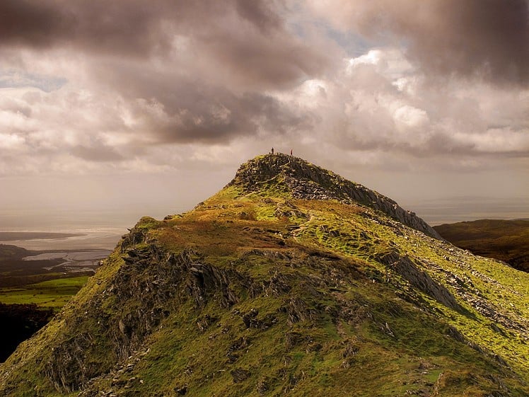
When viewed from across the coastal plain in the west, Cnicht takes on the appearance of a perfect pyramidal mountain reminiscent of a miniature Matterhorn, though sadly that’s where the comparison with Zermatt’s finest ends. Our Cnicht is a bit of an imposter and far from being an isolated peak it is actually the high point of an elevated ridge rising from a boggy tableland. Ok, so now you’ve had the bad news it’s time for the good and there’s plenty of it! This walk around Cnicht and it aqueous environs is one of the most enjoyable in Snowdonia offering some of the finest views in the national park, a smidgeon of optional scrambling and a tour of the most enchanting llynau imaginable. And the best bit? Beyond Cnicht’s airy summit you will more than likely be on your own and wondering what you have done to deserve such a sublime area all to yourself. Enjoy, but don’t tell everyone!

The summit of Cnicht backed by Tremadog Bay  © Nicholas Livesey
The summit of Cnicht backed by Tremadog Bay
Fetching Map

Detailed description

1
SH6319748381 From the car park walk a short distance further down the road and cross a footbridge on the left which takes you towards Nantmor Mountain Centre then through a gate to the steep path heading up the hillside. Cross the stile and follow the path with Cnicht’s less impressive northern profile in full view. Continue onwards as the path (wet in places) swings around to the right through a shallow col arriving at a charming but nameless llyn. Though only a little over a mile from the road this spot feels deliciously remote so you’ll be forgiven for taking a short break to soak up the atmosphere.

2
SH6372446852 From the llyn a path marked on the map is an unpleasant boggy morass so give it a miss and head approximately southwards picking a way over the intervening ridge into the next mini cwm that contains slate spoil and the ruins of an old quarry, a fascinating place which is slowly being reclaimed by nature. Straight ahead now a wall runs up to a pronounced col on the skyline, this is Cnicht’s summit ridge so get yourself up there!

3
SH6396845977 Route finding ceases to be an issue once on the ridge but the views are so absorbing that it may be prudent to pay a little attention to where you’re putting your feet, thus avoiding a fast descent to Cwm Croesor! Before long the bold summit cone comes into view and a little further on is a level shoulder below it. This is a good place to take stock as there are three possible options ahead. On the right is a steep path which bypasses a superb grade 1 gully/runnel with excellent holds. To the left of the obvious runnel is a buttress of solid rock which goes at around moderate and can’t be recommended to anyone without rock climbing experience. Once past this entertaining section it’s a short climb to Cnicht’s airy summit.

4
SH6451046618 From the summit the view in 360 degrees is absolutely spectacular and reveals to the north east a spacious llynau studded hinterland across which you’ll soon be striding (or possibly sqelching), though in poor visibility it’s notoriously difficult to navigate through and is a popular training ground for mountain leadership courses. Head across to Cnicht’s North Top and down the ridge towards beautiful Llyn yr Adar.

5
SH6572847909 Above the llyn the path gives up the ghost and it’s every man for himself over wild and trackless terrain. At a fence skirt the outflow of a small pool over wet ground to gain the north top of Ysgafell Wen and a splendid view out to Moel Siabod.

6
SH6634348559 The penultimate leg is also one of the most interesting and one can visit all (or none if time is short) of the Llynau’r Cwn - the Dog Lakes - which occupy rocky hollows NW of Ysgafell Wen. Wend your way through more trackless territory exploring at will or make a beeline from any of the llynau to a good path above Llyn Llagi which is set in an impressive cwm replete with new winter climbing routes should they ever come into condition!

7
SH6500748552 It’s been a grand day but it’s not over just yet. A sketchy path finds its way past a ruined stone shelter and the curiously named ‘Burnt Mound’ (any ideas?) Descend gently back to Nantmor through a lovely natural rock garden and past a whitewashed farmhouse where the path leads back to the road. A short walk of half a mile takes you back to the start of the route.

This has been viewed 39,573 times


Further Routes

by Nicholas Livesey


Loading Notifications...
Facebook Twitter Copy Email