Easy Alpine ridge route - highly recommended

New Topic
This topic has been archived, and won't accept reply postings.
 Badpanda 19 Sep 2017
A shout out for a cracking route which I have not found any info on in English. Tried to add to database, but not sure if I succeeded. Hope this is useful...and "searchable".

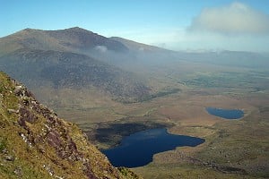
South ridge of the Roc Cornafion. Above Villard de Lans in the Vercors, France. Not a typical Vercors crag climb, but a high mountain ridge.

Excellent easy ridge route at Diff - perhaps with a bit of V Diff. First two thirds is mainly vertiginous walking come scrambling/climbing and an easy equipped abseil. We moved together (and it's good practice for this) but you might choose to carry the rope. Last third is more vertical. Three "walls". The second is the "crux". We got intimidated by some rather worrying internet accounts so put on climbing shoes and pitched. In fact turned out much easier (and less loose and easy to protect) than suggested.

Great, accessible Alpine confidence-builder. And a stunning day out.

Superb atmosphere, locations and views (Ecrins, Mt Blanc, Devoluy etc). A good route if you enjoy big easy British mountain crags.

Good topo on camptocamp.

(The similar Gerbier traverse - the continuation of the same ridge - is also supposed to be good - and better known.)
 ewanjp 20 Sep 2017
In reply to Badpanda:

Do you have a link to the topo on camptocamp?
 Raymondo 21 Sep 2017
In reply to Badpanda:

Looks like a cracking ridge, just googled it for pictures.


In reply to ewanjp:

Here you go....
https://www.camptocamp.org/routes/224450/fr/roc-cornafion-versant-e-voie-no...

and/or
https://www.google.com.au/maps/place/Roc+Cornafion/@45.0625831,5.5833543,14...
 kenr 21 Sep 2017
In reply to Badpanda:
Thanks for that great idea. Eager to try it.

And it's only 4 km north from another fun easy alpine ridge route, the Traverse of the Aretes du Gerbier.
. . . (described on CampToCamp, "Grande classique du Vercors").
. . . (I've done it twice so far).
with a very detailed English-language description
http://www.camptocamp.org/routes/54152/en/gerbier-ridge-traverse

Perhaps could be enchained ... after starting on Roc Cornaflon, return S to Col Vert - GPS latitude longitude approx (N45.0528 E5.5971) - then continue S "skywalking" (or sky-running if fitting this enchainment before sunset) on the wonderful ridge (with a few scrambling sections) almost to the Double Breche. Then drop down on W side to join the "Traversee ... Gerbier" route.

Ken
Post edited at 08:01
 John Gresty 21 Sep 2017
In reply to Badpanda:

We did the Gerbier traverse many years ago as a reccy for the descent after climbing a route on the Gerbier.
Middle of July, set off after lunch, just in running gear carrying water bottles in bum bag, we were fit in those days. North to south. I remember some interesting down climbing at the end, which looked to us as being rigged for abseil descents, but we had no choice, it was either down climb or reverse the whole thing, and we had to be back for 7.00pm.

A good trip, and sorted out our route back after climbing a big route on the Gerbier.

John
 ewanjp 21 Sep 2017
In reply to Badpanda:

Excellent great - one for next summer I think! I take it crampons etc aren't needed?
 kenr 21 Sep 2017
In reply to John Gresty:
The abseils at the S end of the Gerbier traverse are easily avoided. Read the English-language version on c2c -- Not the French guidebooks, which sometimes seem to feel that no mountain outing is complete without a rappel/abseil.

Ken
OP Badpanda 01 Oct 2017
In reply to ewanjp:

Sorry for delay in replying. No crampons; it's a pure rock route in summer. Have a look at the "sorties" ("outings" in English?) on c2c which give a good idea of the conditions at different times of year. It's supposed to be a great winter route too.

Lots of wildlife btw - chamois, ibex, vultures, marmottes. Would have glorious flowers in early summer.
 jcw 02 Oct 2017
In reply to John Gresty: out of interest what route? It is rare to find an enthusiast for the big Vercors routes on UKC.

 John Gresty 03 Oct 2017
In reply to jcw:

We tended to visit a different area each time for our summer trips to Alpine regions, which isn't the best of methods for getting the best out of each place
It was the year of the 500th aniversary of the first ascent of Mont Aiguille, we were two weeks late for the big bash but school holidays set the timetable.
Exact routes, I'm not sure which these days, but I know, in between wet weather, we did a route on the Gerbier, Mont Aiguille, Preseles, and other smaller crags in the region. Added to which there were various walks sorting out approaches, descents, and exploring the region.
We tended to use 'Les Prealpes du Sud' from the Rebuffat 100 best routes series as our basic guide for the longer routes, although we did pick up some locally printed guides for the smalle crags.
Only been back there once since, a walking trip on the plateau in early autumn.

John
 kenr 04 Oct 2017

I tried to squeeze it in this afternoon, between a couple of other critical tasks for flying home early tomorrow morning, but ran out of time. So I only got as far along the Roc Cornafion S ridge to where the horizontal traversing ends and the sustained uphill climbing begins. For sure the Roc looks rather dramatic approaching from the South - (and the overall setting is pretty and pleasant, and included views of some key high peaks of the French Alps).

Key thing I found was that the (short) abseil/rappel at around (N45.0565 E5.5988) is easily avoided by going back S along the ridge 40 meters to a small notch (N45.05603 E5.5986), next off the ridge crest down East about 20 meters, then traverse N across the head of a gully, and then diagonal up to rejoin the ridge crest at the bottom of the abseil, and continue N from there.

I thought the moves after the abseil were more interesting (and less vegetated) than the earlier section south of the abseil point.

I started hiking from the west side from Parking on asphalt, GPS lat long approx (N45.0730 E5.5793) about 2 km E up from the village of Villard de Lans. The trail up to Col Vert (N45.0528 E5.5972) was straightforward, but unfortunately rather muddy due to logging operations.

I sort of doubt it makes sense to try to link the Cornafion S ridge with the Aretes du Gerbier ridge traverse, since the preferred directions of the two routes are opposite.

Ken
Post edited at 20:30
 kenr 04 Oct 2017

I'll guess that Roc Cornafion S ridge is less popular than the Aretes du Gerbier traverse first because the Cornafion ridge is less narrow (nothing like the "razor" section on the Gerbier traverse). And less committing -- lots of escapes to the E side.

Also because the Cornafion peak is so dramatic, it's perhaps harder to enjoy the (longer) horizontal section just for itself. Rather tend to feel it's just something to "get through" on the way to the "real" climbing ahead north.

Never mind comparisons, it's just a worthwhile and pretty outing in itself.

Ken

P.S. For those looking for a longer ridge traverse Link-Up, consider starting at the Double Breche (N end of Aretes du Gerbier traverse) - perhaps doing the alternate approach to it given in the English-language version on c2c, then going N from there to Col Vert, and continuing on up S ridge of Roc Cornafion.
Post edited at 21:18

New Topic
This topic has been archived, and won't accept reply postings.
Loading Notifications...