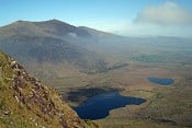
hellvelyn fell top assessor

New Topic
This topic has been archived, and won't accept reply postings.
lee johnson 02 Dec 2010
What ever happened to the daily conditions page on the Met Office website for the top of Hellvelyn. It used to be a godsend.
 Simon Caldwell 02 Dec 2010
In reply to lee johnson:

They start on Saturday.
http://www.lakedistrict.gov.uk/weatherline
 nightmonkeyuk 02 Dec 2010
In reply to Toreador:
Good find, i was thinking about this myself this morning. Its an excellent service.
 JY - changed 02 Dec 2010
In reply to Toreador:
> (In reply to lee johnson)
>
> They start on Saturday.
> http://www.lakedistrict.gov.uk/weatherline

They've got tomorrow completely wrong.

"Forecast for Friday
Weather:

It will be a dry and bright day across much of the Lake District with sunny spells and strong sun glare from the snow. There may just be an isolated light snow flurry, especially over the Southern Lakes during the afternoon. A few patches of freezing fog may linger at low levels."

It's actually now forecast for heavy snow.
 JY - changed 02 Dec 2010
In reply to Jonathan Yates:

5-day Forecast for the Lake District
Produced by the Met Office

No wonder!
 LakesWinter 02 Dec 2010
In reply to Jonathan Yates: It's only a forecast, it's been oscillating all week between dump and weak front not amounting to much, also the main track of the front according to current estimations would miss Penrith and put most snow down over the Southern and Central Lakes, so a slight change could see it miss the Lakes or paste Penrith etc
 Simon Caldwell 02 Dec 2010
In reply to Jonathan Yates:
and this morning the MWIS forecast was for clear blue skies tomorrow with no snow at all
 JY - changed 02 Dec 2010
In reply to Toreador:

and now it's for lots of snow
 wercat 02 Dec 2010
In reply to Jonathan Yates:


the conventional wisdom is that a forecast that changes rapidly should engender lower confidence in the forecast outcome being correct than a forecast which has remained steady over a period of time. Sounds as if the outcome is not fixed yet ...
manboy 02 Dec 2010
In reply to lee johnson: a forecast is only as accurate as when it was taken, there are so many varialbes that we have no control of between when the forecast was taken and when the front arrives. 5 day forcasts are only a rough guests, if the front follows a specific route. You can onky truely look at a forecast the evening before, and ultimately just before you go out. The weather at the moment is so uncharacteristic that they have to keep changing their predictions
 JY - changed 02 Dec 2010
In reply to wercat:

Jezz.

The conventional wisdom is to always check the latest MWIS forecast the night before, which is for heavy snow.
 George Ormerod 02 Dec 2010
In reply to Jonathan Yates:
> (In reply to wercat)
>
> Jezz.
>
> The conventional wisdom is to always check the latest MWIS forecast the night before, which is for heavy snow.

He seems to be hedging his bets; the forecast is for heavy snow showers. Which could be pretty much anything in terms of how much snow is being put down.

 Simon Caldwell 02 Dec 2010
In reply to George Ormerod:

And the Met Office are hedging their bets - the Lakes Mountain forecast is for isolated snow flurries, but they've also issued a weather warning for heavy snow with accumulations of 3-6 cm! Both were first issued at about 4am this morning.
 George Ormerod 02 Dec 2010
In reply to Toreador:

For what it's worth snow-forecast says 3cm. Metcheck has thrown a wobbly and says "data temporarily unavailable"; their pine cone must have fallen of the wall.
 JY - changed 02 Dec 2010
In reply to Toreador:
> (In reply to George Ormerod)
>
> And the Met Office are hedging their bets - the Lakes Mountain forecast is for isolated snow flurries, but they've also issued a weather warning for heavy snow with accumulations of 3-6 cm! Both were first issued at about 4am this morning.

The latest Lakes Mountain forecast (MWIS) is for Heavy Snow Showers and upland Gales.

http://www.mwis.org.uk/mountain/LD.PDF


In reply to Jonathan Yates:
Yeah and keep an eye on how things are developing over several days before! This occluded front was a long warm sector that had been sitting over the Atlantic for a couple of days, presumably picking up moisture. When it hits the current cold air... Who knows until it happens!!!

NMM
jon_nz 02 Dec 2010
In reply to Northern Mountain Monkey: Yep, and how far it gets in, how far it gets pushed up, and how much moisture is all very hard to say. hence the interesting forecasts.
 DR 03 Dec 2010
In reply to Jonathan Yates:
As the second poster said, the fell top guys don't actually start until Saturday so any general forecast is from the Met Office and put up on the LDNPA's website. It's not the NPA's forecast. But from tomorrow we'll get specific conditions from Helvellyn - and it will be for the next four months.

Aye,
Davie

New Topic
This topic has been archived, and won't accept reply postings.
Loading Notifications...