Skip over navigation
UKH
Toggle navigation
Menu
Toggle navigation
Toggle navigation
Toggle navigation
Toggle navigation
News
Latest News
Press Releases
Olympics
Athletes
Events Diary
Weekly Newsletter
Job Finder
Help
Articles
Latest Articles
Destination Articles
Crag Notes
Hill Skills
In Focus
Opinion
Podcasts
Trip Reports
Write for UKH
Gear
Latest Gear
Gear News
Gear Reviews
Competitions
Latest Deals
Product Videos
Help
Directory
All Listings
Find Walking Club
Find Outdoor Shop
Find Accommodation
Find Instructor/Guide
Find Gear Manufacturers
Find Goods/Services
Help
Photos
Photos
Photo Galleries
My Photo Gallery
Latest Photos
Weekly Top 10
Top 200 Photos
Photo Articles
Help
Videos
Videos
Videos
Latest Videos
Categories
Hashtags
Athletes
Search
Route Cards
Routes
Hills
Hills
My Summits
Hill Finder Map
Munros & Hill Lists
Map my Route
Activity Diary
Guidebooks
Help
Forums
Forums
My Forums
My Topics
Search Forums
Premier Posts
Posting Guidelines
Help
Search
Advanced Search
Login
User
My Profile
User Options
Logout from this Location
Logout Everywhere
Search Users
Help
Saved Content
Photo Galleries
My Photo Gallery
Latest Photos
Weekly Top 10
Top 200 Photos
Photo Articles
Help
Videos
Latest Videos
Categories
Hashtags
Athletes
Search
My Summits
Hill Finder Map
Munros & Hill Lists
Map my Route
Activity Diary
Guidebooks
Help
My Forums
My Topics
Search Forums
Premier Posts
Posting Guidelines
Help
My Profile
User Options
Logout from this Location
Logout Everywhere
Search Users
Help
Saved Content
My Forums
UKH
Rocktalk
Hilltalk
Expedition & Alpine
Gear
Crag Access
Politics
Off Belay
Running
Biking
Skiing
Winter Climbing
Photography
Culture Bunker
The Pub
Lost & Found
Lifts & Partners
For Sale/Wanted
Premier Posts
NEW ROUTE CARD: Sheil Bridge- Glenelg Loop
New
Topic
Reply to Topic
This topic has been archived, and won't accept reply postings.
jonnie3430
12 Nov 2011
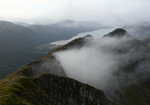
From Shiel Bridge to Glenelg and back along the northern shoreline.
24.07 miles, 38.73 km, 804m ascent, 6 hours. Sheil Bridge
Read more at
http://www.ukhillwalking.com/logbook/r/?i=176
Brass Nipples
12 Nov 2011
In reply to
jonnie3430:
Be great if you hads the ability to load a gpx file of the route for others to download. GPs on a bike justr wipes out all that phaffing at junctions etc.
OP
jonnie3430
12 Nov 2011
In reply to
PaleMan:
There is a house at 837239, so we knew where we were, the map wasn't sure where the path was!!
New
Topic
Reply to Topic
This topic has been archived, and won't accept reply postings.
Latest Jobs
2 New
Jobs
Work at Height and Rescue Trainer
Elsewhere on the site
Podcast
Mountain Air - 13. Jamie Aarons, Fastest Munroist in History
Loading Notifications...