Bowland place names tend towards a rather Tolkienesque darkness. In the course of a single outing you might encounter the Grey Stone of Trough, Dead Man’s Stake, Hell Crag, Pig’s Face, Catshaw Greave, Fiendsdale and Wolfhole Crag. This lupine lair is the destination of our there-and-back-again quest and, if you’re blessed with a vivid imagination, you can envision dark, lowbacked shapes still stalking these moors. As if that wasn’t enough to fire the fancy, this route also visits the geographical centroid of Great Britain: the point on which our kingdom would balance if it were poised on a fingertip. Forget Meriden and Haltwhistle: this is the one, true centre.
Fetching Map
Height Profile
metres / Distance
miles
Detailed description
1
SD6597950111 Start at Dunsop Bridge, noting the Puddleducks cafe as a potential source of refreshment. Set off up the good road heading north, with the playing fields on your right. 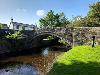
© Norman Hadley, Aug 2023
2
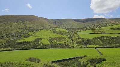
SD6569150894 After a kilometre-or-so, go through a farm yard and cross a footbridge to gain the true right bank of the river. Look out for dippers along this stretch. Keep heading north and upriver, with the Dunsop valley getting steadily more defined. After passing a cluster of water infrastructure at Footholme borehole, climb to a junction of tracks at the 199m spot height.
3
SD6531953575 From the spot height, you'll see a rough track slanting up and half left: this is your return leg. For now, head left towards Brennand Farm.
4
SD6509153793 Another 300m on, a fork in the track is of little consequence, because both forks reconvene. For preference, take the right as this bypasses the Brennand farms and affords their families a little privacy.
5
SD6447654311 After Brennand Farm, the track heads up to an aqueduct, but don't expect soaring arches in the style of Pont du Gard: this is a modest concrete leat carrying water across the slope. This section is the steepest so far, gaining a hundred metres of height in six hundred along. You'll gain a rising shelf overlooking the upper reaches of the Brennand River. The valley is filled with hope-inducing regenerated willow, birch and rowan scrub and, further on, waterfalls (not a common sight in Bowland). 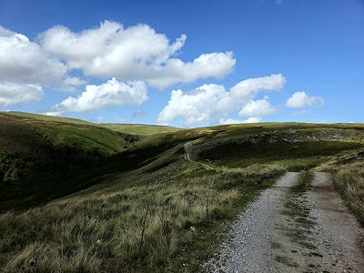
© Norman Hadley, Aug 2023
6
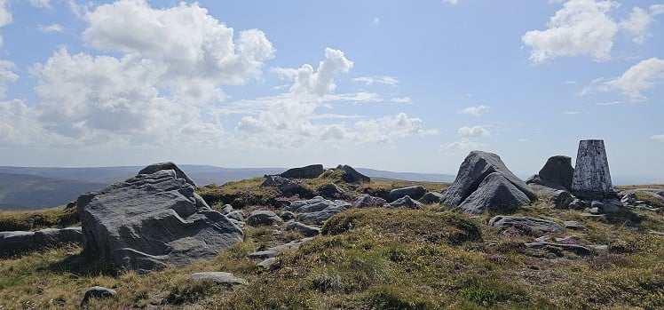
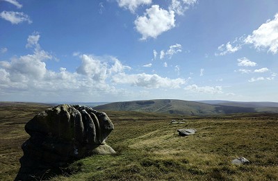
SD6339355941 Shortly after a couple of grouse-shooting buildings, the track comes to a sudden halt and the best you can hope for is to pick up the odd quad-bike track or the footprint of a Hunter welly. In high summer, the bracken can get a bit jungly, so follow Green Pot Clough up to its junction with Dure Clough, then head up the broad, heathery nose between them. Eventually you'll see a few white stakes pointing towards the summit rocks of Wolfhole Crag. These gritstone tors are beautifully clean, crystalline forms, worthy of a modern sculpture exhibition.
7
SD6337457842 From the trig point, follow the fence east, then east-south-east, for a kilometre to a junction of fences. Follow the south-east line, quickly veering south. Watch out for territorial seagulls in this area: this is the notorious Mallowdale gullery. They don't hold back from voicing their disapproval of intruders so if you harbour a Tippi Hedren complex, consider yourself warned.You'll soon reach a cluster of boulders called the Whitendale Hanging Stones, with a tall wooden post set among them. This, I think, marks the centroid. If you know your Winnie the Pooh stories, finding a pole is the ultimate goal of an Expotition(sic). 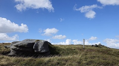
© Norman Hadley, Aug 2023
8
SD6431156278 The fence line veers south east and drops off with surprising steepness to Hunter Hole. Zigzag left then right to get through the gap in the stone wall, then continue on the same fence line past a small pool to a gate carrying a bridleway over a low, indistinct col.
9
SD6523154890 Turn right onto the bridleway and follow it down towards Brennand Farm. After crossing the beck, pick up a track gradually dropping southward. This will take you unerringly to the 199m spot height at point 3. Retrace your steps, remembering to recross the footbridge at point (2)
This has been viewed 926 times
Download
OS maps and some other mapping apps don't allow waypointsStatistics
Difficulty: ModerateDistance: 12.20 miles (19.63 km)
Total ascent: 533m
Time: 2:30 hours (Trail running);
5 hours (Walking)
Voting:
no votes yet
Login as Existing User
to rate this walk.
to rate this walk.
Additional Information
Start/Finish:Dunsop Bridge, SD659501
Nearest town:
Clitheroe
Terrain:
Much of the route is on very good tracks, including tarmacked farm road, but be prepared to get up close and personal with peaty heather in the middle section.
Seasonal variations:
These moors are controlled by grouse-shooting interests so beware of heading up there after August 12th without a flak jacket. In winter, this is committing territory: think Bleaklow if you're familiar with the Dark Peak.
Public transport:
The 510 bus service may be able to get you to Dunsop Bridge from Clitheroe.
Guidebooks:
Maps:
OS Explorer OL2 (1:25,000), OS Explorer OL41 (1:25,000), OS Landranger 103 (1:50,000), OS Landranger 102 (1:50,000) Directory Listings:
Find more Listings near this route Tourist info:
Clitheroe (01200 425 566); Garstang (01995 602125); Settle (01729 825192)
Further Routes
by Norman Hadley
- St Sunday Crag 30 Apr
- Bannisdale Horseshoe 6 Apr
- Sallows and Sour Howes 20 Mar
- Kinder Downfall and the Reservoir Round 14 Feb
- Buttermere Horseshoe 3 Jan
- Brock Crags and Angletarn Pikes 12 Dec, 2023
- The Kentmere Frog 27 Nov, 2023
- High Street North 15 Nov, 2023
- Sgùrr a' Chaorachain: a slice of Applecross 17 Sep, 2023
- Wansfell Pike 16 Aug, 2023


