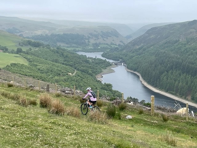
A fantastic mountain bike traverse of the mountains of Mid-Wales, described here over three days. Remote, beautiful and with some tremendous riding. Also check out route cards for days 1 and 3. This is a linear route.

See our article on this route
Detailed description
This has been viewed 247 times
Download
OS maps and some other mapping apps don't allow waypointsStatistics
Difficulty: DifficultDistance: 43.50 miles (70 km)
Total ascent: 1,795m
Time: 7 – 11 hours (Mountain biking)
to rate this walk.
Additional Information
Start Rhayader, SN970680; Finish Llangurig, SN889801
Nearest town:
Rhayader
Terrain:
Rocky tracks, high rolling moorland mountain biking mainly on grass, track and minor roads. Some pushing up steep grass hills and tracks. Very exposed to wind and rain. Remote location.
Seasonal variations:
More of an undertaking in wet, and or windy conditions. Navigation in places will need care in poor visibility.
Public transport:
Difficult to reach with bikes on public transport. Car is best.
Guidebooks:
Basic info and a very good video of the route can be viewed here. https://www.mtb.wales/transcambrianway
Maps:
OS Explorer 187 (1:25,000), OS Explorer 200 (1:25,000), OS Explorer 213 (1:25,000), OS Explorer 214 (1:25,000), OS Landranger 146 (1:50,000), OS Landranger 135 (1:50,000), OS Landranger 136 (1:50,000), OS Landranger 147 (1:50,000)
Accommodation:
Good variety of accommodation Rhayader (Ty Morgans recommended). Also camping near town. Accommodation in Llangurig is limited (Bluebell Inn often has rooms available) Camping near route.
Find more Listings near this route
Tourist info:
Rhayader (01597 810591); Llanidloes (01686 412 855); Builth Wells (01982 553 307)
Further Routes
by Mark Glaister - Assistant Editor
- The Trans Cambrian Way MTB route - day 3 20 Jul, 2023
- The Trans Cambrian Way MTB route - day 1 20 Jul, 2023

