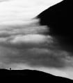
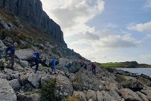
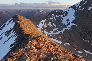
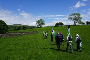
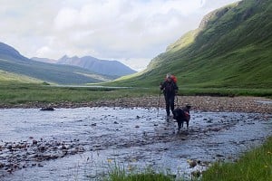
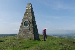
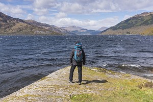
Walking the Tour of the Lake District

© Lesley Williams

The Tour of the Lake District is a 145km (90 mile) circular walking route from Ambleside around the Lake District National Park, visiting all the main valleys and local centres. It can be walked in a suggested nine stages (or fewer if you will), with an optional 'prologue' from Windermere station to the start-point in Ambleside. There are also five interchangeable high-level stages, which offer an opportunity to visit some of the region's most celebrated high peaks, including Scafell Pike, Helvellyn, Great Gable and Coniston Old Man.

Looking across Great Moss to the Scafell range  © Lesley Williams
Looking across Great Moss to the Scafell range
© Lesley Williams

The Lake District has so much to offer; magnificent mountain scenery, attractive valleys, picture-perfect lakes, characterful towns and a rich history... not to mention great walking! While most people tend to do day walks when visiting the Lake District, it's perhaps astonishing that the idea of a circular walking route, taking in the best of the Lake District is just that – an idea, with no official fixed route, and no signposts of any kind.

I had not originally intended becoming a guidebook author, but when the first edition of the Tour of the Lake District was about to go out of print (the author Jim Reid did not want to keep it updated) I found myself volunteering to take on the task of bringing the idea back to life with a completely fresh look at each stage. Marketing director turned author!

On Robin Lane, looking up the Troutbeck Valley, on the prologue stage  © Lesley Williams
On Robin Lane, looking up the Troutbeck Valley, on the prologue stage
© Lesley Williams

Tour stats

Length:

  • Main route (excluding Prologue) 144.5km
  • High routes 156.5km

Total ascent and descent:

  • main 5720m
  • high 7950m

Approx walking time:

  • main 47-50 hours
  • high 56-60 hours

I stared out of the dirty rain-splattered window at the cold grey sea as it buffeted the remote western coast of Cumbria. This was going to be a tough three days, but I had booked the accommodation several weeks ago, and this was still pre-covid days, when a bed for the night in Eskdale and Wasdale was hard to come by, even in late January. Researching alternative routes in this remote area definitely had to be done, and with virtually no options for splitting into day walks, I clambered into the waiting taxi at Ravenglass station and tried not to notice the concerned look on the driver's face.

Stepping stones are sometimes impassable!   © Lesley Williams
Stepping stones are sometimes impassable!
© Lesley Williams

Eskdale is utterly beautiful, and justifiably popular especially in the summer months. Day walks can take you to Scafell Pike and Harter Fell, or maybe to Nether Wasdale or Hardknott Roman Fort, and there's always the La'al Ratty narrow-gauge railway to assist tired legs back along the valley. My soggy afternoon was spent exploring between Doctor Bridge next to the historic Woolpack Inn and Eskdale Green, the final twenty minutes of cold wet walking only dimly illuminated by my headtorch.

Winter light, below Causey Pike  © Lesley Williams
Winter light, below Causey Pike
© Lesley Williams

The following day dawned cold and cloudy, but surprisingly dry. There's a direct route from Eskdale through the Miterdale forest and Irton Fell, neither of which I have to confess I had heard of or walked before. I squelched down the steeper northern flank of Irton fell and investigated a good new route directly to the southern end of Wastwater, then doubled back to Nether Wasdale for a much-needed hot bowl of soup. Walking up the road beside Wastwater was like no other that afternoon. I had the valley to myself in the wind and rain, and recall encountering just one car, one dog walker, and a few wet Herdwick sheep in the seven kilometres to Wasdale Head.

The storm broke overnight, and I noted that the Wasdale Head Inn enquired where I was going, and wished me luck! Up Mosedale, across the angry and turbulent Gatherstone Beck, then over Black Sail Pass, passing two intrepid walkers heading up. For some reason I fantasized about hot soup in the Black Sail Youth Hostel, the fantasy dashed by the reality of a locked door, and the roar of successive gusts of wind and rain as I cowered in the lea of the tiny building eating my squashed tuna sandwich. Where were all the Sunday walkers? With all their best wet weather gear, they were walking around Buttermere and having lunch in the café. It was a moment to be proud of as I entered the village, I had definitely had an adventure.

In Far Easedale, heading for Grasmere  © Lesley Williams
In Far Easedale, heading for Grasmere
© Lesley Williams

Research for the new guidebook had begun eighteen months earlier, curiously with the final stage of the Tour. The original guide included a particularly long final stage walk from Patterdale to Windermere, but by creating a Prologue stage from Windermere to Ambleside, it was possible to move the start and finish of the route to Ambleside. The new final stage took shape one beautiful day in late May. Bluebells had turned the lower slopes of High Hartsop Dodd a shimmering purple, and I was relishing the unusual warmth and vivid blue skies. Picking a way up the remote Caiston Glen brought me to Scandale Pass and a decision. There is an easy descent down Scandale directly to Ambleside, but I chose to climb to Red Screes, enjoying the panoramic views then on down the long broad ridge to Ambleside, a fitting treat for a final stage of the Tour. The direct route could be walked on another day.

So now I had a middle section and an end to the Tour. All I had to do was fill in the other stages. Researching new routes can take several bites of the cherry, as all kinds of things can go wrong or simply not work as well as you would like. There are broken bridges still awaiting repair after Storm Desmond struck in 2015, and stepping stones only passable in dry weather. There are paths marked on maps that are almost impassable when bracken as high as your shoulders covers the hillside, routes through woodland that simply don't work on the ground, and a multitude of alternatives in some valleys, all of which need investigating in order to choose the best possible route. There were many days spent in the Duddon Valley, Wasdale and between Little Langdale and Coniston trying to get things right!

Ennerdale's Black Sail Youth Hostel - no road access makes this a particularly sought after place to stay  © Lesley Williams
Ennerdale's Black Sail Youth Hostel - no road access makes this a particularly sought after place to stay
© Lesley Williams

Two of my favourite stages are the new high level route between Buttermere and Keswick, and the new route from Keswick to Rosthwaite. Climbing Whiteless Pike from Buttermere brings you onto the beginning of a fabulous ridge walk that climbs to 839m on Crag Hill, followed by the rollercoaster ridge over Sail and Scar Crags to craggy Causey Pike, and then down to Keswick. I ended up doing this route three times, as the first time I missed out the Sail and Causey Pike descent, the second time was a beautiful day for photos and recording GPX tracks, and the final time was when I walked the entire Tour in one continuous nine-day trip.

From Keswick, rather than staying low past Derwentwater, one bright cold winter day I climbed to Castlerigg Stone Circle, then on over Walla Crag – a much underrated little fell with great views, then down to Ashness Bridge, through the beautiful Ashness Woods and the Watendlath 'hidden' valley, then over the fells and down to Rosthwaite. The second time I walked the route was on my continuous trek. I had enthused about the route to my husband so there were high expectations. The day we walked the stage in October 2020 turned out to be the wettest day in England since records began. We saw nothing of the views, yet is still ended up being Jonathan's favourite day!

On one of the high level optional legs, descending Swirral Edge  © Lesley Williams
On one of the high level optional legs, descending Swirral Edge
© Lesley Williams

The high level options can be mixed and matched, as both low- and high-level routes for every stage start and end in the same places. My husband Jonathan helped with most of the hig level options, which saved a lot of time, as we could each do a high or low level stage and meet up at the end. There are high options to climb Coniston Old Man, Scafell Pike, Hay Stacks, Great and Green Gable, the Whiteless pike ridge fells, Helvellyn and Red Screes – plenty to keep the peak-bagger happy on the way, and great if it's a good clear day to take in some awesome views.

Each valley brings its own unique flavour and the route takes in lakes, rivers and waterfalls, woodland, valleys and fells. Fascinating historical features include a Neolithic, Roman and other ancient sites, packhorse bridges and properties that once belonged to Beatrix Potter and William Wordsworth.

High Hartsop Dodd turns purple with bluebells in spring  © Lesley Williams
High Hartsop Dodd turns purple with bluebells in spring
© Lesley Williams

A good range of accommodation options are available to suit all budgets, as well as camp sites at the start/end of each stage. In some cases options are limited, so early booking is advisable particularly in the height of summer, however there are nearly always moderately near alternatives just a short taxi or bus ride away, and this is true too when the accommodation provider requires a two night stay, making it possible to just take a lighter day pack on the first or second day, which is something of a treat!

In terms of gear, unless you are using a luggage transport company or organised tour, you will need to carry everything with you – a full change of clothes, the best waterproofs you can possibly afford, warm hat and sun hat, gloves, and ensure that your combined clothes cover for both very warm and cold conditions. You should be able to keep your pack at 5 or 6kg, plus water and food for during the day. Any more than that and you're probably carrying too much. Walking poles can be very useful especially for added stability crossing swollen streams. When it rains in the Lake District it does it a lot, and remember the wettest place in the whole of the UK is Seathwaite in Borrowdale, just a kilometre or two from where you will be walking! Camping trips will need more gear of course, and if staying in hostels you may need a sleeping bag.

Airy views above Borrowdale  © Lesley Williams
Airy views above Borrowdale
© Lesley Williams

It's all part of being an author!

The lumps and bumps along the way were occasionally frustrating. There was the time I turned the camera towards me to record some carefully chosen words, only to find the noise from the wind drowned out everything and my video was useless, just my moving lips and hair standing on end as I faced into the gale at Scandale Pass.

There were a few occasions when I forgot to reset my watch to record GPS tracks, so had to retrace my steps to start again. Then there were the challenges of photography necessitating several visits to particular spots, although I included photos in all weathers in the book, just to demonstrate that the weather can be both glorious and just about as miserable as you can imagine.

Descending into the Duddon Valley  © Lesley Williams
Descending into the Duddon Valley
© Lesley Williams

One thing that endures are the conversations I had with fellow walkers. The lovely older couple on the Walna Scar Road, taking their time but enjoying every minute, and the young couple on the same day marvelling that I was walking a continuous route over nine days. It certainly set their minds to thinking that they might want to do something similar. This was something I found over and over again, in that most people do day walks in the Lake District, but very few ever spend time on a walking journey in the national park to really absorb more of what this beautiful area has to offer. The Cumbria Way and Coast to Coast pass though the national park, but only for a few days, covering just a fraction of the fells and valleys.


Lesley Williams  © Cicerone

About the author

With a lifelong passion for walking, trekking and more recently cycle-touring, Lesley has been Cicerone's marketing director for over 20 years, leading Cicerone's sales and marketing efforts. Based on the edge of the Lake District, she and husband Jonathan have relished the excuse to spend many happy (and sometimes very cold and wet) days in the hills researching the route for this book.

Tour of the Lake District

The Lake District National Park is England's most popular mountain region and is designated as a UNESCO World Heritage site. Suitable for most reasonably fit hillwalkers, the 145km (90 mile) Tour of the Lake District takes in the best of this beautiful region in a circular tour. 

Tour of the Lake District  © Cicerone

The Cicerone guidebook describes the route in nine stages, plus the prologue from Windermere. Each stage includes summary statistics and clear route description illustrated with OS mapping and an elevation profile. There are notes on local points of interest and a wealth of information to help you plan your tour, covering public transport, accommodation and kit. The guidebook also includes suggestions for alternative 7 day and two-week itineraries, a handy public transport diagram and listings of accommodation and facilities. GPS downloads for all the stages are available from the Cicerone website.

In addition to the main (non-waymarked) route, which links the main towns and valleys of the national park, five interchangeable high-level stages are also offered, enabling you to visit some of the region's most celebrated high peaks - including Coniston Old Man, Scafell Pike, Great Gable and Helvellyn - should you so wish. 

Accommodation Advertise here

No Premier Listings found in this area

Instructor/Guides Advertise here

No Premier Listings found in this area


Loading Notifications...
Facebook Twitter Copy Email