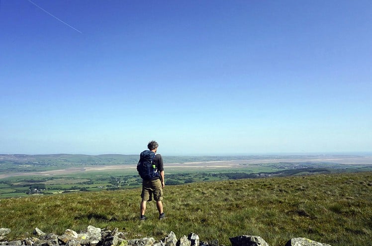
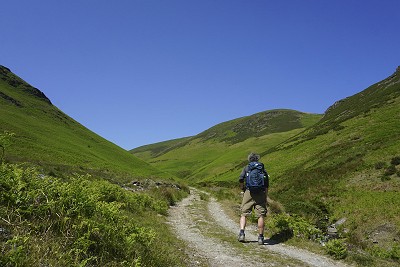
This short walk in the little-visited south-western corner of the Lake District is easy to reach as it starts from the A595. It follows Whitecombe Beck up the steep-sided, tranquil, green valley where views improve with every step. From the lonely summit of Stoupdale Head, a wander across the rugged Whitecombe Moss plateau is followed by a smooth descent, broken only by a detour to the stylishly sharp ridge of White Hall Knott. The larger neighbouring hill, Black Combe, stands to the west and blocks views of the nearby Irish Sea, but the endless golden Duddon Sands can be seen stretching away to the south.
Fetching Map
Height Profile
metres / Distance
miles
Detailed description
1
SD1527084685 Set off north up the lane past Ralliss, with a stream to the left and fields to the right. At Whicham Mill, there is a small bridge and a ford, but stay on the track, keeping the stream to the left. As the trees beside the stream come to an end, a gate/stile leads on to the open moor.
2
SD1518485261 Follow the obvious track up the valley, soon crossing the stream via a wooden footbridge. On both sides the slopes are steep and covered in bracken, with a few rocks here and there higher up. Shortly after passing the site of a disused copper mine, where a stream flows down from the eastern slope, Whitecombe Screes at the head of the valley comes into view.
3
SD1491186191 Having walked below the jagged rocks of Horse Back, cross the stream via a footbridge - or optional ford if you prefer - and head up to a sharp left-hand bend. Continue uphill on a steady gradient, with a zigzag before Whitecombe Head is reached. The most obvious path at the head of the valley curves left towards Black Combe, but continue north along a faint path, which soon works its way to the right and leads to the highest point. Although the valley was steep-sided, this summit area is really quite flat, with cotton grass, patches of heather and bilberry, and skylarks flying overhead.
4
SD1515587368 A small white cairn marks the summit of Stoupdale Head. There is a faint path to White Combe from here, but if in doubt just head south across the open moorland and aim for the cairn. From a distance, this looks like a pile of rocks that have been thrown about the place with reckless abandon, but on arrival you'll see that it is a two-chambered stone shelter. A faint path south-east from the cairn soon turns into a steep descent towards the col to the left of White Hall Knott - a steep green slope leading up to a knife-edge. This ridge is of a different character to the rest of the walk and is a worthwhile detour, with its rocky, gorse-strewn southern slope looking down upon Whicham Valley.
5
SD1554585601 Return along the ridge to the col and join the path heading downhill to the right. After passing through a gate beside a disused pit, turn right along a short section of green lane (not even enough trees to be shown on the OS map) heading down towards the road. Turning left just before the road allows you to walk along the edge of the field to Fox and Goose Cottages, then cross the road and follow the waymarked public footpath back to Beckside.
This has been viewed 625 times
Download
OS maps and some other mapping apps don't allow waypointsStatistics
Difficulty: EasyDistance: 5 miles (8 km)
Total ascent: 447m
Time: 2 – 4 hours (Walking)
Voting:
from 2 votes
Login as Existing User
to rate this walk.
to rate this walk.
Additional Information
Start/Finish:Small parking area at the side of the A595, next to Beckside and directly opposite the lane leading to Ralliss House and Cottage. If this is full there is also a lay-by about 200 to the west, SD152847
Nearest town:
Millom
Terrain:
Wide gravelly track up the valley, then faint path across the open moor.
Seasonal variations:
The open moorland will be quite boggy in wet weather.
Weather and Hill Conditions: mwis: Lake District – Met Office: Lake District
Public transport:
Bus to Silecroft or Hallthwaites
Maps:
OS Explorer OL6 (1:25,000), OS Landranger 96 (1:50,000) Directory Listings:
Find more Listings near this route Tourist info:
Millom (01229 774 819); Broughton-in-Furness (01229 716 115); Ulverston (01229 587120)
Further Routes
by Chris Scaife
- Keswick to Ambleside, via the Helvellyn range 26 Jul, 2023
- Black Combe 28 Jun, 2023
- High Rigg 29 Mar, 2023
- Reston Scar, Hugill Fell and Black Crag 15 Nov, 2022
- Kentmere Horseshoe from Kendal 29 Sep, 2022
- Lyke Wake Walk 21 Aug, 2022
- Whitbarrow 3 Jul, 2022
- Wild Boar Fell and Swarth Fell - a walk on the wild side 14 Jun, 2022
- Hawnby Hill - A Little Yorkshire Gem 1 Feb, 2022
- Kendal Fell, Cunswick Scar, and Scout Scar 20 Dec, 2021


