An exciting loop taking in both Scafell and Scafell Pike
I was looking for an alternative to the 'tourist track' up Scafell Pike, so decided on a long and varied loop taking in both Scafell and Scafell Pike, as well as Broad Crag and Great End.
Fetching Map
Height Profile
metres / Distance
miles
Detailed description
1
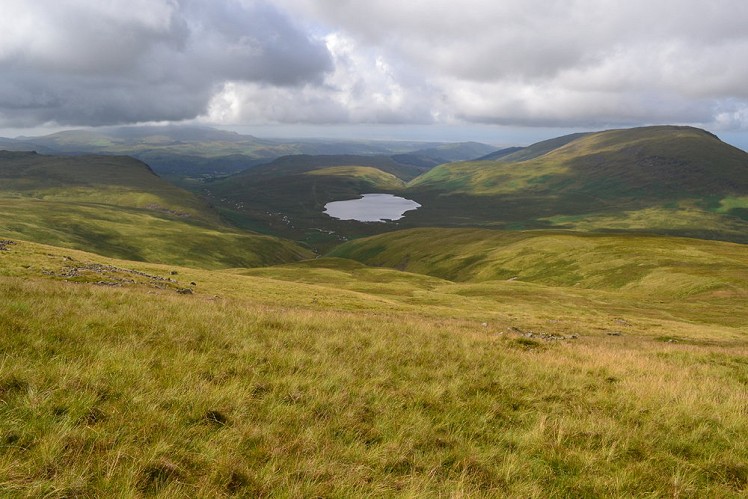
NY1813207537 From the start follow a good path up to Burnmoor Tarn. This isn't too steep, so makes a good warm up.
2
NY1870304622 Follow Hardrigg Gill up to Scafell. The path may be indeterminate in places, so be sure to set compass bearings for the summit. In fog the cairn may be hard to find and the terrain is very rocky near the top.
3
NY2068806446 The col between Scafell Pike and Scafell is called Mickledore; a direct descent to this from Scafell is via the notorious Broad Stand, a tricky rock step that should be avoided in descent unless you're a climber. It's an accident black spot. Instead the safe way to Mickledore is on the well-used path that cuts hard right to descend steeply past Foxes Tarn to reach the narrow cove southeast of Mickledore.
4
NY2119006593 Unfortunately you've lost a lot of height in the process. From here climb a steep eroded path onto the saddle of Mickledore. Here meet the busy path to Scafell Pike that has run up from Wasdale through the corrie of Hollow Stones; this gives an obvious ascent route onto the summit plateau of Scafell Pike.
5
NY2155007199 Continue easily to Broad Crag.
6
NY2184807561 Follow the paths to Great End (and watch the crowds on Scafell Pike disappear behind!).
7
NY2266008393 Retrace your steps back off the summit of Great End to find the path that loops around the back to pass Sprinkling Tarn before reaching Styhead Pass.
8
NY2190609430 Follow any one of several paths from Styhead Pass down into Wasdale Head. There's a usefully located pub for refreshments here! Follow the road or path (as shown on the route card) back to your start point. The path back to the campsite follows the river bed and may flood after heavy rain, if in doubt take the road back to the campsite.
This has been viewed 4,507 times
Download
OS maps and some other mapping apps don't allow waypointsStatistics
Difficulty: DifficultDistance: 11.46 miles (18.45 km)
Total ascent: 1,274m
Steepest Gradient: 50% (1 in 2)
Time: 8 – 11 hours (Walking)
Voting:
from 1 votes
Login as Existing User
to rate this walk.
to rate this walk.
Additional Information
Start/Finish:Wasdale Head campsite (as shown on the route card) or at the carpark in the village (if this is the case follow the path or the road down to the campsite), NY181076
Nearest town:
Whitehaven or Ulverston
Terrain:
Good paths in places, boggy terrain around Burnmoor Tarn and Hardrigg Gill, rocky terrain around the summits with a little scrambling in places.
Seasonal variations:
This is a mountainous area, so the weather is liable to change at any time. There may be snow in winter and the ground will be boggy after heavy rain.
Weather and Hill Conditions: mwis: Lake District – Met Office: Lake District
Maps:
OS Explorer OL4 (1:25,000), OS Explorer OL6 (1:25,000), Harvey/BMC Lake District (1:40,000), OS Landranger 89 (1:50,000) Directory Listings:
Find more Listings near this route Tourist info:
Seatoller (017687 77294); Grasmere (015394 35245); Coniston (015394 41533)


