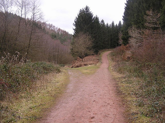
A nice combination of hills and long flats, and paths and tracks and pavements, with a small amount of mud thrown in for good measure!
My staple run from my mid-late teens. Minny Winn was an old lady that lived in a house near Serridge, and my father introduced me to the route "Coming for a run out round Minny Winns."

Fetching Map
Height Profile
metres / Distance
miles
Detailed description
1
SO6099915206 Cross the road, ascend the track up to the houses, down the small drop, and follow the track towards "The Old Vicarage." When you get to the bridge, either climb to the 'old railway track' (the new cycle track), or follow the muddy track up the Dam Bottom. If you take the old railway, when you get to the next bridge, drop down to the track below.
2
SO6135115215 Follow the valley all the way up, the track changing getting less muddy and more Forestry Track as you go.
3
SO6218615386 Turn right along the road, and right again ascending all the way to the petrol station in Brierley.
4
SO6222515074 Turn right along the forestry track, bearing right along the long flat.
5
SO6335515111 A surprisingly steep rise to Serridge. Another long flat, you can stride it out a bit, as you've got a long downhill from Serridge Lodge.
6
SO6192914242 Drop down the hill, crossing the forestry track, along a rocky path. Continue as far as the bridge, where you meet the cycle track.
7
SO6145614535 You'll want to go straight over, it's the least obvious path and it's not marked on the map. Continue on soft grassy ground, under mature trees down, build up some momentum to carry you through the steep stream bank at the bottom. You're now at an old car park. Then head out to the road, cross over and follow the (also unmarked) track up to the forestry track, turn right and hundred meters away is the main Coleford- Cinderford Road, a hundred meters or so up from Mirystock.
8
SO6112514560 Up 'the long hill', until you reach Worral Hill football pitch.
9
SO6029614311 The track follows the perimeter of the football field, in the Chestnut wood. This becomes a gravel track at the end of the football field, with houses on the left- and starts to descend. When you reach the metalled road, turn left along it, and it's downhill all the way- see how fast your legs can carry you to the finish.
This has been viewed 2,199 times
Download
OS maps and some other mapping apps don't allow waypointsStatistics
Difficulty: EasyDistance: 5.62 miles (9 km)
Total ascent: 212m
Steepest Gradient: 10% (1 in 10)
Time: 0:38 – 1:20 hours (Trail running)
Voting:
from 2 votes
Login as Existing User
to rate this walk.
to rate this walk.
Additional Information
Start/Finish:Layby at Camomile Green turning, SO606152
Nearest town:
Upper Lydbrook
Terrain:
A mixture of paths, forestry tracks, pavement, and grass verge.
Public transport:
The main Coleford-Cinderford-Gloucester bus goes through Mirystock and Brierley. You could make alternative starts here.
Seasonal variations:
It would be nice to turn off before Worral Hill, and run down the other side of the Chestnut Ain, to the end of the forestry track. From here you could descend the path all the way to the Start/Finish. Another alternative is to use the Road through Worral Hill. You could also cut the run short by taking the forestry track from Mirystock through to The Bourts. You'd also, by doing this, skip the last big hill. You've various options for 'a little bit more'- perhaps carrying on from Serridge on a loop round to the brick works, or by dropping down from Serridge Lodge generally West to pick up the North-South Forestry track that mostly handrails the B4234. You could also pick up the forestry track that handrails 'the long hill' and avoid the road. For some reason this never seemed as satisfying.
Maps:
OS Explorer OL14 (1:25,000), OS Landranger 162 (1:50,000) Directory Listings:
Find more Listings near this route Tourist info:
Ross-On-Wye (01989 562768); Newent (01531 822 468); Chepstow (01291 623772)

