Climbs 100
Rocktype Gneiss
Altitude 2392m a.s.l
Faces all
The Monastary © 9fingerjon
Crag features
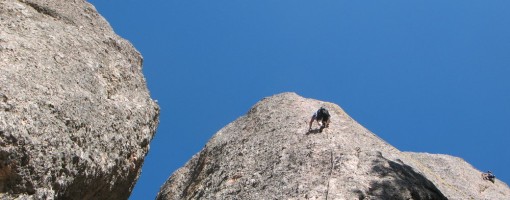
The Monastery. Once the scene of some of the most bucolic climbing in the Front Range, The Monastery looks now more like the Tora Bora. The crags at The Monastery lie between the Galuchie and Bobcat gulches just adjacent to the Hyatt Mine, and therefore were the scene of terrific devastation by the Bobcat fire in June of 2000. The whole area comprised of Spruce Mountain, Cedar Park, and Bobcat Gulch burned in one of the worst fires of recent memory, consuming over 5,000 acres of pristine meadow and forest. However, the fires left most of the crags untouched, and restoration of the access trail is largely complete. Climbing at The Monastery is on igneous schist and gneiss. It is steep and edgy or slabby and on great friction. Alligator skin is common on the steeper walls. Many of the dozen or so crags have excellent South faces that remain dry for a large part of the year, however, they are located at 8,000+ feet and can get cold on a cloudy day, or snowed in in mid-winter. As probably everyone in Colorado knows, most the routes were established by Mike and Tommy Caldwell, so you can expect some hard climbing. Don't be put off by the bulk of difficult routes; plenty of excellent bolt-protected 5.9s and 5.10s exist.
The routes here are documented in Bernard Gillett's Estes Park Valley guidebook.
Approach notes
Getting to The Monastery is easy to do but complicated to describe. Going up for the first time one might want to go with someone who has been here. That said, the directions can be followed. Take US 34 West, out of Loveland. After passing through the Big Thompson Canyon, you will come to the town of Drake, set the odometer. Take a right onto County Road 43 West of Drake several hundred feet. After 0.3 miles turn right onto Colo 128 (Storm Mt Rd), this will take you to Combat Rock after 1 mile. Continue on 128 to a T-intersection at 2.5 miles - go left. At the Y-intersection go left again and stay on 128 until the odometer reads about 5.1 miles. Pull into a camping area on the left and park. Walk about 50 yards up the road to the switchback and the trailhead on the left. Do not park at the switchback by the trailhead; this is posted as a No Parking area.
You will be near the Hyatt mine. The trail head runs left of the road and will take 45 min to one hour to hike, go left at the fork in the trail. The trail has a steep downhill section at the start and a steep uphill section afterward. Be prepared for the hike out; it's as difficult as the hike in, and takes just about as long.
The first major formation you come to is The Guardian.
| There are no comments from visitors to this crag. |
Climbs at this crag
| Name | Grade | Stars | Type | Logs | Partner Ascents |
|---|
These climbs you have climbed by seconding or top-roping.
These climbs you have Dogged.
These climbs you Did not Finish.
Climbs are waiting to be checked by a crag moderator, and may not be accurate. Climbs can't be verified by a crag moderator, and they need more information to confirm it. Climbs are no longer climbable.
Moderators Updates to this page are checked by a UKC volunteer Charlie Low