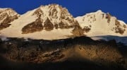
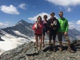
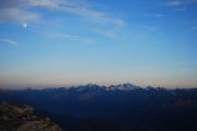
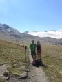
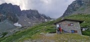
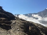
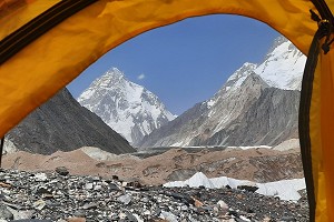
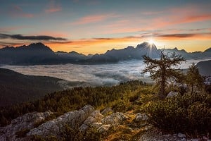
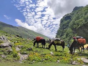
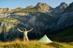
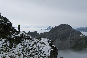
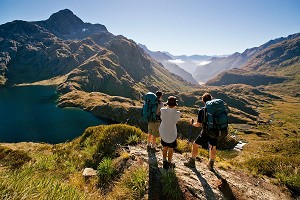
How to Hike the Gran Paradiso's Alta Via 2

© Cecilia Mariani

Most people will know of the famous Alta Via routes in the Dolomites, but fewer will have heard of the Alta Via 1 and 2 in Italy's western alps. Lesser known but not in the least less beautiful, this pair of long distance trails forms a lap around the Valle d'Aosta, and can be walked together for a total of roughly 300km and 24,000m of ascent (the same route followed by the trail running race Tor de Géants) or done individually as a linear trek.

Val Veny and Aig. de Peuterey  © malk
Val Veny and Aig. de Peuterey
© malk, Oct 2006

Two years ago I decided to walk the Alta Via 2 with my friend Louise; here's how we got on:

Planning and logistics

The Alta Via 2 runs for roughly 150km from Courmayeur to Donnas, pretty much following the eastern border of Valle d'Aosta with France first, and the southern border with Piemonte after, going through the most incredible alpine landscape all the way. However, we had to do things differently, so we decided to walk it the other way round, skipping the very first stage and starting in Champorcher. This way we started with an easy first couple of days and ended with the stunning views of Mont Blanc as we got closer to Courmayeur.

Enjoying a spectacular view of the impressive southern side of the Mont Blanc massif  © Cecilia Mariani
Enjoying a spectacular view of the impressive southern side of the Mont Blanc massif
© Cecilia Mariani

With the help of a guidebook and some maps we studied the route. It could be done by either staying in huts and hotels, or we could carry our tent and just play it by ear. We went with the second option, since it gave us more freedom and helped keep the price low, even though that meant carrying more equipment and food with us. It also meant we didn't have to book anything, just a place for the first couple of nights in Champorcher and then we could walk as much or as little as we wanted every day, no ties.

Once all this was decided, all we had to do was pack and go.

Immersed in silence in the middle of a beautiful cirque, we stopped at the sight of some chamois quietly catching the sun on some rocks

Packing

Packing for 11 days in the mountains is not easy. You want to keep the weight to a minimum, but there's so much stuff you need to carry! We started with all the necessary stuff to sleep and eat: tent, mats, sleeping bags, stoves and gas, pots, cutlery. Then clothes, and here you really need to embrace the fact that you are going to smell and are not going to need more that two t-shirts, plus there's always going to be a chance to wash your stuff, so no need to worry. It's the bits and pieces that are tricky to organise: headtorch, sunglasses, a book, hat and gloves, portable powerbank, first aid kit, etc. Here is where your packing skills are really going to make a difference.

Even after years of experience you're always going to do it wrong. We ended up with too much stuff: we brought two stoves and only ever used one, we brought a tea towel and a bikini (don't ask, it seemed like a good idea at the time) and two first aid kits that were totally unnecessary. Long story short, our bags were 15kg each and we were stuck with them.

Where next? Checking out the onward route at Lac du Fond  © Cecilia Mariani
Where next? Checking out the onward route at Lac du Fond
© Cecilia Mariani

The hike

Day 1 - Champorcher to Rifugio Miserin

When we stepped out the door on day one the sun was shining and we still had not realised how heavy our bags really were, so we were 100% ready for the adventure!

We quickly left the lovely hamlet of Chardonney behind and started climbing on an old hunting track. I used to spend my summer holidays here as a child and it was great to see that not much had changed. We were really amazed by how many old buildings were popping out everywhere in the middle of the pastures. After a couple of hours we reached Rifugio Dondena and had lunch: salami, cheese and bread, the perfect mountain snack (we would quickly get bored of this). Then another couple of hours of hiking and we got to Rifugio Miserin, with its beautiful lake and church (there are churches everywhere in Italy). The wind had picked up so we sheltered inside and enjoyed our first hut beer, then decided to pitch our tent just by the church and treat ourselves to some amazing hut food.

Lillaz Wterfalls, Cogne - when they're not frozen....  © TimC123
Lillaz Wterfalls, Cogne - when they're not frozen....
© TimC123, Aug 2014

Day 2 - Rifugio Miserin to Lillaz

After some light rain overnight, we woke to a foggy but quite atmospheric morning. We packed our tent, had some breakfast (porridge is the way to go, especially if your hiking partner is Scottish) and left for the col Fenêtre de Champorcher. We were excited for a new day on the trail, the only downside was that we were walking beside some huge and ugly pylons. But we got to the col and there was no sign of them on the other side. We started walking down, not yet knowing that this would become the model of our standard day on the trek, since we'd have to cross a mountain pass pretty much every day, and then go all the way back to the valley floor. We went through alpine pastures first, and even saw some grazing cows, and then we entered into a beautiful arolla pine forest that accompanied us all the way to Lillaz.

We met some really good people, lived some proper mountain hut atmosphere and left happy in the morning, reminded of the real reason we go to the mountains

The second day was over, and we were not quite used to the weight of our bags yet, so we had to make sure we spent quite some time stretching our sore muscles to avoid any pain the next day. Followed by a much needed shower at the campsite, some laundry and a beer, of course.

Day 3 - Lillaz to Rifugio Vittorio Sella

Although we spent so much time stretching the night before, we were pretty sore in the morning and decided to skip the first three kilometres of tarmac and took the bus to Cogne. In the village we had time to stock up on food, grab a quick coffee and then we started walking towards Valnontey, a beautiful alpine village tucked away at the foot of Gran Paradiso. We had entered the Grand Paradiso National Park, the oldest national park in Italy, and a great place for wildlife spotting.

After the village we took a path that climbed steadily uphill, quickly getting to the treeline and admiring some amazing views of Grand Paradiso. We got to the hut pretty early in the afternoon and decided to sleep there for the night  since it's forbidden to pitch a tent anywhere within the park boundaries. We had plenty of time to chill and freshen up in the stream by the hut, then met two very funny Welsh men who were doing the same route as us, and whom we met again along the way on the following days. Needless to say that day three also ended with beer!

At the Rifugio Vittorio Sella  © Cecilia Mariani
At the Rifugio Vittorio Sella
© Cecilia Mariani

Day 4 - Rifugio Vittorio Sella to Eaux Rousses

After an early start and the usual porridge we were ready to tackle day four and the hike towards Col du Loson, the highest point on the trek at 3299m. We left the hut as the first rays of sunshine started warming us up and took the path that quickly gained height through the meadows and the scree fields. Immersed in silence in the middle of a beautiful cirque, we stopped at the sight of some chamois quietly catching the sun on some rocks. As we got to the col we were able to see the whole Cogne valley in all its beauty, and Monte Rosa in the distance.

The descent on the other side was one of the best sections on the trek; we saw plenty of chamois and ibex, lay down in the sun for a while and finally reached Eaux Rousses, 1600m lower than the col.

The lovely owner of the nearby campsite came and picked us up, so we managed to avoid a 2km tarmac walk. We pitched our tent, did some washing and sat planning the next few days. We could notice days were getting shorter, but we were quite happy to tuck away in our tent as soon as the sun went down, resting our muscles in preparation for a new day.

Louise climbing the last few metres to Col du Loson, the highest point of the trek  © Cecilia Mariani
Louise climbing the last few metres to Col du Loson, the highest point of the trek
© Cecilia Mariani

Day 5 - Eaux Rousses to Rifugio Marmotte

The lovely man from the campsite gave us a lift back to the path, and we started to climb up through the woods to Lago Djouan. One of the things we were looking forward to the most before starting the trek was wild swimming, so even though the weather was not the best we embraced the moment and jumped in. It was cold of course, but made us feel so good afterwards.

From Mont Blanc to Monte Rosa, some of the most beautiful mountains in the Alps were there in front of our eyes

We reached our col for the day, Col Entrelor, and after a short descent came to Rifugio Marmotte. We were unsure if we wanted to stay there at the start, but I'm so glad we did in the end. The hut was run by some really nice volunteers who offered us some tea, we started chatting and straight away the atmosphere became very friendly.

We met some really good people that night, lived some proper mountain hut atmosphere and left happy in the morning, reminded of the real reason we go to the mountains.

Day 6 - Rifugio Marmotte to Rifugio Chalet de l'Epée

From Rifugio Marmotte we went straight down to the lovely village of Rhemes-Notre-Dame to get some supplies. The very steep climb to Col Fetêtre was awaiting, but it wasn't as bad as we thought. On the other side of the pass we found the only technical bit of the trek: some metal staples had been placed on the rock to aid the descent. We overcame the obstacle without any issues and reached a beautiful high valley crossed by a stream. We stopped for a bit, and simply lying down beside it listening to the water go by was so regenerating.

Shortly after we reached the hut, where we met our Welsh friends again. We pitched our tent outside but treated ourselves to a lovely hut meal and a couple of glasses of wine. The Welsh guys were changing their plans for the following day, so this was our last night together on the trail.

The idyllic Lac du Fond  © Cecilia Mariani
The idyllic Lac du Fond
© Cecilia Mariani

Day 7 - Rifugio Chalet de l'Epée to Lac du Fond

From here and for the next couple of days we were going totally wild. With scarce accommodation in this section of the trek we had decided to adjust the stages and wild camp for a couple of nights.

We restocked in the lovely village of Valgrisenche and left for Planaval and Lac du Fond. After a long walk on the valley floor to Planaval we climbed up towards Lac du Fond on what was the hottest day on the trek, but we made it just in time to go for a swim in the lake and pitch our tent before the rain came. It didn't last long though, and we were able to cook outside and enjoy a drop of Genepi, the local herb liqueur, before watching a breathtaking sunset and falling asleep in the middle of nowhere, alone for miles.

Sunset from our wild camp at Lac du Fond  © Cecilia Mariani
Sunset from our wild camp at Lac du Fond
© Cecilia Mariani

Day 8 - Lac du Fond to Rifugio Deffeyes

I now know that this was the hardest but also the most scenic day on the trek. We left early to start our climb to Col de Crosatie. We were still sleepy and already quite tired after the previous day, but as soon as we got to the top of the pass we found ourselves facing one of the most incredible views I have ever seen in my life, and forgot about all the rest. From left to right we could see the whole Mont Blanc massif, with the main summit to the left of Dent de Geant and the Grandes Jorasses, Grand Combin to the right, then the Matterhorn and Monte Rosa. Some of the most beautiful mountains in the Alps were all there in front of our eyes, and no picture could do them justice. We had to stop for a while to take it all in.

Then a very steep descent followed, as we had to go down almost 1000m only to regain the same amount of height to Haut Pass. This was definitely the hardest bit of the trek: we were tired under the heavy weight of our bags, but managed to get to the pass at a reasonable time. A short descent followed and we reached a lovely spot by a stream, just out of sight of Rifugio Deffeyes. And what did we do? We jumped in of course, appreciating the little things that the mountains have to offer. The swim was so regenerating that we even found the strength to walk to the hut for a beer.

What a beautiful day, but we were starting to feel like the end was getting closer.

Day 9 - Rifugio Deffeyes to La Thuile

After yesterday we really needed to rest, so a short day was in order. The walk down to La Thuile took us roughly three hours, and by lunch time we were sitting at a bar on the high street enjoying a lovely meal full of fresh vegetables: what a treat after days of salami and cheese!

But after only a couple of hours we were already tired of the traffic, and the commodities that the village had to offer didn't seem much needed anymore. We were already itching to go back to the wild, and so we waited for the next day to come, with trepidation.

Val Veny glacial lakes and the Peuteray   © TimC123
Val Veny glacial lakes and the Peuteray
© TimC123, Aug 2014

Day 10 - La Thuile to Rifugio Elisabetta Soldini

The second to last day on the trek and one that we had been waiting for a long time: today we were going to see Mont Blanc in all its glory. The ascent from La Thuile to Col de Chavannes was long but steady, and we even saw some cow herds making their way down to the valley after leaving the alpine pastures.

On the col we had another of those moments where we had to stop and just admire what was in front of us, in silence. We stayed there for at least an hour studying every glacier and every pinnacle of the southern side of Mont Blanc, map in hand trying to figure out where everything was. We were so close to the border with France.

We then quickly descended to Val Veny and Rifugio Elisabetta, where our path joined the more famous Tour du Mont Blanc. We had a lovely night in the company of some German and Dutch trekkers, played some board games and went to bed with that trepidation that precedes every important moment in our life: tomorrow would be our last day.

Day 11 - Rifugio Elisabetta Soldini to Courmayeur

The last and unfortunately the "ugliest" day on the trek. The descent down to Courmayeur was long, knee breaking and it went under the many ski lifts that have been built above the village. I'm not a fan of ski resorts, and to see the mountains this way always makes me very sad. But despite this, arriving in Courmayeur felt good. We celebrated with ice-cream and local biscuits and put on some fresh clothes for the first time in over a week.

Now it was time to relax, take it all in and enjoy the moment. We were tired, but we knew that we would have been ready to walk again the next morning. The end of one path is just the start of another.

This experience left in me the desire of doing more treks of this type, and I'm already thinking about what I could do this summer. I had not been in Valle d'Aosta in many years, and I was surprised to find it still so wild compared to other areas of the Alps. Who knows, maybe I'll even go back to complete the loop with Alta Via 1. To be continued...?

Beautiful morning mist and the Rutor glacier in the distance  © Cecilia Mariani
Beautiful morning mist and the Rutor glacier in the distance
© Cecilia Mariani

Factfile

Guidebook

The guidebook I used is Cicerone's guide Walking and Trekking in the Gran Paradiso

Maps

I used 1:50 maps published by Istituto Geografico Centrale. You'll need sheet n. 3 Parco Nazionale del Gran Paradiso and sheet n. 4 Massiccio del Monte Bianco.

Gear

It can be very warm during the day in the summer, but it can also become very cold in the evening so it's important to be prepared for different types of weather. If camping then a tent, sleeping bag and sleeping mat and cooking equipment will be necessary

You'll need:

  • Shorts or long trousers, depending on your preference; T-shirts; Fleece; Warm jacket for the evening; Waterproof jacket and trousers; Clothes to sleep in; Underwear and walking socks
  • Walking boots
  • Walking poles
  • Water bottle and filter, to fill up along the way
  • Sun hat and sunscreen
  • Warm hat and gloves
  • A good rucksack to carry it all in

Where to stay

A mix of mountain huts and accommodation in the valleys. It's better to book in advance, especially in the summer, to be sure to have a place. Huts need to be booked individually. Wild camping is also an option but only above 2500m and it's forbidden within the boundaries of the national park. The guidebook can help find the best accommodation.

Food and supplies

All the villages in the valleys have small shops where it's possible to resupply along the way. Some of them are very small and don't offer a huge variety of options. Also some are only open for a few hours during the day. Most huts and other accommodation offer breakfast, evening meals and the possibility of purchasing packed lunches, but it's always better to check at the time of booking.

When to go

If you're planning on using huts, they're normally open between the 20th of June and the 20th of September, and so your trip should be planned within this dates. The early season could be tricky and, depending on the amount of snow that fell over the winter, there could still be patches of snow on the high passes. August is when most Italians go on holiday, so it could be pretty busy then. In September the days are shorter but the weather could be quite stable, and the mountains will definitely be quieter. I suggest to go between the second week of July and the 20th of September, avoiding the middle two weeks of August if you don't want the mountains to be too busy.

Accommodation Advertise here

No Premier Listings found in this area

Instructor/Guides Advertise here

No Premier Listings found in this area


Loading Notifications...
Facebook Twitter Copy Email