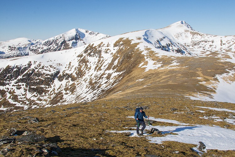
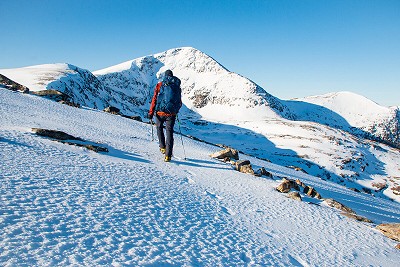
An extensive range of nine Munros, the Fannaichs offer a winning combination of easy grassy ridge walking and dramatic views. While a full traverse has an obvious logic, it's a major day for most; more convenient is to visit sections of the range over several visits. This medium-long route around the eastern peaks is reasonably challenging in its own right. The walk hinges on Sgurr Mor. Biggest of Fannaichs, and the highest point this far north in Scotland, it's an impressive steep-sided peak; and while the other three Munros feel rather less distinctive, the route linking them all is a great day out.
Fetching Map
Height Profile
metres / Distance
miles
Detailed description
1
NH2772174255 Follow the A-road over Torrandhu Bridge then turn right onto a forestry track. Pass through a gate into Altan Wood, a large area of young scots pine plantation. The track (marked on the 1:50,000 OS and Harvey maps) winds uphill through the woods, heading roughly southwest for about 2km. At a junction go right to descend steeply and exit the wood at its southwest corner. Cross a bridge over the Abhainn an Torrain Duibh.
2
NH2633272104 Beyond the bridge is a trail junction. Stay right to follow an ATV track on a slightly convoluted ascent of the boggy east flank of Creag Dhubh Fannaich. The track fizzles on a shoulder at 550m but an intermittent path continues to the stony top of Creag Dhubh Fannaich. Cross a little col and follow the broad ridge northwest to the summit of Beinn Liath Mhor Fannaich.
3
NH2195772408 To outflank the steep west side of the hill first descend north-northwest on stony ground, to pick up a well-made old stalker's path. This makes a descending traverse to reach the col west of Beinn Liath Mhor Fannaich. The ridge now leads up around the corrie rim, over a minor top before a steeper ascent to the summit of Sgurr Mor - in winter conditions take care of the corniced edge on the right, and the incut at the head of a gully. The summit cairn is poised spectacularly on the edge of the mountain's sweeping east face (home to the classic winter climb Resurrection).
4
NH2031171806 Descend south on gentler-angled grassy slopes, crossing a series of distinctive little terraces (an ice age relic), to a broad col above Fuar Tholl Mor. Go over the top of Meall nan Peithirean, and descend the broad southeast ridge. A stalker's path now skirts the south side of Creachan Rairigidh to reach a grassy bealach at 836m (a spot height on some, but not all maps).
5
NH2159470113 At a path junction stay left for the steady climb onto the stony top of Meall Gorm. Continue along the flat-topped ridge, passing a small ruined stone shelter, to reach Meall Gorm's lower east top. A steeper descent southeast on rough ground leads to the Bealach Ban below the round's fourth and final Munro. Though An Coileachan can be climbed directly, it's somewhat easier to bear slightly left in ascent to join a path on the north flank before doubling back south to the summit cairn, which sits on a distinctive little rock outcrop.
6
NH2416668012 Make sure you've got something left in the tank for the walk-out, which is longer and more onerous that you might imagine. Retrace your steps briefly, then continue north down steep, rough ground. Bear slightly left towards a tiny lochan, then follow a well trodden trail northeast down to a col at 565m, just above remote Loch Gorm.
7
NH2426469211 Don't descend to the loch, but stick with the eroded path to traverse the west flank of Meallan Buidhe. In the folorn wastes beyond, both the path and your sense of humour tend to fizzle into the bogs. Keep heading roughly north-northeast, passing the occasional sign that other lost souls have come this way, to eventually meet a very soggy ATV track leading to a bridge over the Abhainn a' Ghiubhais Li. You're not quite home and dry yet (definitely not the latter), as the sodden path along the north bank of the burn twists and turns for two more rough kilometres (that feel like four) before you're finally back at the bridge of stage 1. The track back through the woods is mercifully dry underfoot.
This has been viewed 1,782 times
Download
OS maps and some other mapping apps don't allow waypointsStatistics
Difficulty: SevereDistance: 15.47 miles (24.90 km)
Total ascent: 1,371m
Time: 7:30 – 8:30 hours (Walking)
Voting:
from 1 votes
Login as Existing User
to rate this walk.
to rate this walk.
Summits
Beinn Liath Mhor Fannaich 954 mSgurr Mor 1110 m
Sgurr Mor - Meall nam Peithirean 974 m
Meall Gorm 949 m
Meall Gorm - Southeast Top 922 m
An Coileachan 923 m
Additional Information
Start/Finish:Car park by a weather station off the A835 near Torrandhu Bridge, NH277742
Nearest town:
Ullapool
Terrain:
Forest track, muddy ATV track, hillwalker's trails and some pathless sections. Lower down the ground tends to be pretty boggy and rough, especially in wet weather or after spring thaw, but up on the ridges it's largely short grass and flat stones, and the going is easier.
Seasonal variations:
A long round for a winter day, but technically straightforward. The descent from Beinn Liath Mhor Fannaich is briefly steep and rocky, while the ascent of Sgurr Mor can be on quite steep snow. Be wary of cornices around the northeast corrie of Sgurr Mor and along the edge of Meall nam Peithirean.
Weather and Hill Conditions: mwis: Northwest Highlands – Met Office: West Highlands
Public transport:
Inverness - Ullapool buses pass the start of the walk.
Guidebooks:
The Munros (SMC)
Maps:
OS Explorer 436 (1:25,000), OS Landranger 20 (1:50,000) Directory Listings:
Find more Listings near this route
Further Routes
by Dan Bailey UKH
- East Ridge of Beinn a' Chaorainn and Beinn Teallach 21 Jan
- A' Chralaig and Mullach Fraoch-choire 4 Dec, 2023
- Meall na Teanga & Sron a' Choire Ghairbh - The Loch Lochy Munros 6 Nov, 2023
- Bynack More 19 Oct, 2023
- Beinn a' Mhuinidh 4 Oct, 2023


Good ridge but s*** approach. I biked it in to Fannaich Lodge from the south - felt like very hard work going in despite almost no contour lines crossing the track, but in the dusk I whizzed back out to the main road in about 25 minutes. And very few bogs on the hill
When I did this recently, once I'd reached the bridge on the non-path on the way back, I cut diagonally up the hillside to rejoin the track you walk in on, saving the flog along the river. Seemed well worth it.
That may have been a good call, the river path is pretty awful
Think I might give this approach a go in spring, and do all the peaks