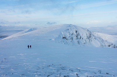
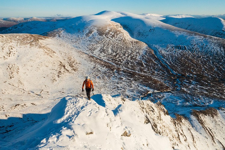
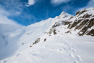
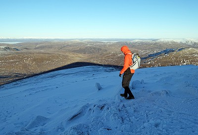
An amenable mountaineering route in a spectacular setting, the East Ridge of Beinn a' Chaorainn is a fantastic introduction to winter climbing (if in doubt, hire a guide), and makes an equally satisfying trip for more experienced teams looking for a fast-moving day. Formerly a mud-fest, access has become much easier in recent years thanks to an ugly but convenient forestry road. After a steep, turfy start, the ridge itself proves friendly in most conditions, with some mild exposure and a few largely optional rocky steps; and like a classic ridge should, it brings you to within a few strides of the summit cairn. The fairly featureless summit ridge of Beinn a' Chaorainn is a grand viewpoint in good visibility, but an infamous navigational black spot when the clag is in - beware cornices. Most parties will probably opt for the quick descent back to the road, but on a good day it's worth prolonging the fun and earning an extra Munro tick with a continuation onto neighbouring Beinn Teallach.
See our article on this route
Detailed description

This has been viewed 2,266 times
Download
OS maps and some other mapping apps don't allow waypointsStatistics
Difficulty: SevereDistance: 10.81 miles (17.40 km)
Total ascent: 1,167m
Time: 5 – 7 hours (Walking)
to rate this walk.
Additional Information
Start/Finish:Layby on the A86 just east of a wide forest track entrance, NN390818
Nearest town:
Fort William
Terrain:
Forest tracks give quick access. The East Ridge is an entertaining scramble in summer (grade 1) but probably better under snow, when it becomes a grade I/II winter climb, and while fair for the grade it definitely will not be suitable for non-climbers. In either season the main difficulties are generally avoidable. Teams wanting to do this round minus the ridge can easily ascend the southwest flank of Beinn a' Chaorainn instead. The continuation to Beinn Teallach is a bit boggy and largely pathless, but straightforward. Descent from here can be very wet. Crossing the Allt a' Chaorainn may be problematic in spate, and require a lengthy detour upstream.
Seasonal variations:
The east face of Beinn a' Chaorainn can hold a lot of snow and the plateau edge may be heavily corniced. There's a notorious accident black spot between the central and southern summits of the hill, where a single straight bearing between the tops would lead you out over the cornice; in poor visibility be sure to add a dogleg, or take a line well to the west to avoid all risk of unexpected air time.
Weather and Hill Conditions: mwis: Northwest Highlands – Met Office: West Highlands
Public transport:
Despite the A86 being the main road between Speyside and Lochaber, there is a surprising dearth of public transport connectivity. With services this poor, it's no wonder everyone in the Highlands drives.
Guidebooks:
Maps:
OS Explorer 393 (1:25,000), OS Explorer 400 (1:25,000), OS Explorer 401 (1:25,000), OS Landranger 41 (1:50,000), OS Landranger 34 (1:50,000) Directory Listings:
Find more Listings near this route Tourist info:
Spean Bridge (0845 22 55 121)
Further Routes
by Dan Bailey UKH
- A' Chralaig and Mullach Fraoch-choire 4 Dec, 2023
- Meall na Teanga & Sron a' Choire Ghairbh - The Loch Lochy Munros 6 Nov, 2023
- Bynack More 19 Oct, 2023
- Beinn a' Mhuinidh 4 Oct, 2023
- Loch Ossian round - Seven Munros by Train 15 Sep, 2023


Glad you mentioned the cornices, Dan. Back in the day, the OS map 1:50,000 map used to show a direct bearing between the tops so I was following the compass trustingly through a total white-out.
To this day, I don't know what made me stop - it was nothing visual, maybe just a shift in wind speed or direction that told me the edge was near. A crack propagated across the snow by my feet and I lunged rightwards like a goalkeeper stretching for a penalty kick to get an axe into something secure, just as half the hill whoomped down into the clag.
I might have shrugged it off as one more near miss if I hadn't read about the horrific fatality there had been at the same spot the previous winter, when the victim's body wasn't found until August. Anyway, don't want to be a buzzkill - it's a damn fine hill, but it's one to respect.
The East Ridge of Beinn a' Chaorainn is one of my absolute favourite grade IIs. Take all the obstacles direct and it's brilliant! Heading North then East and climbing Creag Meagaidh is a nice add on as I find Beinn Teallach is less interesting, apart from the river valley to the main road which is beautiful through the forests. Careful navigation is required on Beinn a' Chaorainn in poor vis - it's not at all obvious ground and is disconcerting at times.
When I was bagging we did these two hills on different days out and both in less than optimal weather. For Teallach we approached up the obvious glen which wasn't particularly inspiring. To enliven our walk we left the glen and headed up a fairly obvious looking stream bed which seemed to head directly to the top. It actually turned out to be quite a nice, continuous scramble and most likely an improvement on the trudge up to the bealach.
Lucky escape Norman! It's a notorious spot as I'm sure you now know: the edge is incut, so a direct bearing between the two summits leads out over the cornice.
Late 1980s or so - three parties went through on the same day IIRC