Logbooks & Hills
Clickable map of hills
Search over 5,500 hills & mountains in the UK and further afield. Includes height, location, local weather forecasts, parking details and user-contributed photos.
- Find Hills Map using our clickable map, or search by hill name or location
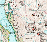
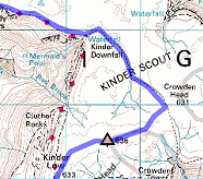
Search by Location will show you hills & mountains near a town name, a postcode, an OS grid reference or the name of a mountain range. Zoom in for 1:25K and 1:50K Ordnance Survey and satellite maps.
The UKH Logbooks are a place to record your hillwalking successes, and summits that are on your wishlist. Also includes details of many easy climbs & scrambles. Each registered user on the site has their own personal Logbook, and they can choose whether to share it with other users, or to keep it completely private.
Unregistered user
You will need to Register as a New User before setting up your Hillwalking Logbook. If you are already registered, Login as Existing User before returning to this page.
Munros & Hill Lists
The Munros & Hill Lists detail all the main UK hills, including the Munros, Munro Tops, Corbetts, Grahams, Wainwrights and Marilyns. You can also build your own 'ticklists' of hill summits & climbs to share with your friends.
Map my Route
You can Map my Route, drawing your walks, bike rides & trail runs onto 1:25K and 1:50K Ordnance Survey maps, or upload your route from a GPS device.Share your favourite routes with friends, and get inspired by routes published by other users.