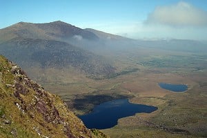
Is this Everest?

New Topic
This topic has been archived, and won't accept reply postings.
hnmw 03 May 2015
I took a photo of the Himalayas on a flight from Kathmandu to Lhasa while sitting on the right hand side of the plane. The photo appears to show two mountains that reach up above the clouds.

I showed the photo to three people who have been to Everest before. Two of them said it was Everest while the other person said it wasn't.

Can someone here confirm whether one of the mountains in the photo is Everest? Please only comment if you know what Everest looks like from different angles because I know that Everest may look different depending on which side of the mountain you are on.

The photo is attached here: postimg.org/image/8l3vb85gd

Thanks.
 jon 03 May 2015
In reply to hnmw:

The link didn't work.
 cranc 03 May 2015
In reply to hnmw:
http://postimg.org/image/8l3vb85gd
Post edited at 13:57
 Damo 03 May 2015
In reply to hnmw:

It's almost certainly not Everest.

But honestly, the photo is so bad that unless you have a better idea of where you were, it could be any of a dozen places.
hnmw 03 May 2015
In reply to Damo:

I took the photo around 6 minutes after the Himalaya mountain range first came into view during the flight.

I know the photo is of poor quality. As I posted, please only comment if you know what Everest looks like from all sides.
 kwoods 03 May 2015
In reply to hnmw:

> I know the photo is of poor quality. As I posted, please only comment if you know what Everest looks like from all sides.

A touch insulting toward Damo. Don't troll someone trying help!

It almost certainly isn't Everest. And the photo is so bad it could almost be anything.

Get Google Earth out, estimate the flight path and how far you would have travelled in six minutes.
 jon 03 May 2015
In reply to kwoods:
> A touch insulting toward Damo. Don't troll someone trying help!

Especially as he's the person here that's the most likely to know!

Don't know why but I still can't make the link work. Not that it matters as I'd have no idea anyway...
Post edited at 16:35
 highcamp 05 May 2015
In reply to hnmw:

As mentioned on MountainProject: looking at flight paths on Flightradar24, it looks like most all of the flights from Kathmandu to Lhasa pass through the Himalaya to the east of Makalu National Park (which is SE of Everest). So unless your plane took a different flight path, a pic out the right side while heading to Lhasa would not capture Everest. I put a pin on Everest for reference:

Image w/Everest: http://goo.gl/QLSLIi

Flight path: http://www.flightradar24.com/data/flights/3u8720/#628c643
 Mal Grey 05 May 2015
In reply to highcamp:

If, as sounds likely, this was the path taken by the flight (and a look at the map shows why it would be, as it follows the most obvious "break" in the high mountains), then looking to the right the highest peaks might be those around Kanchenjunga. Very hard to tell from the photo, and can't think what the obvious pointed peak is.


Parrys_apprentice 05 May 2015
In reply to hnmw:

no, it's not
hnmw 06 May 2015
In reply to Parrys_apprentice:

Parry, can you elaborate slightly?

I seem to recall I took the photo from the right side of the plane but I am not certain as I did switch sides mid-way through the flight.
 Mal Grey 06 May 2015
In reply to hnmw:

If it was to the left, the view might have been something like this;

https://www.google.co.uk/maps/@27.8239025,87.6462121,7620a,20y,270h,77.62t/...

In which case, the pointed peak could be Ama Dablam or even Makalu (which is labelled in the wrong place on Google Maps, you need to combine Google with a "real" map to work out peak names). In theory, the big peak in the top right in the clouds, could be Everest (or Makalu if "pointy" is Ama Dablam)

New Topic
This topic has been archived, and won't accept reply postings.
Loading Notifications...