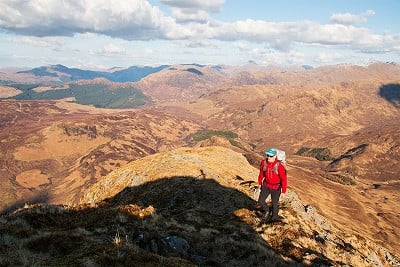
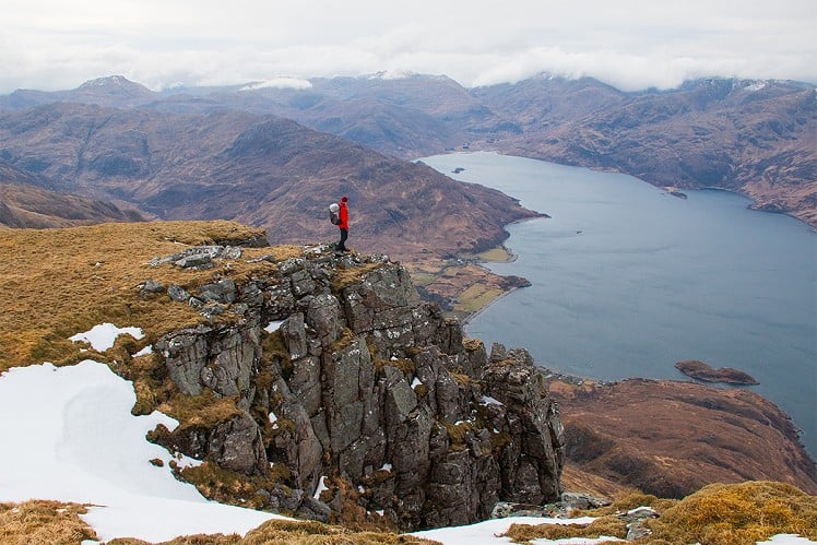
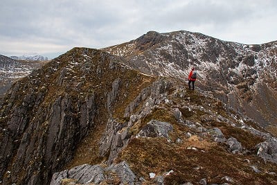
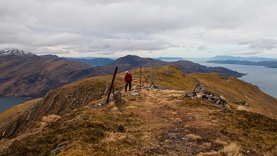
Few big Scottish hills rise from sea to summit quite as abruptly as Beinn Sgritheall. Guarding the entrance to Loch Hourn, this steep-sided wedge of rock and scree has a truly gull's eye outlook over the water to the hills of Knoydart, and out to Rum and Skye. Sgritheall is generally treated as a solitary entity, being the sole 3000-footer in the Glenelg hinterland, but if you discount Munro status it can be seen for what it really is - just one peak of many jostling along the north shore of the loch. Combining several of them makes for a logical, challenging round. The standard Sgritheall-only graunch from Arnisdale in the south has brevity on its side, but this longer circuit from the north offers more, from the fascinating brochs of Gleann Beag to the wild, cliffy corrie scenery on the under-appreciated north side of the Munro. And if bagging's your game, there's something here on three different lists - the knobbly Graham Beinn a' Chapuill; Munro Beinn Sgritheall itself; and a pair of fine Corbetts, Beinn na h-Eaglaise and Beinn na Caorach.
Detailed description

This has been viewed 876 times
Download
OS maps and some other mapping apps don't allow waypointsStatistics
Difficulty: SevereDistance: 14 miles (22.50 km)
Total ascent: 1,723m
Time: 9 – 11 hours (Walking)
to rate this walk.
Summits
Beinn a' Chapuill 759 mBeinn Sgritheall 974 m
Beinn na h-Eaglaise 805 m
Beinn nan Caorach 774 m
Additional Information
Start/Finish:End of public road at Balvraid (limited verge parking, take care not to obstruct farm access; more parking further west at Dun Troddan broch), NG846165
Nearest town:
Kyle of Lochalsh
Terrain:
A lot of rough, rocky and tussocky terrain on the hills. Pathless on the linking sections between most of the summits, with the only well-worn trail to be found on the main crest of Beinn Sgritheall. Some very steep ground on the slopes into and back out of the Bealach Arnisdale, with the ascent of Beinn na h-Eaglaise on precipitous grass requiring particular care; this could be dangerous in the wet, would merit a winter grade I climb in snow, and is definitely no place for the nervous.
Seasonal variations:
The traverse would be a tremendous winter challenge, but not one to underestimate, with some remote ground and a mountaineering edge.
Weather and Hill Conditions: mwis: Northwest Highlands – Met Office: West Highlands
Public transport:
None
Maps:
OS Explorer 413 (1:25,000), OS Landranger 33 (1:50,000)
Accommodation:
S/C rental house at Dun Brewing, Gleann Beag - but more importantly the brewery has a tap room and food/drink.
Find more Listings near this route
Tourist info:
Kyle of Lochalsh (0845 22 55 121); Broadford (0845 22 55 121); Lochcarron (01520 722357)
Further Routes
by Dan Bailey UKH
- A' Chralaig and Mullach Fraoch-choire 4 Dec, 2023
- Meall na Teanga & Sron a' Choire Ghairbh - The Loch Lochy Munros 6 Nov, 2023
- Bynack More 19 Oct, 2023
- Beinn a' Mhuinidh 4 Oct, 2023
- Loch Ossian round - Seven Munros by Train 15 Sep, 2023


Looks an awesome route, Dan. We know what to do if the bridge is out.
Yep, the baggers' route for Sgritheall is an odd list-blinkers construct when you see the hill group from the Ratagan Pass.
There's also a potential Munro/Graham/S2K Marilyn loop from the West with Beinn Mhialarigh. Having done a couple of loops from Glenelg and a couple from the west I wouldn't even consider the Arnisdale smash and grab route.
I’ve done the westerly circuit based on your recommendation years ago.