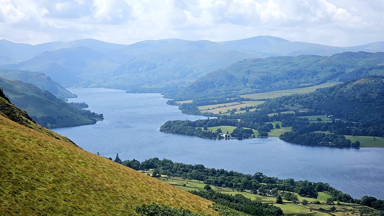
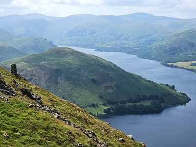
The High Street range is perfect terrain for striding out, Just ask any Roman soldier, pacing out the miles between Brougham and Ambleside. This route samples the northern terminus of the ridge, with its craggy escarpment offering magnificent panoramas over Ullswater. As so often with the Far Eastern fells, the lesser summits of Arthur’s Pike, Bonscale Pike and Steel Knotts prove to be the highlights, with steep slopes of boulder and bracken and interesting summit features both artificial and natural. We start at the lakefoot village of Pooley Bridge. After the shocking collapse of the original stone structure, courtesy of Storm Desmond in 2015, it’s a relief to see the new stainless steel arch bedding into the landscape. The village is often busy with visitors but you’ll soon be out on the open fell, enjoying some of the most delightful views in the Lakes.
Detailed description
This has been viewed 572 times
Download
OS maps and some other mapping apps don't allow waypointsStatistics
Difficulty: DifficultDistance: 14.23 miles (22.90 km)
Total ascent: 857m
Time: 6:30 – 7:30 hours (Walking)
to rate this walk.
Summits
Arthur's Pike 532 mBonscale Pike 524 m
Loadpot Hill 671 m
Wether Hill 670 m
Steel Knotts 432 m
Additional Information
Start/Finish:Pooley Bridge, NY469245
Nearest town:
Penrith
Terrain:
Mostly grass with good trails at the start and end.
Seasonal variations:
Winter mountaineering issues seem unlikely as the steepest slopes are low down on Steel Knotts
Weather and Hill Conditions: mwis: Lake District – Met Office: Lake District
Public transport:
The 508 bus services will get you to Pooley Bridge from the south in summer. A shuttle bus also runs from Lowther on summer weekends
Guidebooks:
Wainwright Book Two - The Far Eastern Fells
Maps:
OS Explorer OL5 (1:25,000), Harvey/BMC Lake District (1:40,000), OS Landranger 90 (1:50,000) Directory Listings:
Find more Listings near this route Tourist info:
Pooley Bridge (017684 86530); Rheged (01768 860 034); Penrith (01768 867466)
Further Routes
by Norman Hadley
- Bannisdale Horseshoe 6 Apr
- Sallows and Sour Howes 20 Mar
- Kinder Downfall and the Reservoir Round 14 Feb
- Buttermere Horseshoe 3 Jan
- Brock Crags and Angletarn Pikes 12 Dec, 2023
- The Kentmere Frog 27 Nov, 2023
- Sgùrr a' Chaorachain: a slice of Applecross 17 Sep, 2023
- Wolfhole Crag: A Journey to the Centre of the Earth 5 Sep, 2023
- Wansfell Pike 16 Aug, 2023
- Walla Crag, Bleaberry Fell and High Seat 4 Jul, 2023


Or for a slightly shorter version, take the ferry between Pooley Bridge and Howtown.
It's a lovely area but Bonscale and Arthur's Pikes really demonstrate how odd some of Wainwright's criteria on what constitutes a seperate fell were. From up on the heights they barely register from what I recall. Great views of Ullswater mind and on that score alone they're worth visiting.
Yes, Harry, the boat opens options. The Pooley Bridge bailout is mentioned at step 11 but you could also do the sailing first and go anticlockwise round the fells. Or get the boat from Glenridding and do the whole loop from Howtown. Loads of possibilities.
Absolutely, Lankyman. Both "summits" are overshadowed by grassy lumps 20-30m higher just to the south. Yet I reckon AW's priorities were sound: his designated summits are both nicely poised on the edge of steep ground, putting aesthetics before arithmetic. 😃
Agreed. It's just one of the many charms and idiosyncrasies of Wainwright's guides. If he had personal guidelines they were based on 'feeling' rather than maths. I've read a few biographies (plus his own 'Fellwanderer') and I think I recall that how something looks viewed from the valley approach was a major factor. Slight Side on Scafell comes to mind. Why didn't he give a chapter to nearby Great How? It's much more of an independent fell than Slight Side. Just looking at the OS map and 'The Far Eastern Fells' you could (IMO) argue for seperate fell status for quite a few lumps and bumps in the region. I've wandered over much of Place Fell and there are a few examples there (eg Bleaberry Knott or High Dodd particularly).