Rocktype UNKNOWN
Altitude 191m a.s.l
Faces N
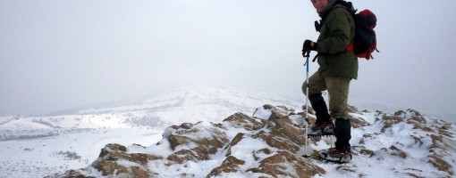
Crampons on Crook Peak. © deepstar
Summit of this hill
This summit has been climbed in 35 logbooks.Hill features
The site extends for some 5km from west to east. Near its eastern end it is divided by a gap used by the A38 road and the disused Cheddar Valley railway line. From west to east the site includes these hills:
Crook Peak, reaching 191m (627 ft), a prominent feature from the surrounding landscape. Evidence of early human occupation includes a polished flint axe.
A ridge to the southeast of Crook Peak, known as 'The Razor', is used by the West Mendip Soaring Association to fly model aircraft in south-westerly/southerly or north-easterly winds.
Approach notes
King's Wood between Cross Plain and Shute Shelve Hill is owned by the National Trust operate a small carpark.
Route Cards
Sorry, There are no Route Cards associated with this hill
|
Login as Existing User to add your comments
Summits, Scrambles, and Easy Climbs on this hill
| Name | Grade | Stars | Type | Logs | Partner Ascents |
|---|
These routes you have climbed clean.
These routes you have climbed by seconding or top-roping.
These routes you have Dogged.
These routes you Did not Finish.
Routes are waiting to be checked by a crag moderator, and may not be accurate. Routes can't be verified by a crag moderator, and they need more information to confirm it. Routes are no longer climbable.